MyTopo
Classic USGS Lay Dam Alabama 7.5'x7.5' Topo Map
Couldn't load pickup availability
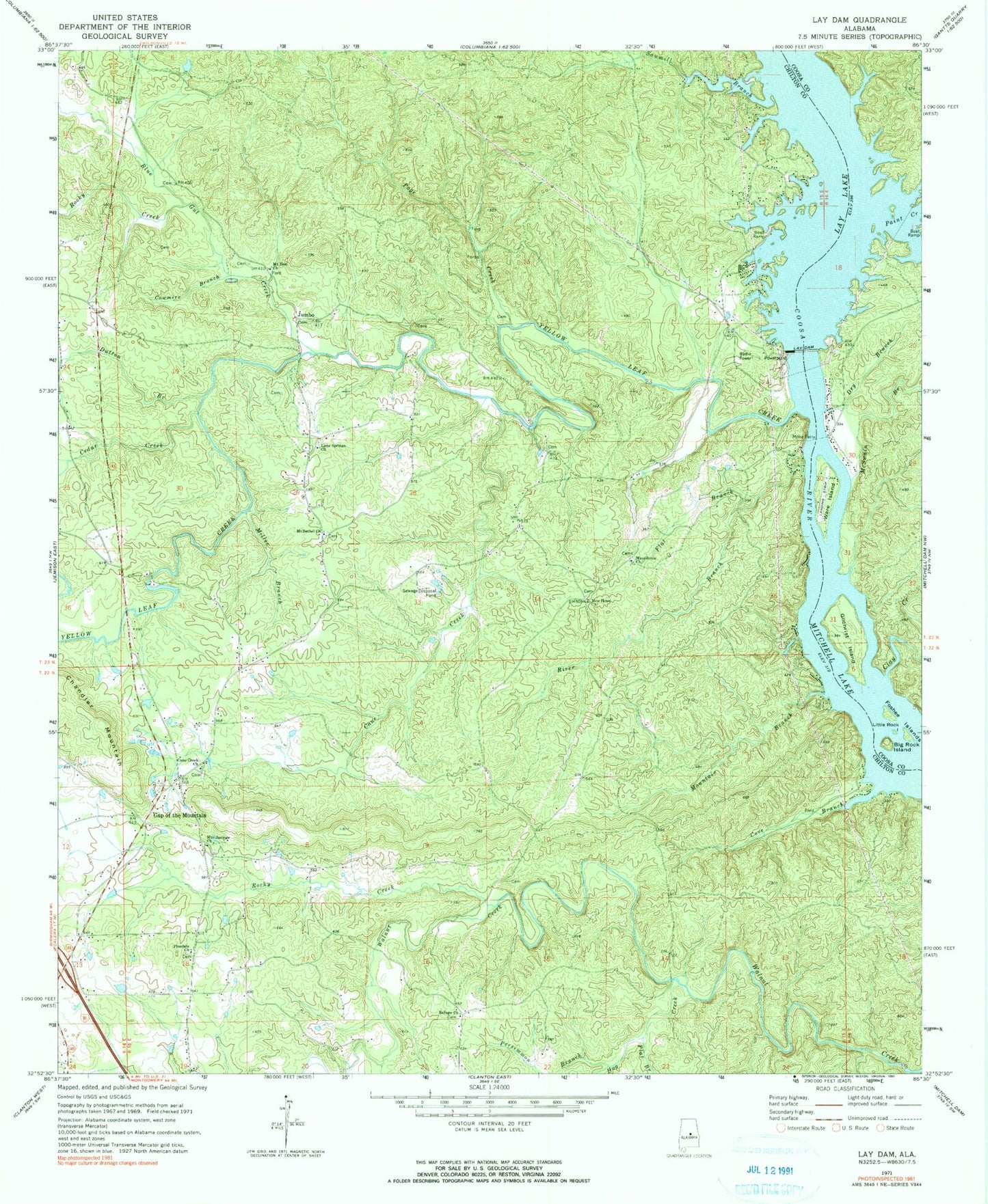
Historical USGS topographic quad map of Lay Dam in the state of Alabama. Map scale may vary for some years, but is generally around 1:24,000. Print size is approximately 24" x 27"
This quadrangle is in the following counties: Chilton, Coosa.
The map contains contour lines, roads, rivers, towns, and lakes. Printed on high-quality waterproof paper with UV fade-resistant inks, and shipped rolled.
Contains the following named places: Big Rock Island, Blue Gut Creek, Butting Ram Shoals, Cane Creek, Cane Creek Baptist Church, Cane Creek Cemetery, Cedar Circle Fish Camp, Cedar Creek, Cedar Island, Clay Creek, Cove Branch, Cowmire Branch, Dry Branch, Dutton Branch, Flat Branch, Foshee Islands, Gap of the Mountain, Gap of The Mountain Fire and Rescue Station, Gilchrist Island, Hog Creek, Hunts Mill, Jumbo, Lay Dam, Lime Springs Cemetery, Lime Springs Methodist Church, Little Rock Island, Lock Twelve, Macedonia Cemetery, Macedonia Church, Macedonia School, Maddox Mine, McKee Cemetery, McSwain Branch, Miller Branch, Mims Ferry, Mineral Springs Division, Mount Bethel Baptist Church, Mount Bethel Cemetery, Mount Bethel Youth Camp, Mount Zion Cemetery, Mount Zion Church, Mountain Branch, Mountain Springs Cemetery, Mountain Springs Methodist Church, New Hope Assembly of God Church, New Hope Cemetery, Old Maddox Mine, Page Creek, Pages Old Ferry, Paint Creek, Persimmon Branch, Pine Dale School, Pinedale Assembly of God Church, Pinedale Cemetery, Refuge Baptist Church, Refuge Cemetery, River Branch, Rocky Creek, Sawmill Branch, Sears Camp, The Negrohead, Ware Island, Ware Island Airport, Yellow Leaf Creek, ZIP Code: 35046