MyTopo
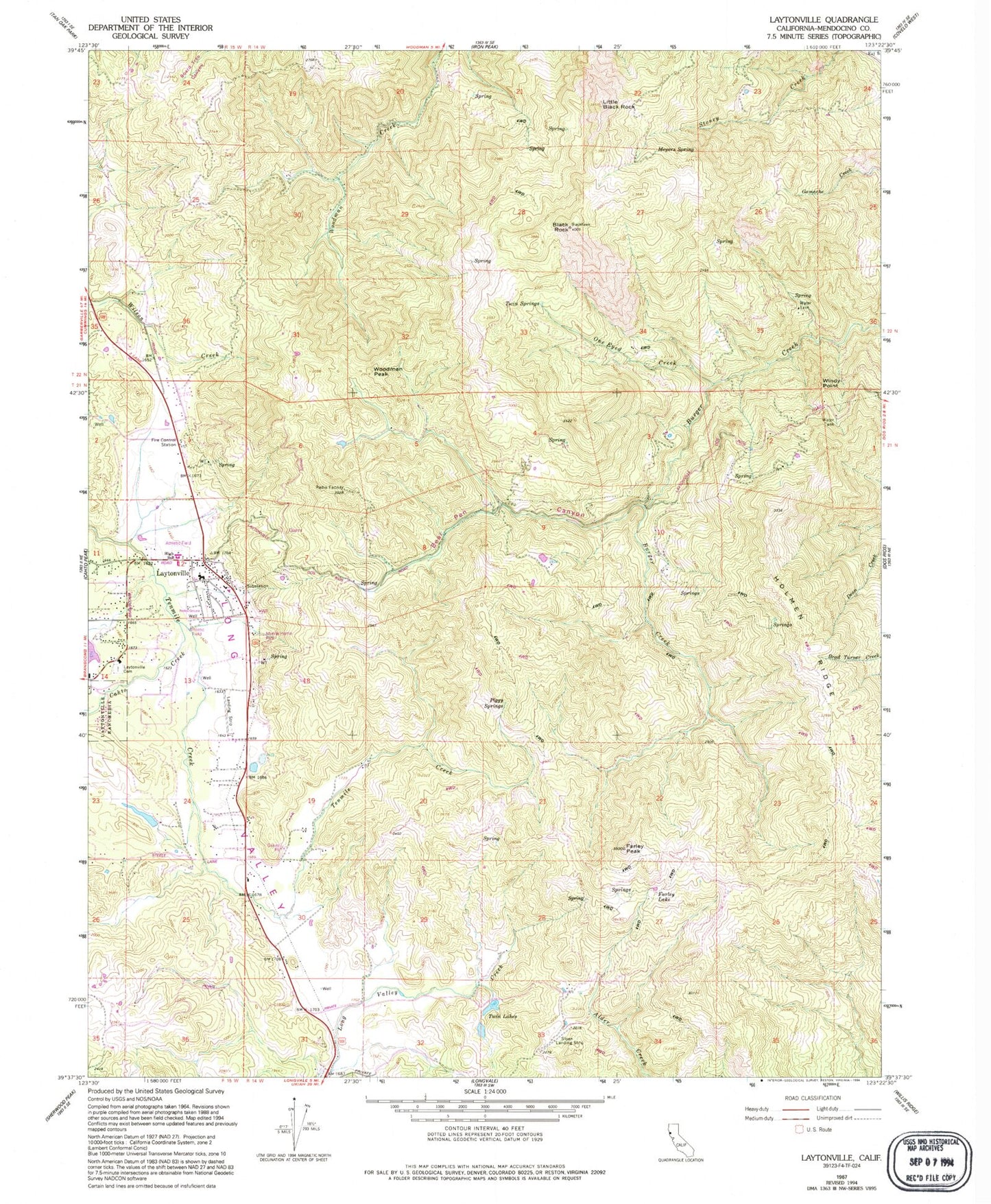
Classic USGS Laytonville California 7.5'x7.5' Topo Map
Couldn't load pickup availability
Historical USGS topographic quad map of Laytonville in the state of California. Map scale may vary for some years, but is generally around 1:24,000. Print size is approximately 24" x 27"
This quadrangle is in the following counties: Mendocino.
The map contains contour lines, roads, rivers, towns, and lakes. Printed on high-quality waterproof paper with UV fade-resistant inks, and shipped rolled.
Contains the following named places: Bear Pen Canyon, Black Rock, Black Rock Ranch, Cahto Creek, California Department of Forestry and Fire Protection Laytonville, Farley Lake, Farley Peak, Hanke Ranch, Holmen Ridge, Laytonville, Laytonville Cemetery, Laytonville Census Designated Place, Laytonville Continuation High School, Laytonville Elementary - Middle School, Laytonville High School, Laytonville Post Office, Little Black Rock, Long Valley Creek, Long Valley Volunteer Fire Protection District, Meyers Spring, One Eyed Creek, Piggy Springs, Twin Lakes, Twin Springs, Vinton Lake, Windy Point, Woodman Peak