MyTopo
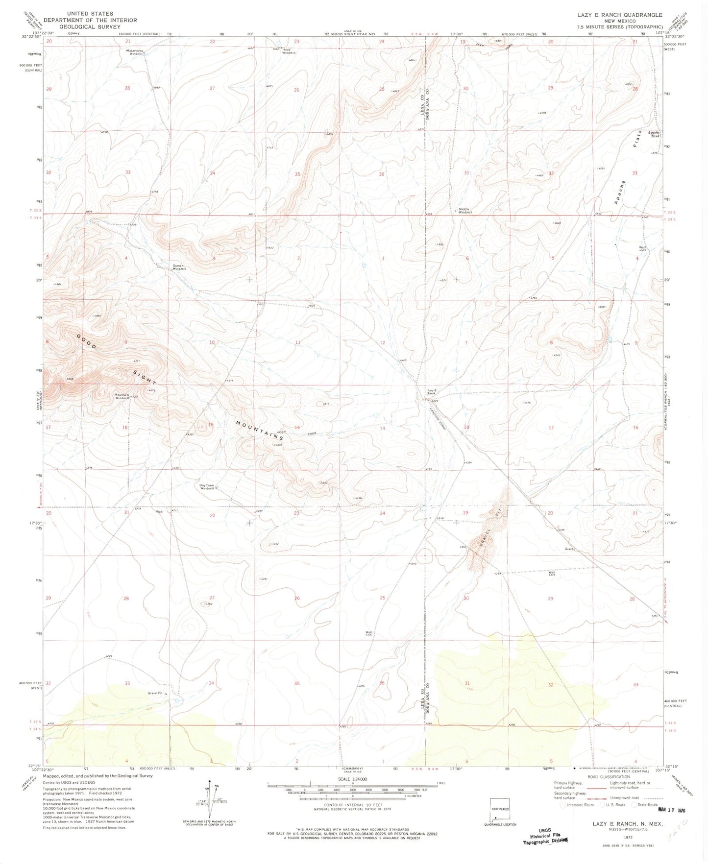
Classic USGS Lazy E Ranch New Mexico 7.5'x7.5' Topo Map
Couldn't load pickup availability
Historical USGS topographic quad map of Lazy E Ranch in the state of New Mexico. Map scale may vary for some years, but is generally around 1:24,000. Print size is approximately 24" x 27"
This quadrangle is in the following counties: Do��a Ana, Luna.
The map contains contour lines, roads, rivers, towns, and lakes. Printed on high-quality waterproof paper with UV fade-resistant inks, and shipped rolled.
Contains the following named places: 01584 Water Well, 01587 Water Well, 01589 Water Well, 01590 Water Well, 01591 Water Well, 01680 Water Well, 06130 Water Well, 06131 Water Well, Apache Flats, Apache Tank, Burris 'E' Ranch Airport, Dog Town Windmill, Hood Wind Mill Water Well, Hood Windmill, Lazy E Ranch, Matamoros Windmill, Middle Windmill, Middle Windmill Water Well, Mountain Windmill, Number 1205 Water Well, Suman Windmill