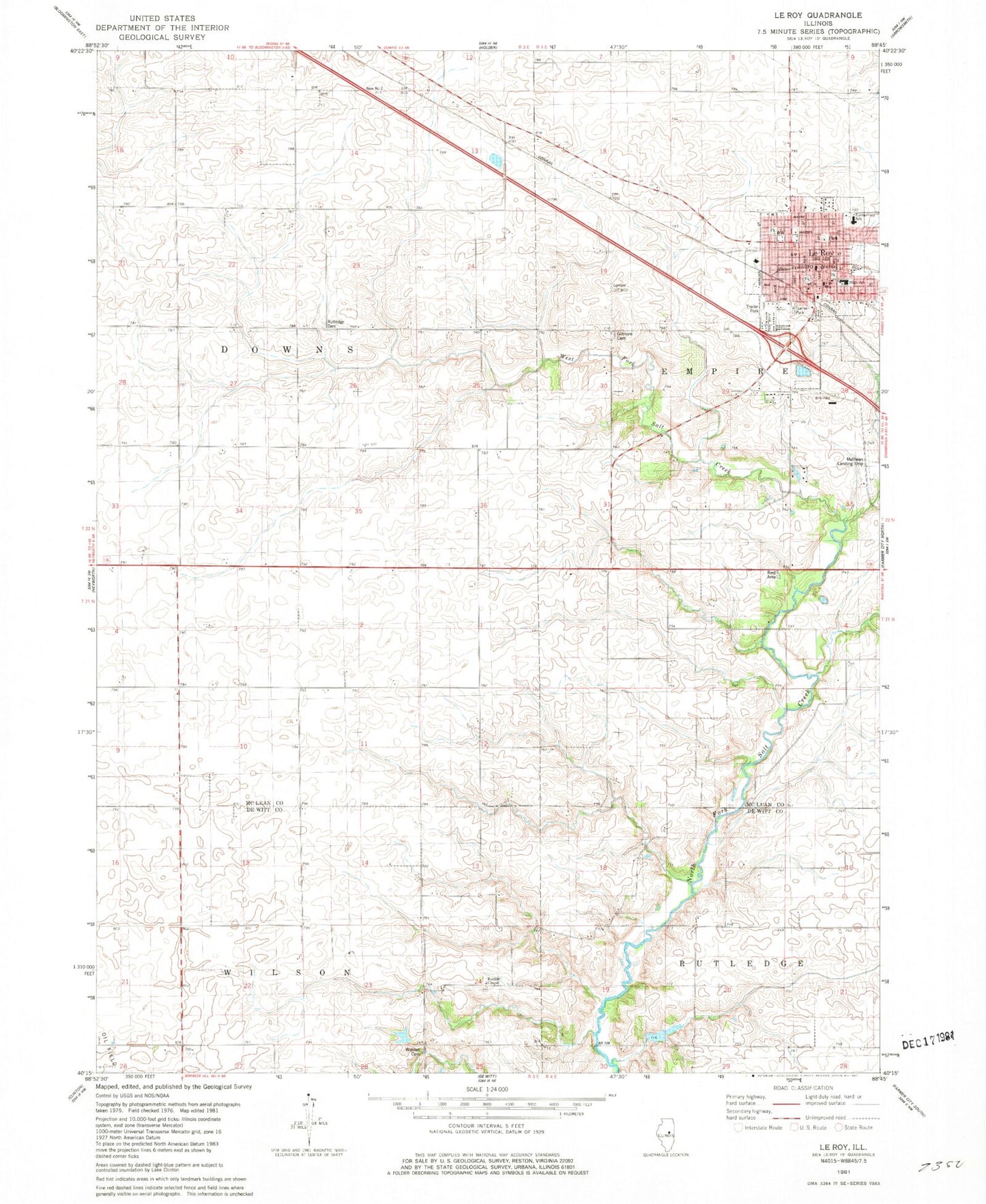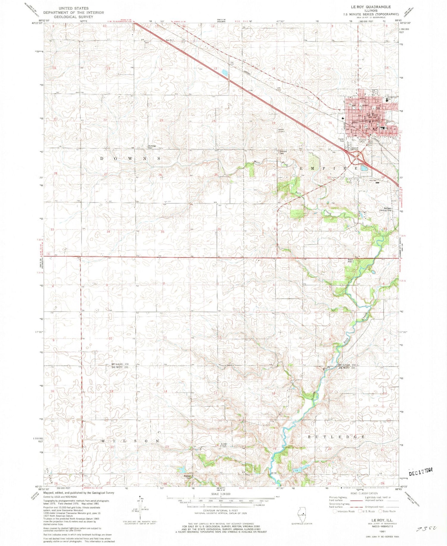
MyTopo
Classic USGS Le Roy Illinois 7.5'x7.5' Topo Map
Couldn't load pickup availability
Historical USGS topographic quad map of Le Roy in the state of Illinois. Typical map scale is 1:24,000, but may vary for certain years, if available. Print size: 24" x 27"
This quadrangle is in the following counties: De Witt, McLean.
The map contains contour lines, roads, rivers, towns, and lakes. Printed on high-quality waterproof paper with UV fade-resistant inks, and shipped rolled.
Contains the following named places: Field School (historical), Gilmore Cemetery, Imperial School (historical), Le Roy, Rucker Chapel, Rutledge Cemetery, South Downs School (historical), Washington School (historical), West Fork Salt Creek, Long Point Creek, Township of Downs, Township of Wilson, Clyde Vance Lake Dam, Clyde Vance Lake, Le Roy High School, Le Roy Post Office, Mathews Landing Strip (historical), Walden Cemetery, LeRoy City Hall, Le Roy Elementary School, Le Roy Junior High School, Crumbaugh Memorial Public Library, City of Le Roy, Le Roy Emergency Ambulance Service, Le Roy Community Fire Protection District