MyTopo
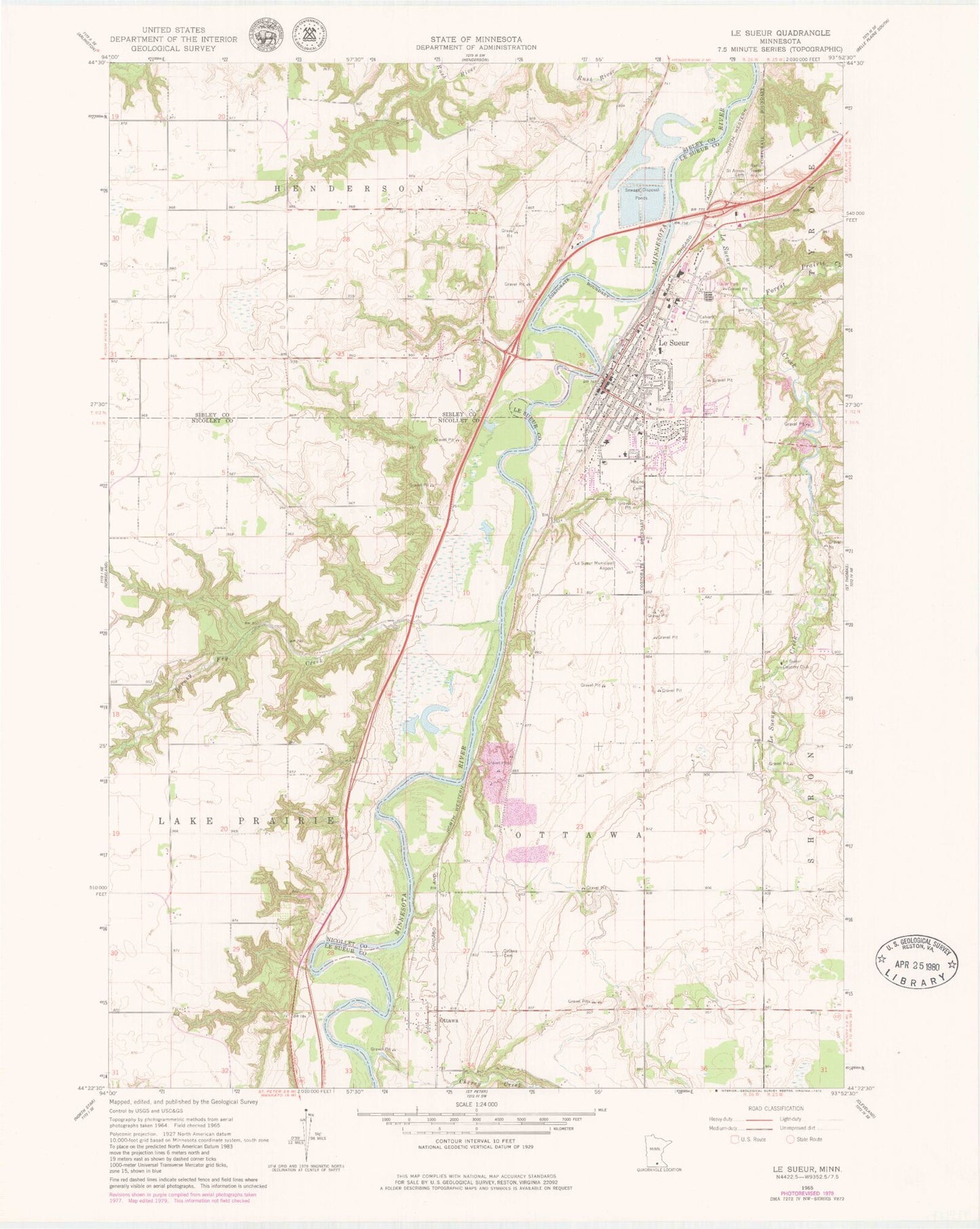
Classic USGS Le Sueur Minnesota 7.5'x7.5' Topo Map
Couldn't load pickup availability
Historical USGS topographic quad map of Le Sueur in the state of Minnesota. Map scale may vary for some years, but is generally around 1:24,000. Print size is approximately 24" x 27"
This quadrangle is in the following counties: Le Sueur, Nicollet, Sibley.
The map contains contour lines, roads, rivers, towns, and lakes. Printed on high-quality waterproof paper with UV fade-resistant inks, and shipped rolled.
Contains the following named places: Allina Medical Clinic, American Legion Park, Barney Fry Creek, Calvary Catholic Cemetery, City of Le Sueur, Doctor William W Mayo House Historical Marker, First Lutheran Church, Forest Prairie Creek, Grace Evangelical Lutheran Church, Jolly Green Giant Historical Marker, Kingsway Estates, Le Sueur, Le Sueur - Henderson High School, Le Sueur - Henderson Middle School, Le Sueur Country Club, Le Sueur Creek, Le Sueur Erosion Project Dam, Le Sueur Fire Department, Le Sueur Historical Marker, Le Sueur Medical Clinic, Le Sueur Municipal Airport, Le Sueur Museum, Le Sueur Police Department, Le Sueur Post Office, Le Sueur Public Library, Louise Park, Mayo Park, Mayoview History Center, Minnesota River Valley Historical Marker, Minnesota Valley Rest Area, Mound Cemetery, Ottawa, Ottawa Cemetery, Ottawa Post Office, Ottowa, Park Elementary School, Presbyterian Church, Ridgeview Le Sueur Medical Center, River Hills Christian Church, River Park, Saint Anne's Catholic School, Saint Annes Cemetery, Saint Anne's Church, Saint Johns Evangelical Cemetery, Township of Ottawa, United Methodist Church, Valleygreen Square Mall, W W Mayo House, Word of Life Lutheran Church, Ziebarth Alternative Learning Center, Zion United Church of Christ, ZIP Code: 56058