MyTopo
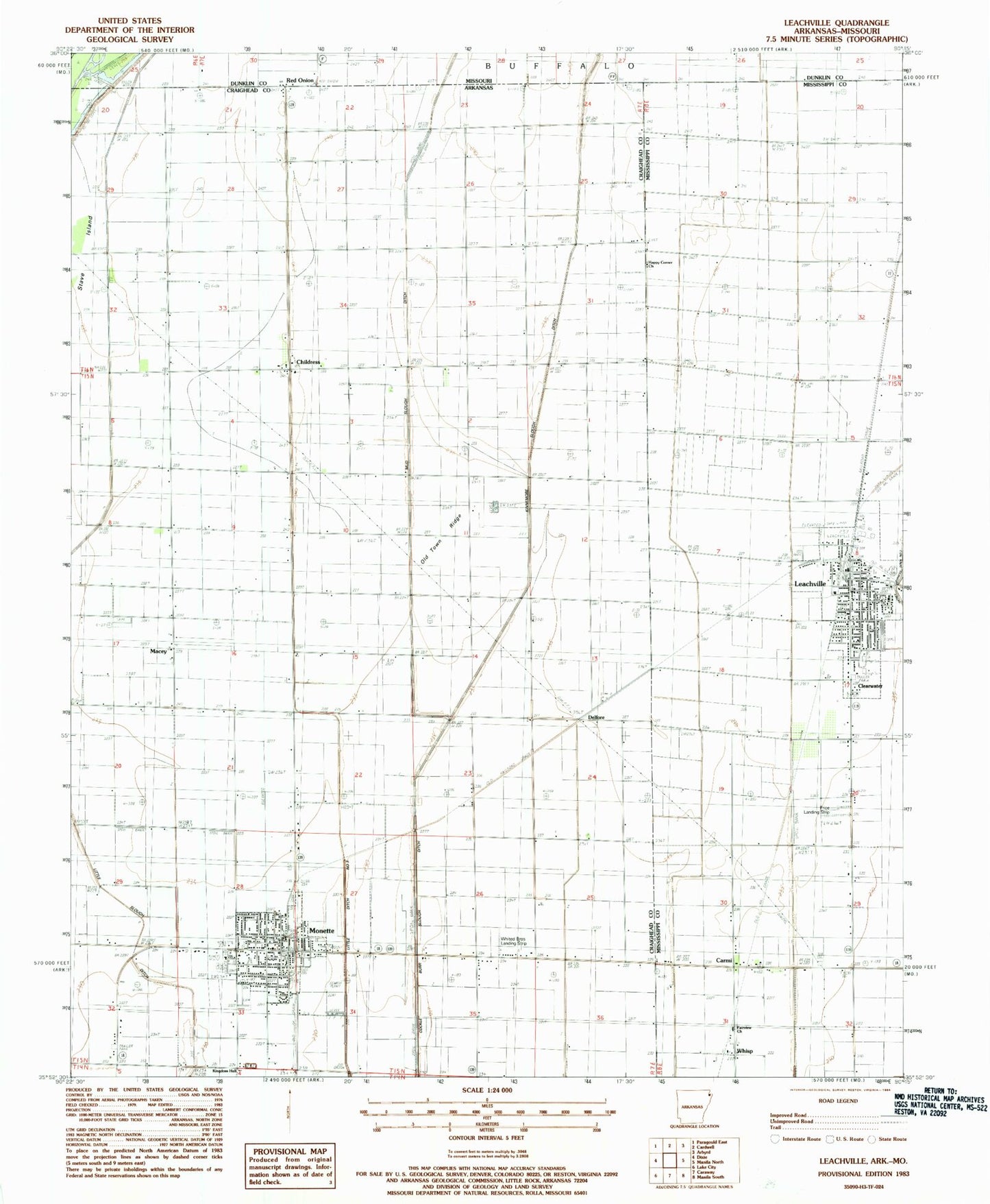
Classic USGS Leachville Arkansas 7.5'x7.5' Topo Map
Couldn't load pickup availability
Historical USGS topographic quad map of Leachville in the states of Arkansas, Missouri. Map scale may vary for some years, but is generally around 1:24,000. Print size is approximately 24" x 27"
This quadrangle is in the following counties: Craighead, Dunklin, Greene, Mississippi.
The map contains contour lines, roads, rivers, towns, and lakes. Printed on high-quality waterproof paper with UV fade-resistant inks, and shipped rolled.
Contains the following named places: Buffalo Island Central East Elementary School, Buffalo Island Central High School, Buffalo Island Central Junior High School, Buffalo Island Central West Elementary School, Buffalo Island Emergency Medical Services, Carmi, Childress, City of Leachville, City of Monette, Clearwater, Delfore, Happy Corner Church, Happy Corners, Kingdom Hall, Kinnemore Slough, KXXA-AM (Monette), Leachville, Leachville Police Department, Leachville Post Office, Leachville Volunteer Fire Department, Little Ditch Number 3, Macey, Macey School, Macy Cemetery, Macy Church, Monette, Monette Police Department, Monette Post Office, Monette Volunteer Fire Department, Mud Slough Ditch, Old Town Ridge, Orr, Price Landing Strip, Red Onion, Springfield, Township of Buffalo, Turkey Run School, Upper Macey School, Whisp, Whited Brothers Landing Strip, ZIP Code: 72447