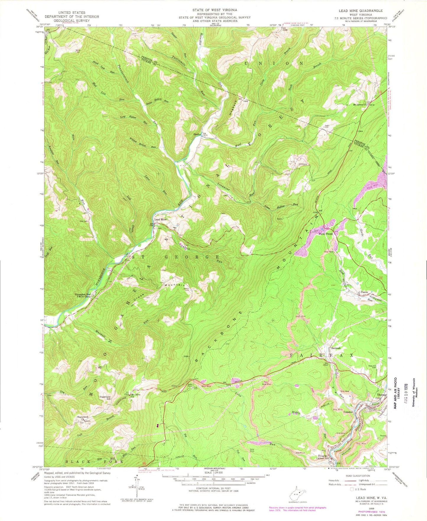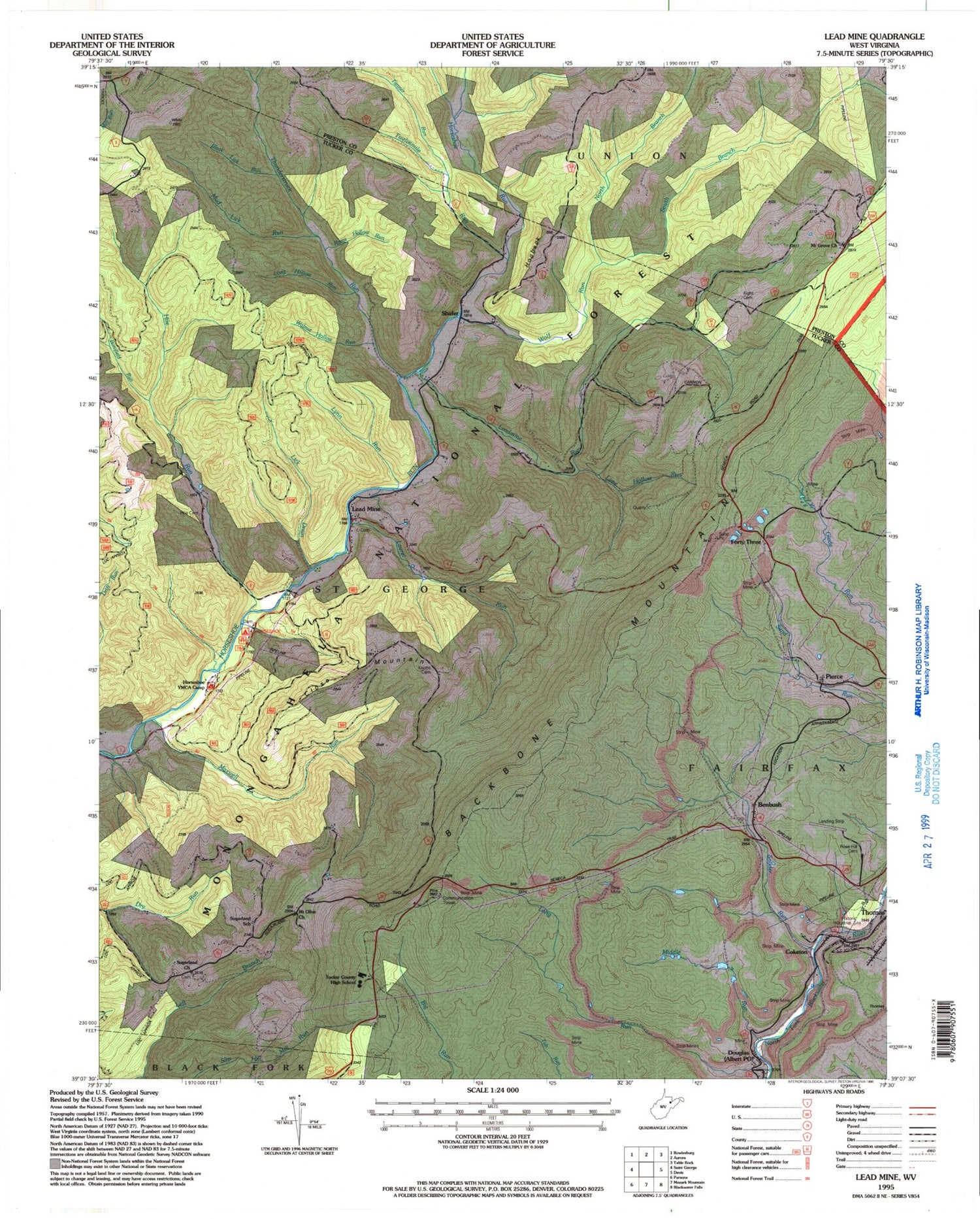
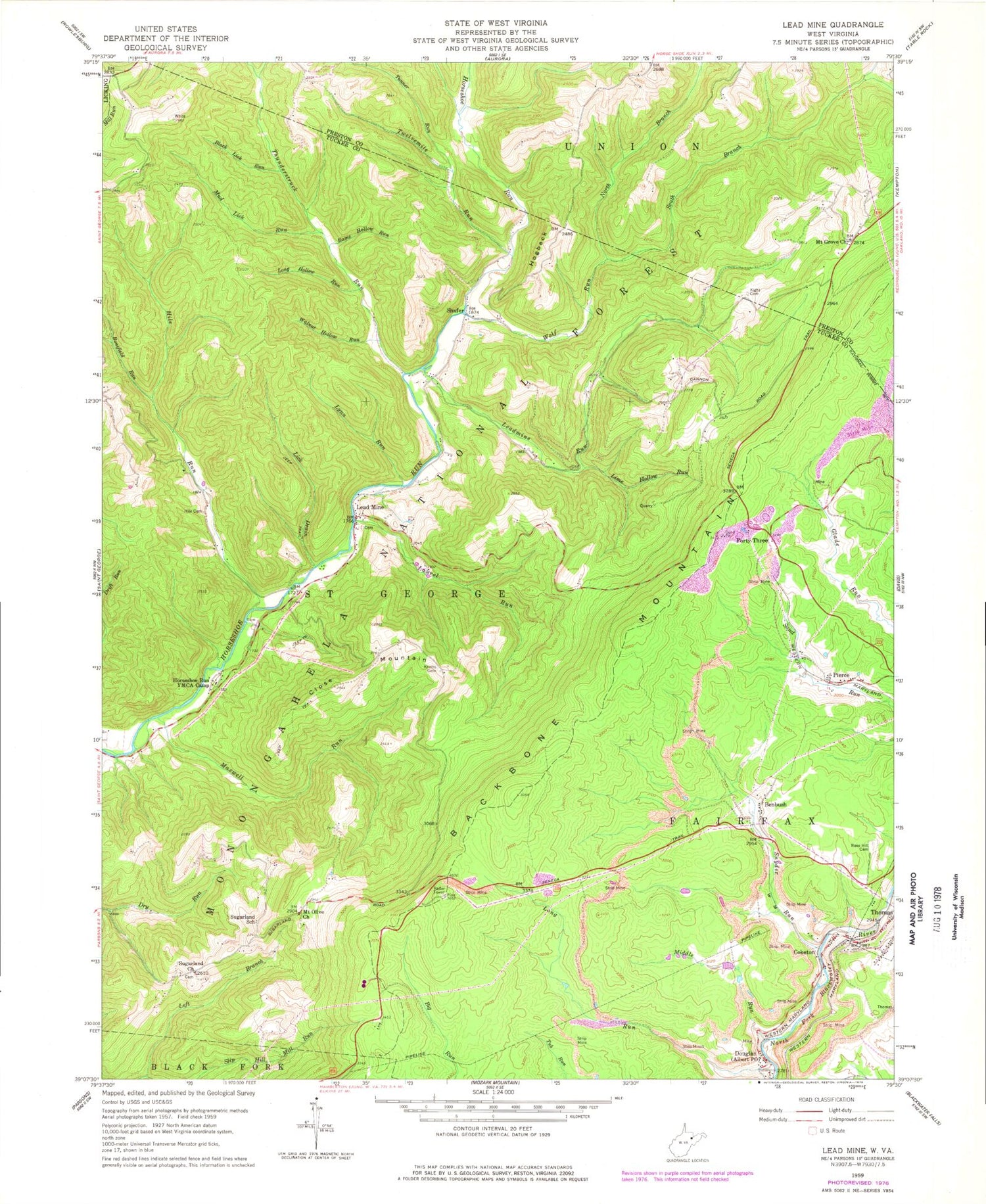
MyTopo
Classic USGS Lead Mine West Virginia 7.5'x7.5' Topo Map
Couldn't load pickup availability
Historical USGS topographic quad map of Lead Mine in the state of West Virginia. Map scale may vary for some years, but is generally around 1:24,000. Print size is approximately 24" x 27"
This quadrangle is in the following counties: Preston, Tucker.
The map contains contour lines, roads, rivers, towns, and lakes. Printed on high-quality waterproof paper with UV fade-resistant inks, and shipped rolled.
Contains the following named places: Benbush, Black Lick Run, Blackwater Wildlife Management Area, Bonifield Run, Cannon School, Close Mountain, Close Mountain School, Close Mountain Spring, Coketon, Douglas, Evans Mill, Fairfax District, Fairfax Quarry, Forty Three, Hickory Grove School, Hile Cemetery, Hile Run, Hogback, Horseshoe YMCA Camp, Horseshore Recreation Site, Kight Cemetery, Knotts Family Cemetery, Laurel Run, Lead Mine, Leadmine Run, Left Branch Mill Run, Lick Drain, Lime Hollow Run, Long Hollow Run, Long Run, Lynn Run, Maxwell Run, Middle Run, Mount Grove Church, Mount Hope School, Mount Olive Church, Mud Lick Run, North Branch Wolf Run, Pierce, Pine Grove School, Rams Hollow Run, Rose Hill Cemetery, Sell School, Shafer, Shaffertown School, Snyder Run, Stanbaugh School, Sugarland Church, Sugarland School, Tanner Run, Tucker County Ambulance Authority Squad 54734, Tucker County High School, Twelvemile Run, Walnut Hollow Run, Wolf Run, ZIP Code: 26292