MyTopo
Classic USGS Leadbetter Island Maine 7.5'x7.5' Topo Map
Couldn't load pickup availability
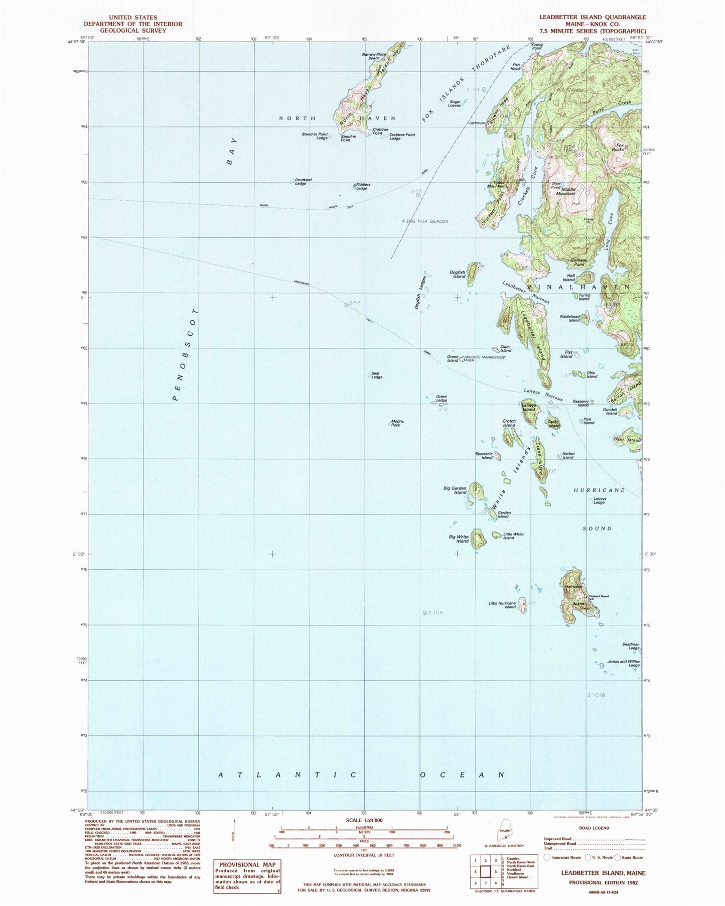
Historical USGS topographic quad map of Leadbetter Island in the state of Maine. Map scale may vary for some years, but is generally around 1:24,000. Print size is approximately 24" x 27"
This quadrangle is in the following counties: Knox.
The map contains contour lines, roads, rivers, towns, and lakes. Printed on high-quality waterproof paper with UV fade-resistant inks, and shipped rolled.
Contains the following named places: Big Garden Island, Big White Island, Browns Head, Browns Head Light Station, Calderwood Rock, Carver Ledge, Cedar Island, Clam Island, Clam Ledge, Conway Point, Crabtree Point, Crabtree Point Ledge, Crane Island, Crockett Cove, Crockett Point, Cross Island Ledge, Crotch Island, Deadman Ledge, Dog Fish Beacon, Dogfish Island, Dogfish Ledges, Drunkard Ledge, Dyer Island, Dyer Pond, Fiddlehead Island, Fiddler Ledge, Fiddlers Ledge, Fish Head, Flat Island, Fox Ears, Fox Rocks, Garden Island, Green Island, Green Ledge, Gundell Island, Hall Island, Harbor Island, Hurricane Island, Hurricane Sound, Inner Bay Ledges, James and Willies Ledge, Lawrys Island, Lawrys Ledge, Lawrys Narrows, Leadbetter Island, Leadbetter Narrows, Little Hurricane Island, Little White Island, Long Cove, Medric Rock, Middle Mountain, Narrow Place Beach, Ohio Island, Outward Bound School, Perry Ledge, Pole Island, Rasberry Island, Sand-in-Point Ledge, Seal Ledge, South Big Garden Island, Spectacle Island, Stand-in Point, Sugar Loaves, Tiptoe Mountain, Turnip Island, White Island, Young Point, Youngs Cove