MyTopo
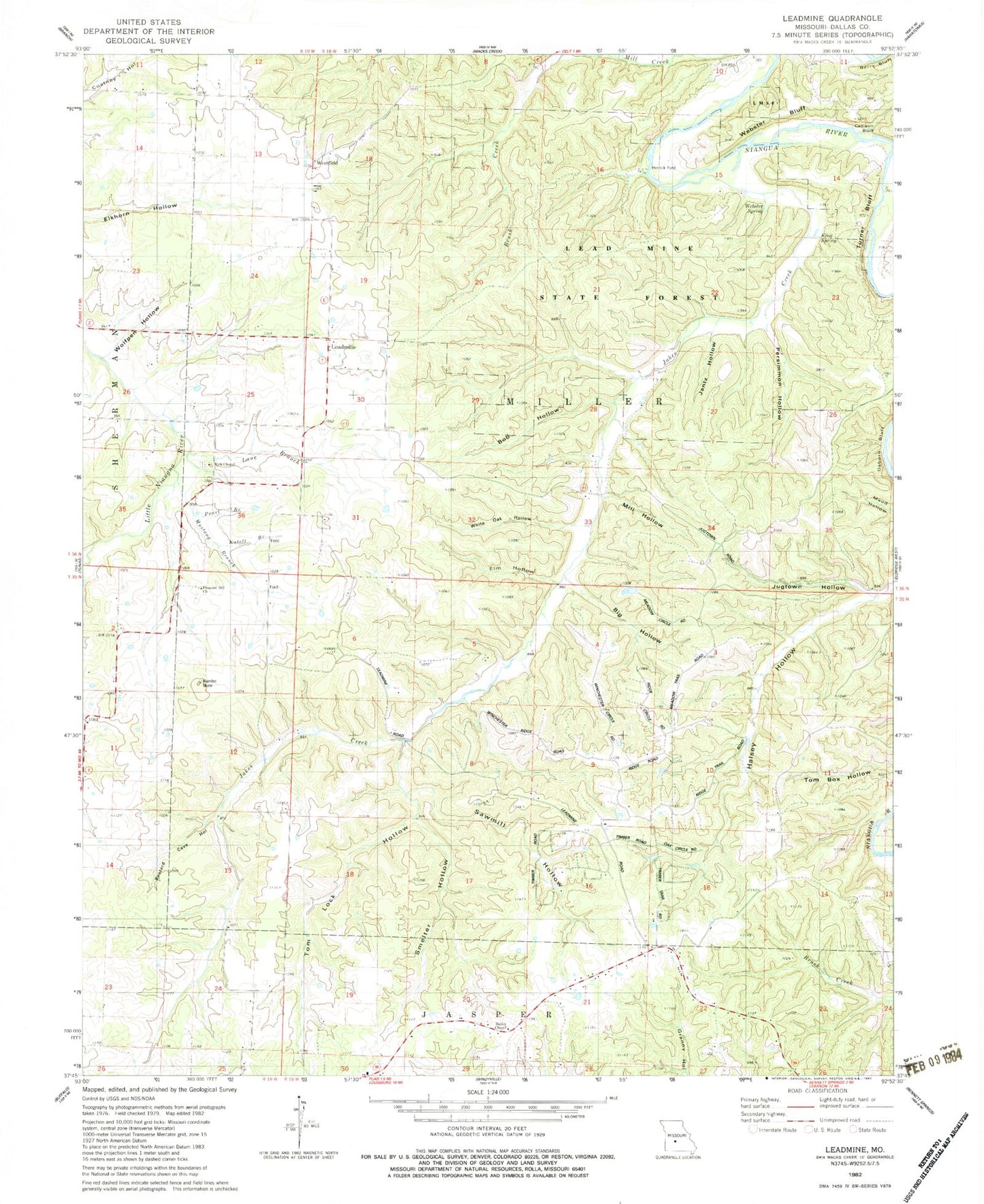
Classic USGS Leadmine Missouri 7.5'x7.5' Topo Map
Couldn't load pickup availability
Historical USGS topographic quad map of Leadmine in the state of Missouri. Typical map scale is 1:24,000, but may vary for certain years, if available. Print size: 24" x 27"
This quadrangle is in the following counties: Dallas.
The map contains contour lines, roads, rivers, towns, and lakes. Printed on high-quality waterproof paper with UV fade-resistant inks, and shipped rolled.
Contains the following named places: Barkley School (historical), Big Hollow, Bob Hollow, Buzzard Cave Hollow, Elm Hollow, Excell School (historical), Hickory Hill School (historical), Jantz Hollow, Jugtown Hollow, King Spring, Kirk Chapel, Lane Branch, Leadmine, Leadmine School, Mill Hollow, Osborn Bluff, Persimmon Hollow, Pleasant Hill Church, Sawmill Hollow, Smelter Hollow, Tom Lock Hollow, Turner Bluff, Union Victory School (historical), Webster Spring, Whiteoak Hollow, Wolfpen Hollow, Kirk Chapel Cemetery, Jakes Creek, Webster Bluff, Westfield, Pearl Branch, Mustang Branch, Katell Branch, Berry Ford (historical), Herrick Ford, Bailey Chapel, Lead Mine State Forest, Rambo Mine, Township of Miller, Louisburg Volunteer Fire Department Station 2