MyTopo
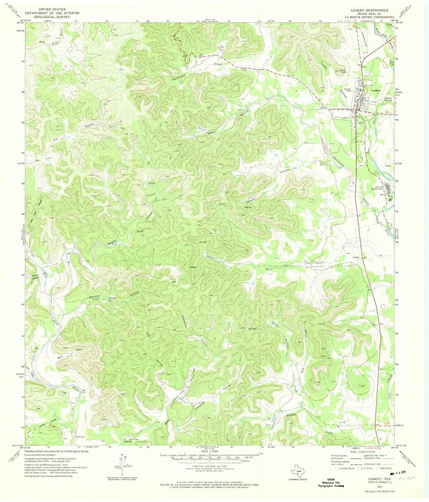
Classic USGS Leakey Texas 7.5'x7.5' Topo Map
Couldn't load pickup availability
Historical USGS topographic quad map of Leakey in the state of Texas. Map scale may vary for some years, but is generally around 1:24,000. Print size is approximately 24" x 27"
This quadrangle is in the following counties: Real.
The map contains contour lines, roads, rivers, towns, and lakes. Printed on high-quality waterproof paper with UV fade-resistant inks, and shipped rolled.
Contains the following named places: Alto Frio Encampment, Big Lake, Big Lake Dam, Buck Hollow, Buffalo Creek, Cattail Hollow, Cedar Hollow, City of Leakey, Clark Cemetery, Cow Hollow, Cummins Hollow, Daliby Hollow, Elm Creek, Exile Cemetery, Frio Canyon Emergency Medical Service, Leakey, Leakey City Hall, Leakey Post Office, Leakey Springs, Leakey Volunteer Fire Department, Lee Creek, Leonard Harmon Hollow, Little Buffalo Creek, Patterson Creek, Real County Airport, Real County Jail, Real County Sheriff's Office, Sanders Hollow, Sedberry Hollow, Spring Branch Springs, Tucker Hollow, Wilson Hollow