MyTopo
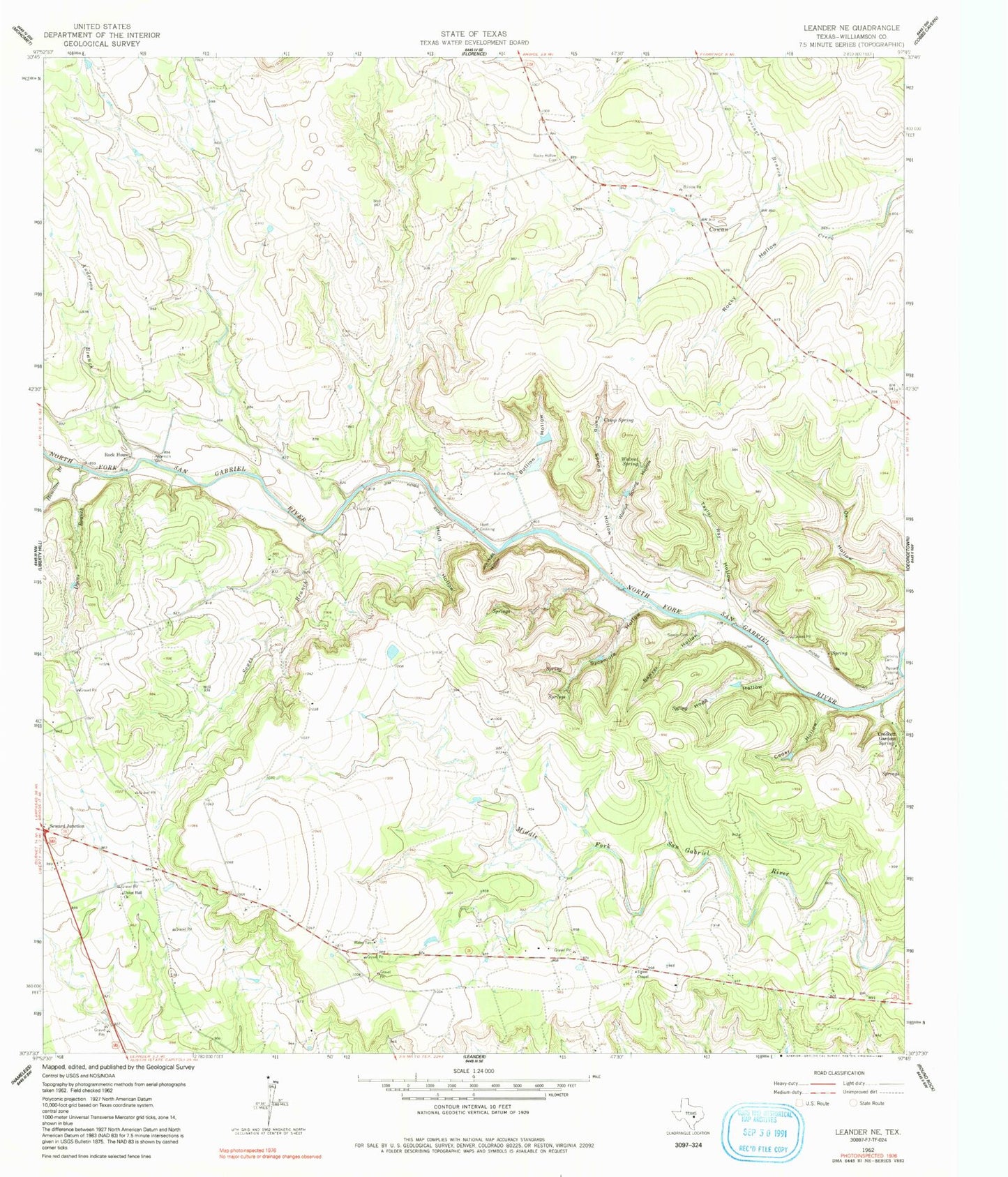
Classic USGS Leander NE Texas 7.5'x7.5' Topo Map
Couldn't load pickup availability
Historical USGS topographic quad map of Leander NE in the state of Texas. Typical map scale is 1:24,000, but may vary for certain years, if available. Print size: 24" x 27"
This quadrangle is in the following counties: Williamson.
The map contains contour lines, roads, rivers, towns, and lakes. Printed on high-quality waterproof paper with UV fade-resistant inks, and shipped rolled.
Contains the following named places: Anderson Branch, Anderson Cemetery, Bullion Cemetery, Bullion Hollow, Camp Spring, Camp Spring Hollow, Cedar Hollow, Crockett Gardens, Dyeus Branch, Fore Cemetery, Hamilton Branch, Hunt Cemetery, Hunt Hollow, Jenkins Cemetery, Jennings Branch, Jim Hogg Hollow, Ox Hollow, Rock House, Rocky Hollow, Rocky Hollow Cemetery, Sawyer Cemetery, Sawyer Hollow, Sowes Branch, Spring Hogg Hollow, Sycamore Hollow, Taylor Ray Hollow, Union Chapel, Union Hall Church, Walnut Spring, Walnut Spring Hollow, Hunt Crossing, Russell Crossing, 4BH Heliport, Hilde-Griff Field, Knight Spring, Sawyer Park, Russell Park, Walnut Spring Park, Britts Crosswind Airport, Santa Rita Ranch Census Designated Place, Santa Rita Ranch