MyTopo
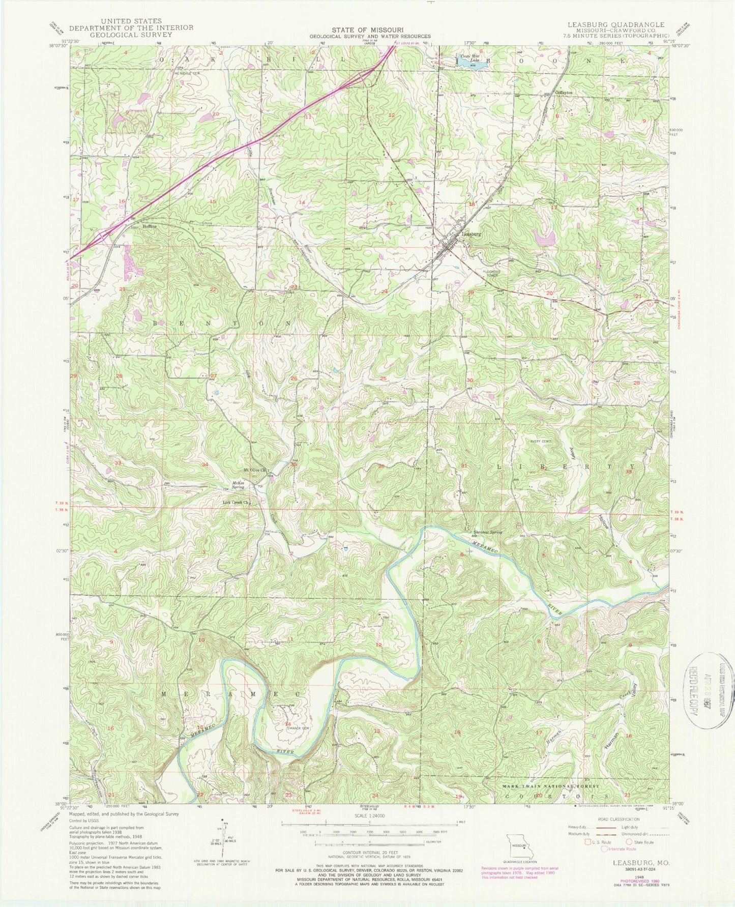
Classic USGS Leasburg Missouri 7.5'x7.5' Topo Map
Couldn't load pickup availability
Historical USGS topographic quad map of Leasburg in the state of Missouri. Typical map scale is 1:24,000, but may vary for certain years, if available. Print size: 24" x 27"
This quadrangle is in the following counties: Crawford.
The map contains contour lines, roads, rivers, towns, and lakes. Printed on high-quality waterproof paper with UV fade-resistant inks, and shipped rolled.
Contains the following named places: Zane Iron Mine, Railroad Iron Mine, Landtown, Griffith Iron Mine, Clapps Iron Mine, Blue Hole, Blairs Creek, Avery (historical), Avery Cemetery, Avery Hollow, Coffeyton, Crote Mac Lake, Haack Cemetery, Hofflins, Leasburg, Liberty School, Lick Creek, Lick Creek Church, Lick Creek School, Matlock School, McKee Spring, McNickle Cemetery, Mount Olive Church, Nixon School, Saranac Spring, Sunnyside School, Harman Valley, KBCC-AM (Cuba), Brummet Lake Dam, Brummet Lake, Kemp Lake Dam, Kemp Lake, Cuba Fish Farm Dam, Cuba Fish Farm Lake, Haladale Lake Dam, Pine Lake, Klontz Lake Dam, Klontz Lake, Matthews Lake Dam, Matthews Lake, Budget Buster Dam, Sprinkles Bass Hole, Jellystone Park Dam, Boo-Boos Lake, Ford Lake Dam, Ford Lake, Township of Benton, Village of Leasburg, Leasburg Volunteer Fire Department, Lea Cemetery, Leasburg Post Office