MyTopo
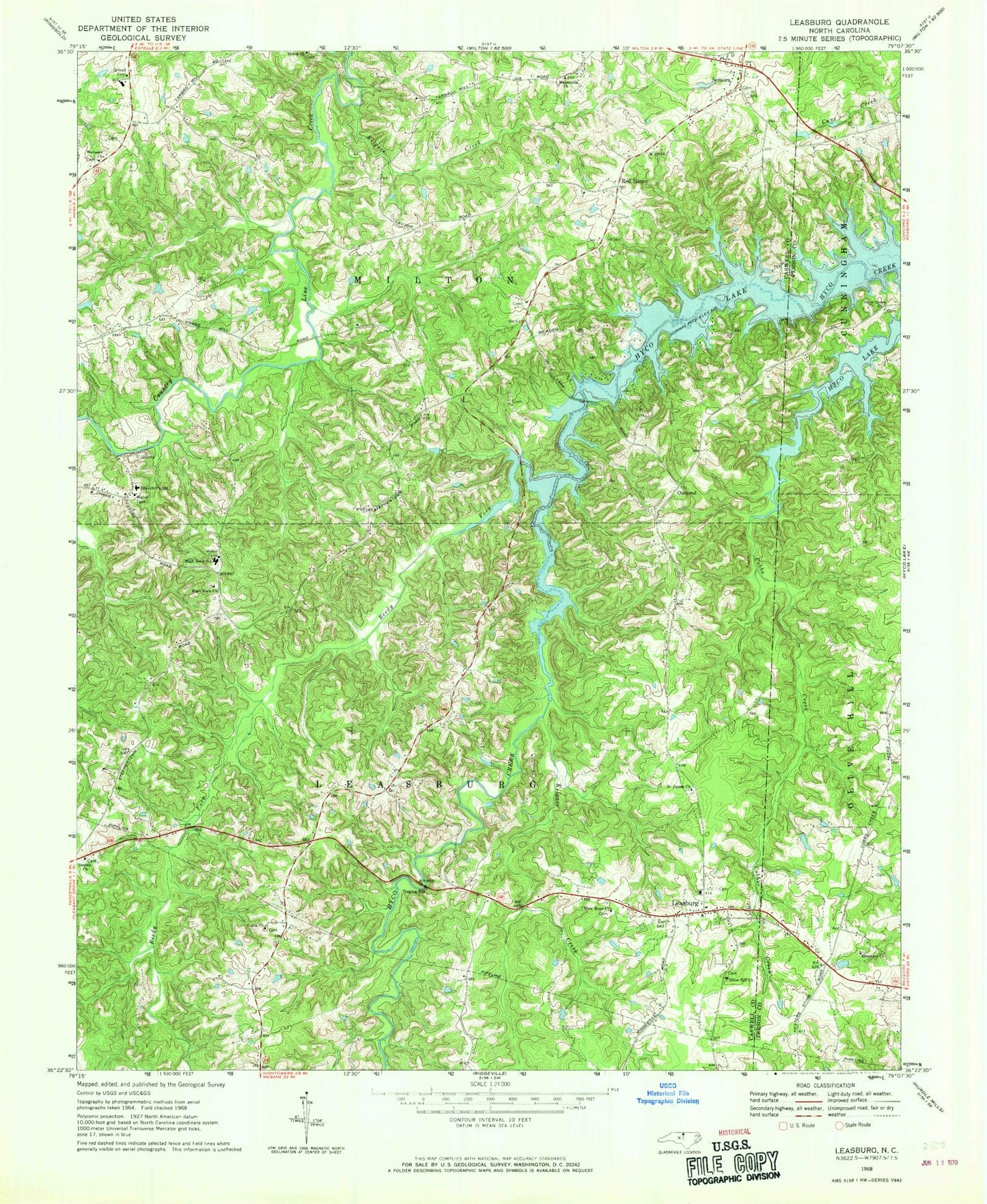
Classic USGS Leasburg North Carolina 7.5'x7.5' Topo Map
Couldn't load pickup availability
Historical USGS topographic quad map of Leasburg in the state of North Carolina. Map scale may vary for some years, but is generally around 1:24,000. Print size is approximately 24" x 27"
This quadrangle is in the following counties: Caswell, Person.
The map contains contour lines, roads, rivers, towns, and lakes. Printed on high-quality waterproof paper with UV fade-resistant inks, and shipped rolled.
Contains the following named places: Archibald Murphy Elementary School, Beulah Church, Blanch Prison, Caswell Wildlife Mgmt Area Pond T, Caswell Wildlife Mgmt Pond Dam Number Two, Ebenezer Church Cemetery, Ebenezer Primitive Baptist Church, Gilead Cemetery, High Rock Church, High Rock School, Kilgore Creek, Leasburg, Leasburg Post Office, Leasburg Volunteer Fire Department, Macedonia Church, New Hope Church, Oak View School, Olive Grove Church, Olive Hill Church, Osmond, Red House, Reedy Fork, Saint James Church, Semora, Semora Volunteer Fire Department, Township of Leasburg, Township of Milton, Union Church, Welcome Church, Winstead '76' Airport, Yarbro, ZIP Code: 27291