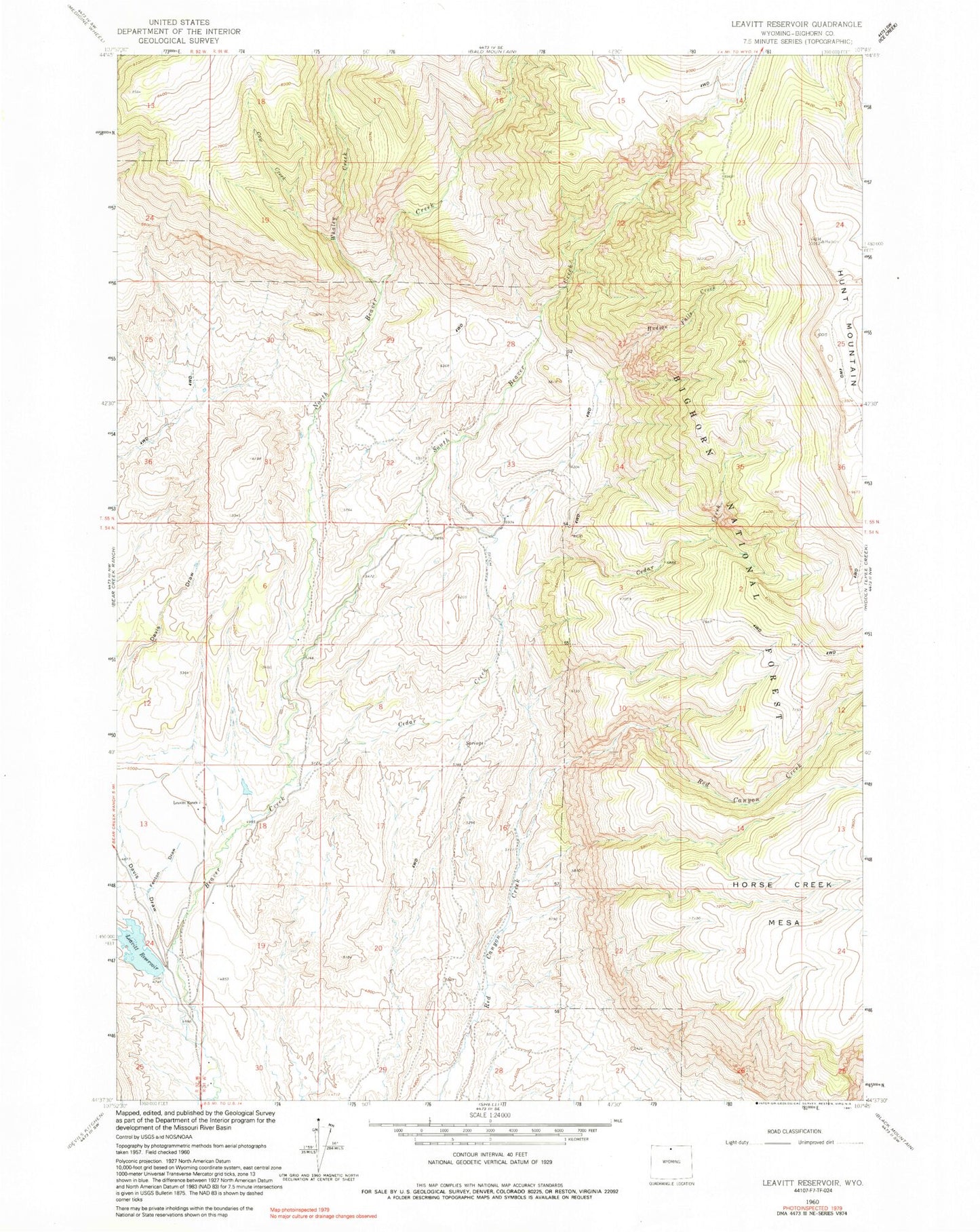
MyTopo
Classic USGS Leavitt Reservoir Wyoming 7.5'x7.5' Topo Map
Regular price
$16.95
Regular price
Sale price
$16.95
Unit price
per
Couldn't load pickup availability
Historical USGS topographic quad map of Leavitt Reservoir in the state of Wyoming. Map scale may vary for some years, but is generally around 1:24,000. Print size is approximately 24" x 27"
This quadrangle is in the following counties: Big Horn, Sheridan.
The map contains contour lines, roads, rivers, towns, and lakes. Printed on high-quality waterproof paper with UV fade-resistant inks, and shipped rolled.
Contains the following named places: Beaver Creek Mine, Cedar Creek, Cow Creek, Davis Draw, Fenton Draw, Hudson Falls Creek, Hunt Mountain, Leavitt Dam, Leavitt Ranch, Leavitt Reservoir, London Ditch, North Beaver Creek, South Beaver Creek, Whaley Creek, ZIP Code: 82441