MyTopo
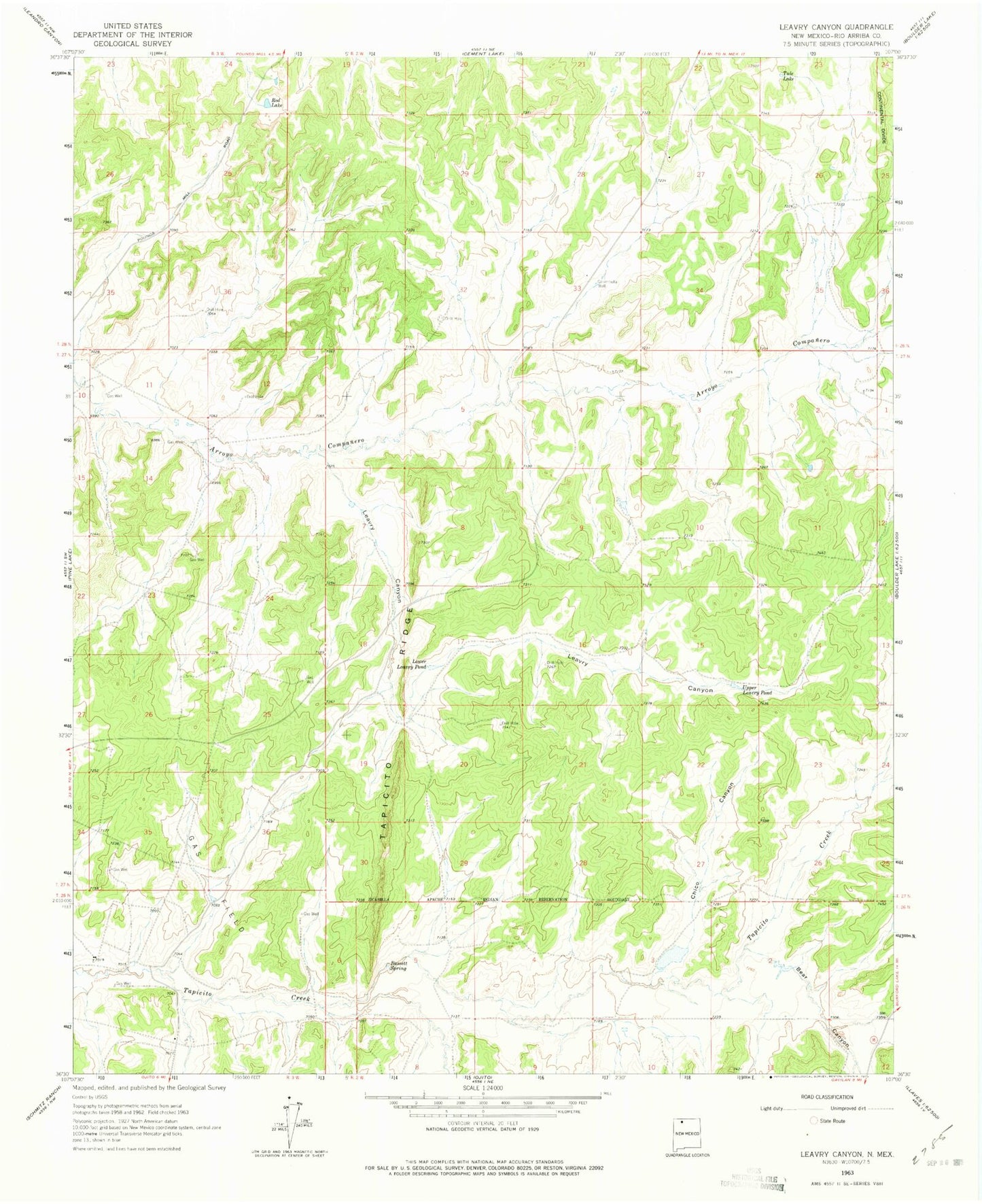
Classic USGS Leavry Canyon New Mexico 7.5'x7.5' Topo Map
Couldn't load pickup availability
Historical USGS topographic quad map of Leavry Canyon in the state of New Mexico. Map scale may vary for some years, but is generally around 1:24,000. Print size is approximately 24" x 27"
This quadrangle is in the following counties: Rio Arriba.
The map contains contour lines, roads, rivers, towns, and lakes. Printed on high-quality waterproof paper with UV fade-resistant inks, and shipped rolled.
Contains the following named places: Bassett Spring, Bear Canyon, Chico Canyon, Edward Velarde Water Well, Five Tanks Water Well, Garambulla Well, Jicarilla Apache Nation Reservation, L Garambullo Water Well, Leavry Canyon, Lincoln Velarde Water Well, Lower Leavry Pond, Red Lake, Robert Imel Water Well, Tapicito Ridge, Tule Lake, Upper Leavry Pond