MyTopo
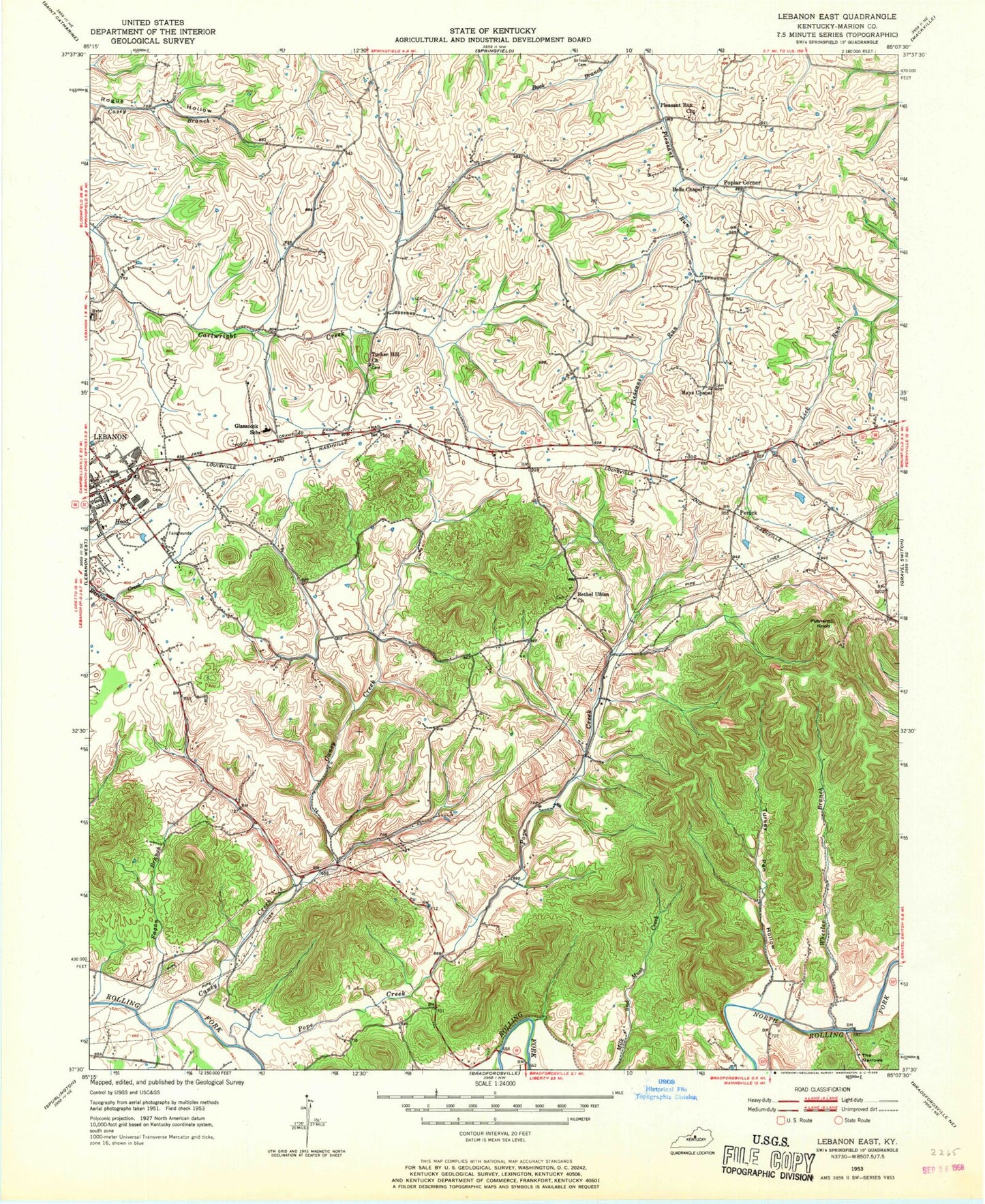
Classic USGS Lebanon East Kentucky 7.5'x7.5' Topo Map
Couldn't load pickup availability
Historical USGS topographic quad map of Lebanon East in the state of Kentucky. Map scale may vary for some years, but is generally around 1:24,000. Print size is approximately 24" x 27"
This quadrangle is in the following counties: Marion.
The map contains contour lines, roads, rivers, towns, and lakes. Printed on high-quality waterproof paper with UV fade-resistant inks, and shipped rolled.
Contains the following named places: Amboy Railroad Siding, Bells Chapel, Bethel Union Church, Boy Scout Park, Caney Creek, Colgans Hill, Fagan Branch, Fagan Branch Lake, Glasscock Elementary School, Helm, Helm School, Lebanon Division, Lebanon Fire Department, Lebanon Volunteer Fire Department, Marion County Lake, Mays Chapel, Penick, Penick Post Office, Penick Railroad Station, Pleasant Run, Pleasant Run Church, Pope Creek, Poplar Corner, Proctor Knott Chautauqua Association Historical Marker, Putnam Knob, Ryder Cemetery, Saint Ivos Cemetery, Sandusky Station Historical Marker, Shortline Pike, Springfield Pike, The Narrows, Tucker Hill Church, Turkey Pen Hollow, Wheeler Branch, WLBN-AM (Lebanon), WLSK-FM (Lebanon), ZIP Code: 40033