MyTopo
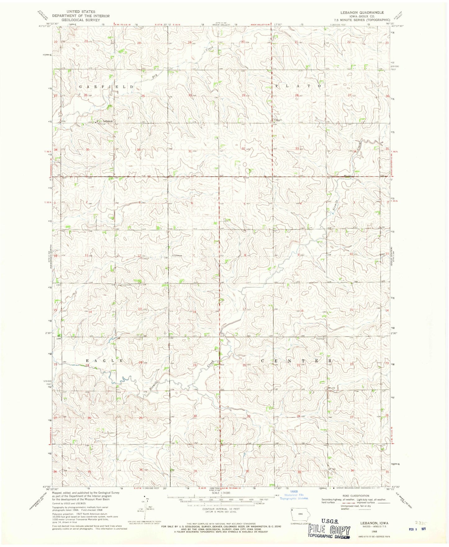
Classic USGS Lebanon Iowa 7.5'x7.5' Topo Map
Couldn't load pickup availability
Historical USGS topographic quad map of Lebanon in the state of Iowa. Map scale may vary for some years, but is generally around 1:24,000. Print size is approximately 24" x 27"
This quadrangle is in the following counties: Sioux.
The map contains contour lines, roads, rivers, towns, and lakes. Printed on high-quality waterproof paper with UV fade-resistant inks, and shipped rolled.
Contains the following named places: Blue Grass Stock Farm, Center Townhall, De Roon Hog Farm, Dejong Farm, Dykshorn Farm, E and A Farm, Highland Cemetery, Highland Park, Horstman Farms, J A Farms, KTSB-FM (Sioux Center), Lebanon, Lebanon Christian Church Cemetery, Lebanon Church, Peace Church, Peace Lutheran Cemetery, Post Farm, R B F Farms, Raak Farms, Sweet Nectar Farms, Township of Center, Van Berkel Farms, Van Voorst Dairy Farm