MyTopo
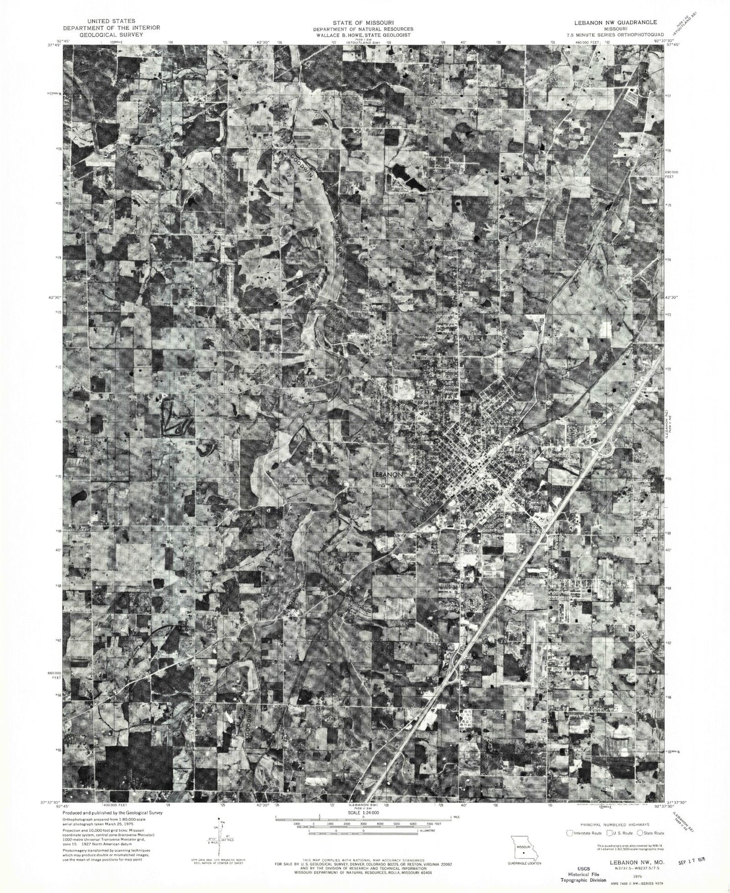
Classic USGS Lebanon Missouri 7.5'x7.5' Topo Map
Couldn't load pickup availability
Historical USGS topographic quad map of Lebanon in the state of Missouri. Map scale may vary for some years, but is generally around 1:24,000. Print size is approximately 24" x 27"
This quadrangle is in the following counties: Laclede.
The map contains contour lines, roads, rivers, towns, and lakes. Printed on high-quality waterproof paper with UV fade-resistant inks, and shipped rolled.
Contains the following named places: Adkins Sink, Atchley, Atchley Cemetery, Azure Hills Golf Course, Bland School, Bolles Cemetery New, Bolles School, Candock Church, Candock School, City of Lebanon, Department of Conservation Southwest Field Fire Office Lebanon, Donald Cemetery, Dotson Cemetery, Emmanuel Chapel, Fellowship Church, Floyd W Jones Lebanon Airport, High Prairie Church, Highland Park Church, Hillcrest School, Holman Cemetery, Horseshoe Lake, Ivey Cemetery, Ivy School, Joel E Barber School, Kapp School, Keck School, Keen Lake Dam, KJEL-AM (Lebanon), KLWT-AM (Lebanon), KLWT-FM (Lebanon), KTTK-FM (Lebanon), Laclede County Sheriff's Office, Lake Shore Estates Lower Dam, Lake Shore Estates Upper Dam, Lebanon, Lebanon Carrier Annex Post Office, Lebanon Cemetery, Lebanon Country Club, Lebanon Fire Department Station 1, Lebanon Fire Department Station 2, Lebanon Police Department, Lebanon Rural Fire Protection District Station 1 Headquarters, Lebanon Rural Fire Protection District Station 3, Liberty Cemetery, Liberty School, Maplecrest Park, Maplecrest School, Mark Twain School, Mercy Hospital Lebanon, Mount Rose Memorial Park, Number 54 Lake, Russell, South Five Church, Southern Heights Church, Township of Lebanon, Vernon Cemetery, Victory Church, Wallace Lake, West Lebanon, ZIP Code: 65536