MyTopo
Classic USGS Lebanon Ohio 7.5'x7.5' Topo Map
Couldn't load pickup availability
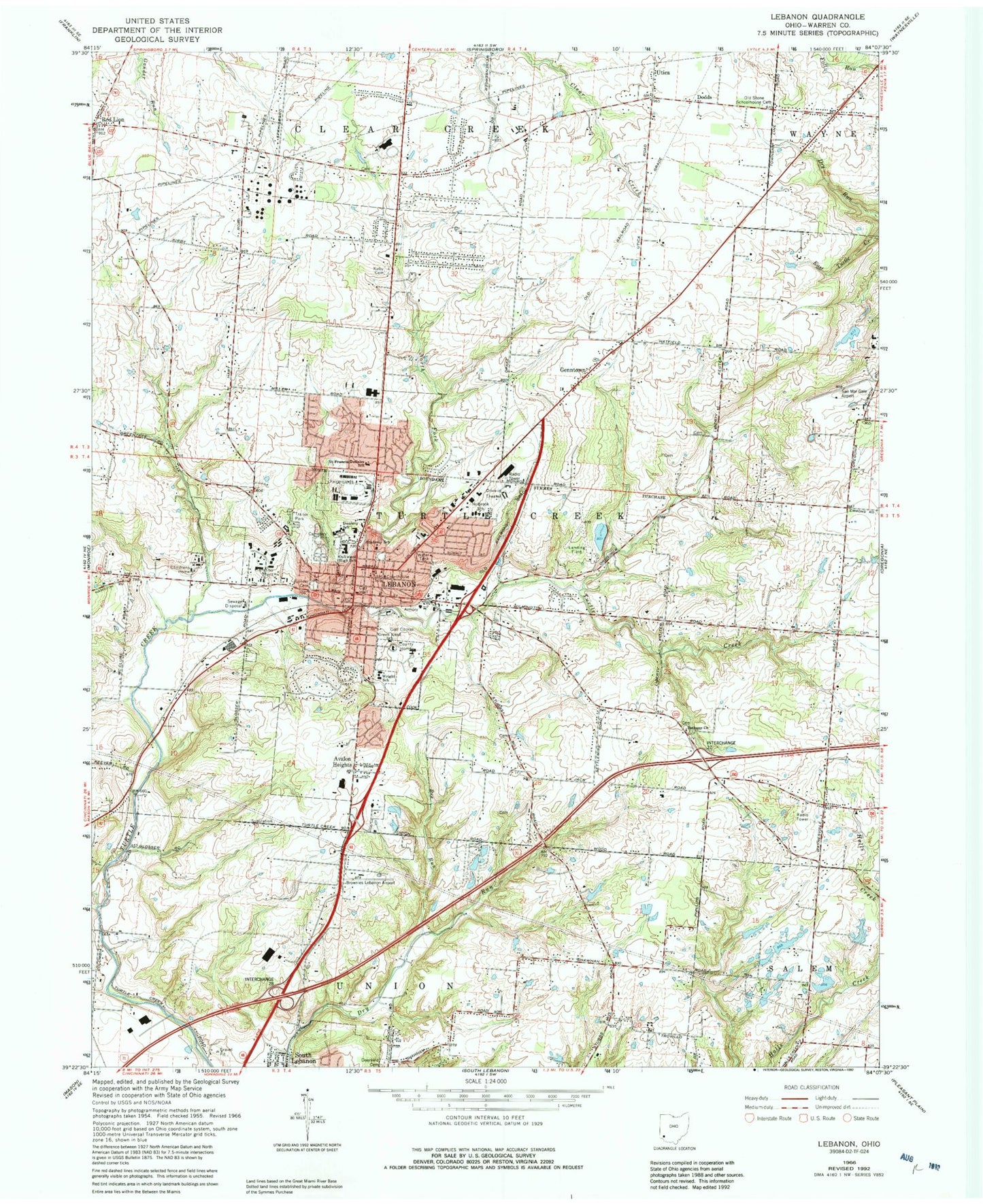
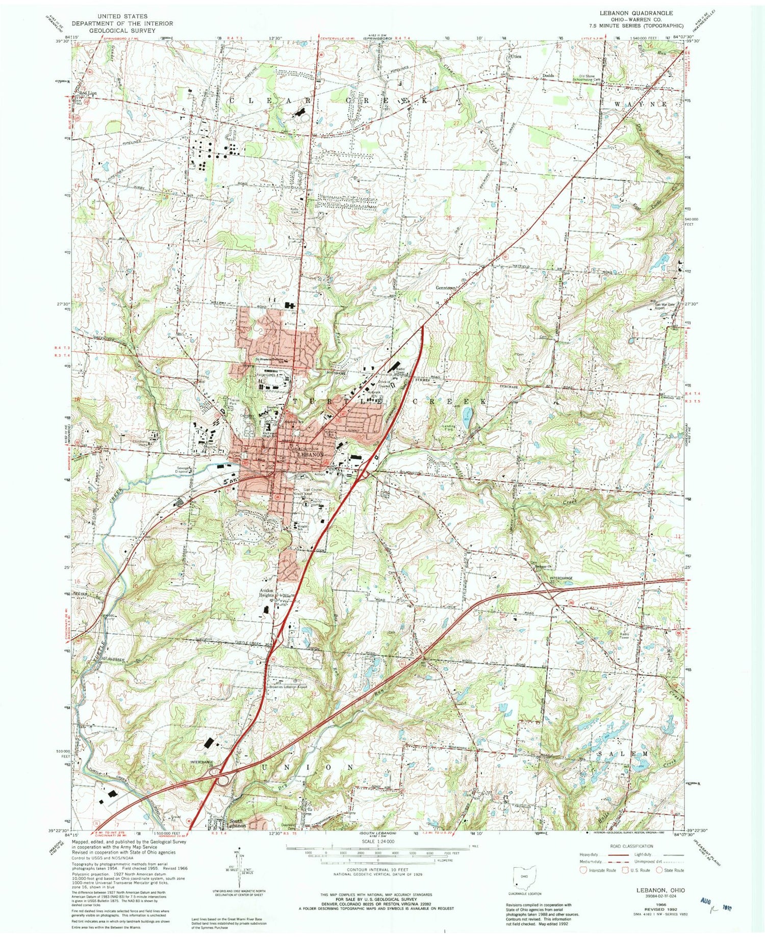
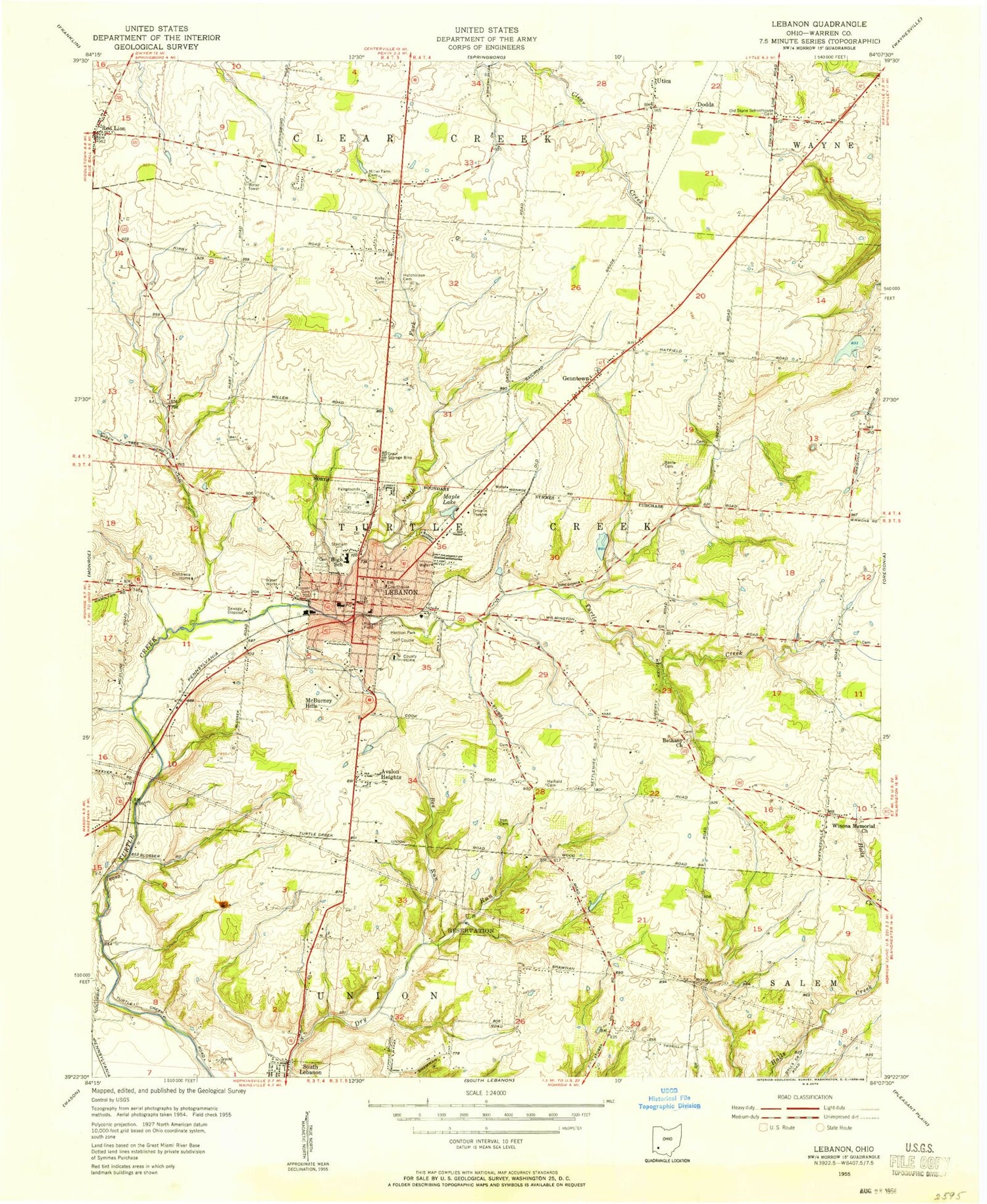
Historical USGS topographic quad map of Lebanon in the state of Ohio. Map scale may vary for some years, but is generally around 1:24,000. Print size is approximately 24" x 27"
This quadrangle is in the following counties: Warren.
The map contains contour lines, roads, rivers, towns, and lakes. Printed on high-quality waterproof paper with UV fade-resistant inks, and shipped rolled.
Contains the following named places: Academy School, Alfred Holbrook Elementary School, Avalon Heights, Baker Creek, Bee Run, Berry Intermediate School, Bethany Cemetery, Bethany Church, Bethesda-Warren County Health Center, Bible Church of God, Boehmler Pond, Boehmler Pond Dam, Brownies Lebanon Airport, Calvary Baptist Church, Church of Christ, City of Lebanon, Clearcreek Township Fire District Station 23, Colonial Park, Colony Square Shopping Center, Countryside Plaza Shopping Center, Dancing Horse Farm, Dodds, Dodds Cemetery, East End Historic District, First Baptist Church, First Church of God, First Presbyterian Church, Floraville Historic District, Francis Dunlavy Elementary School, Fred Lake, Fred Lake Dam, French Run, Genntown, Glendower Museum, Green Knoll School, Greenwood Cemetery, Greenwood School, Harmon Golf Course, Harmon Industrial Park, Harmon Park, Harrison School, Hart School, Harts Plaza Shopping Center, Hatfield Cemetery, Howards Run, Hutchinsons Run, Independent School, Irons Fruit Farm, Irons Run, Jamisons Run, Kirby Cemetery, Lebanon, Lebanon Cemetery, Lebanon Christian School, Lebanon Commerical Historic District, Lebanon Division of Police Station, Lebanon East Commercial Industrial Park, Lebanon Fire Station and Emergency Medical Services Station 41, Lebanon Fire Station and Emergency Medical Services Station 42, Lebanon High School, Lebanon Post Office, Lebanon Public Library, Lebanon Public School, Lebanon Town Hall, Lelan, Liberty School, Lilley Lake, Lilley Lake 9341-006, Lilley Lake 9341-006 Dam, Lilley Lake Dam, Little Muddy Creek, Louisa Wright Elementary School, Lucille Berry Middle School, Maplewood Orchard Airport, Maplewood Sanitorium, Mary Ann Klingling Childrens Home, Maryhaven Juvenile Center, Merrittstown, Mooneys Run, Mulfords Run, North Broadway Historic District, Oakwood High School, Ohio State Highway Patrol - Lebanon Patrol Post, Pilgrim Baptist Church, Pioneer Cemetery, Red Lion, Red Lion United Methodist Church, Reeders Run, Ridge, Ridge School, Runyan Field, Saint Francis De Sales Roman Catholic Church, Saint Francis DeSales School, San Mar Gale Airport, San Mar Gale Farm, Spear Pond, Spear Pond Dam, Stolle Lake, Stolle Lake Dam Number Two, Thompson Run, Township of Union, Turtlecreek Township Fire and Emergency Medical Services Fire Station 31 Bostic, Turtlecreek Township William A Stevens Fire and EMS Station 32, Utica, Utica School, Valley School, Warren County, Warren County Childrens Home, Warren County Courthouse, Warren County Fairgrounds, Warren County Home, Warren County Jail, Warren County Museum, Warren County Sheriff's Office, Washington School, West Baptist Church, Zion Baptist Church, ZIP Code: 45036