MyTopo
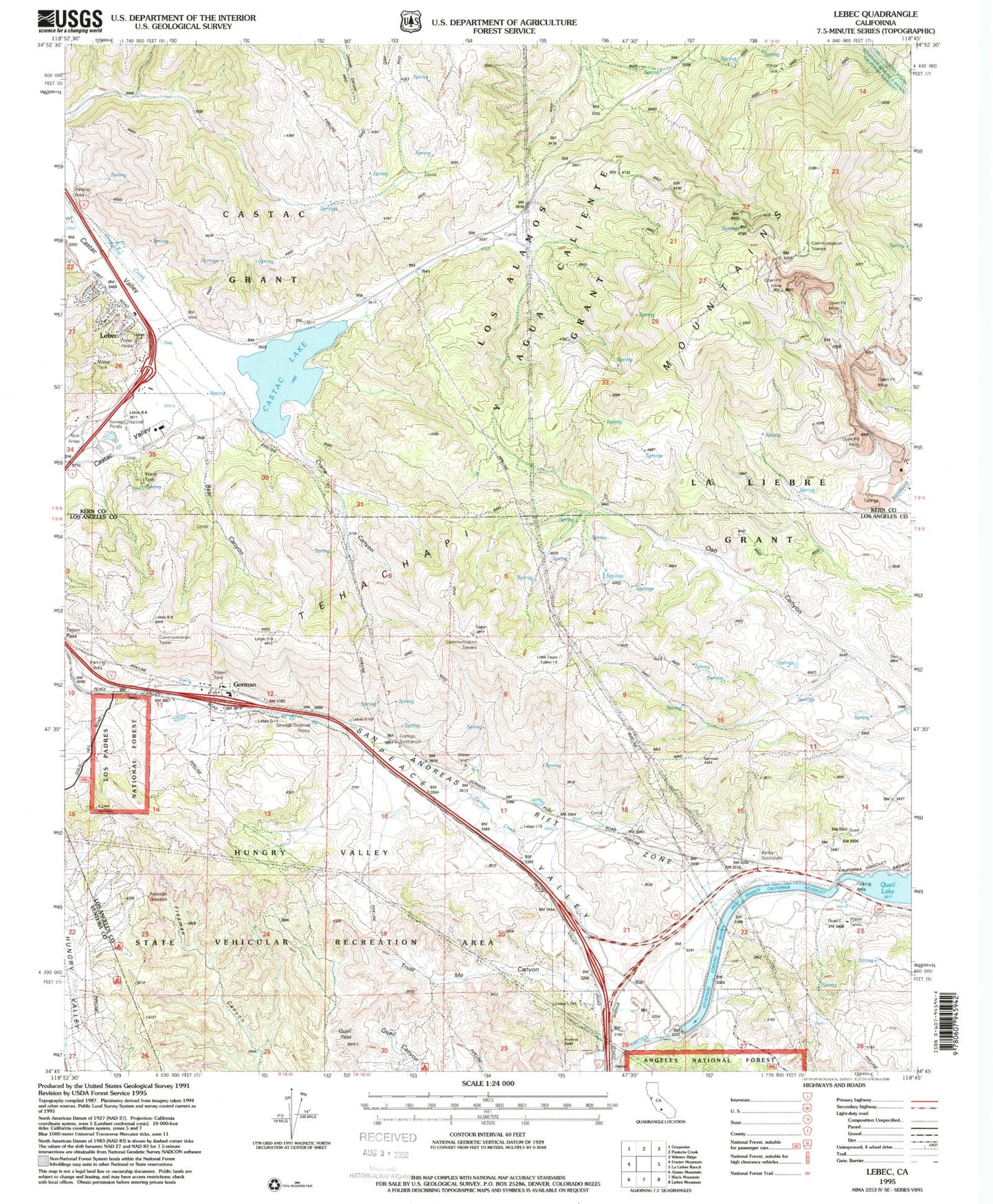
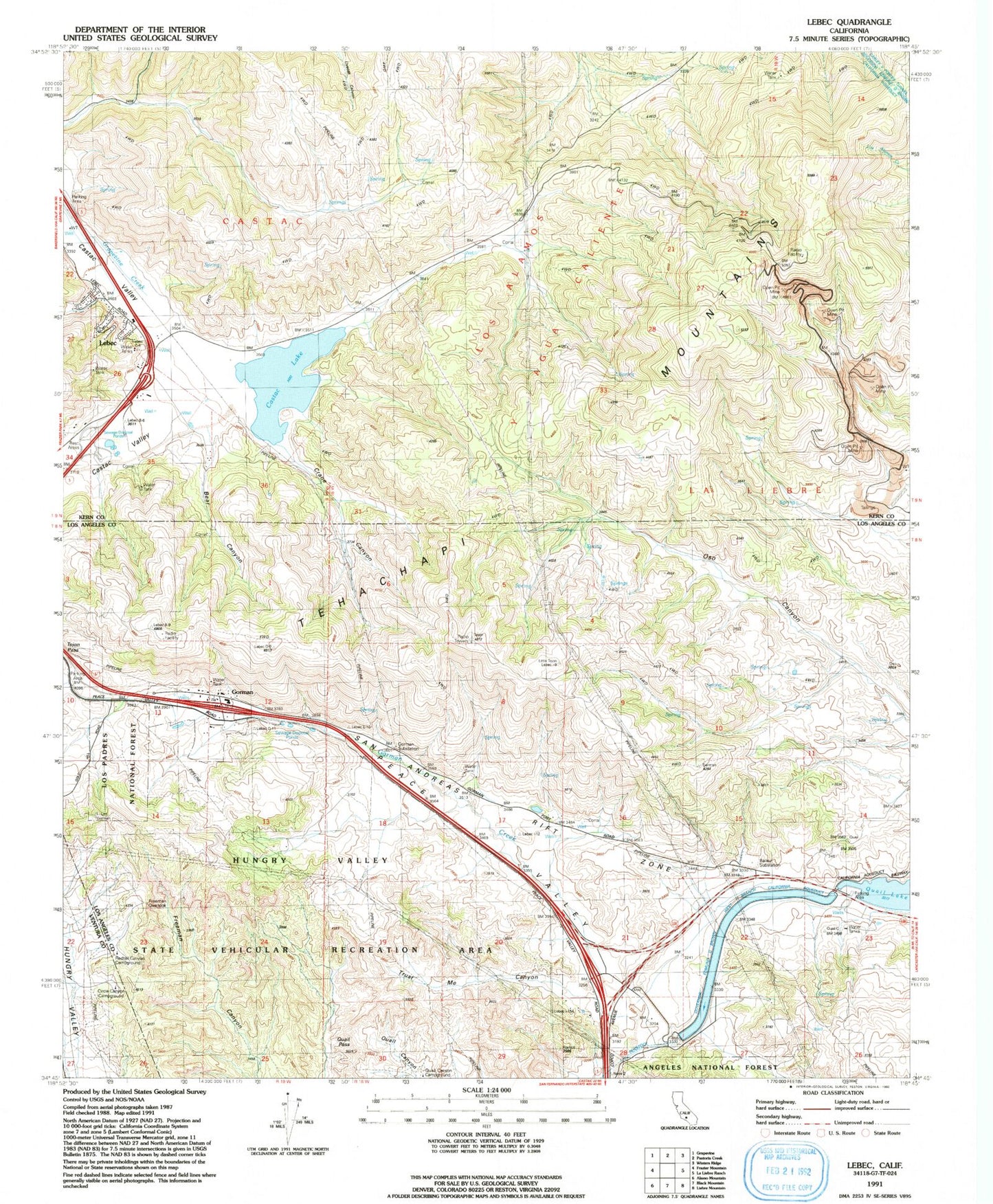
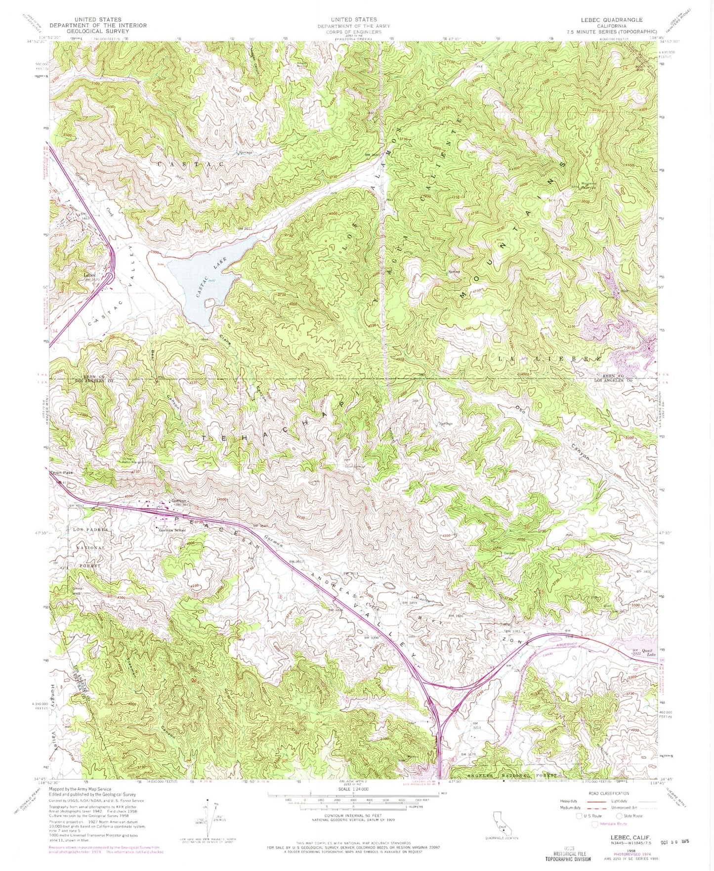
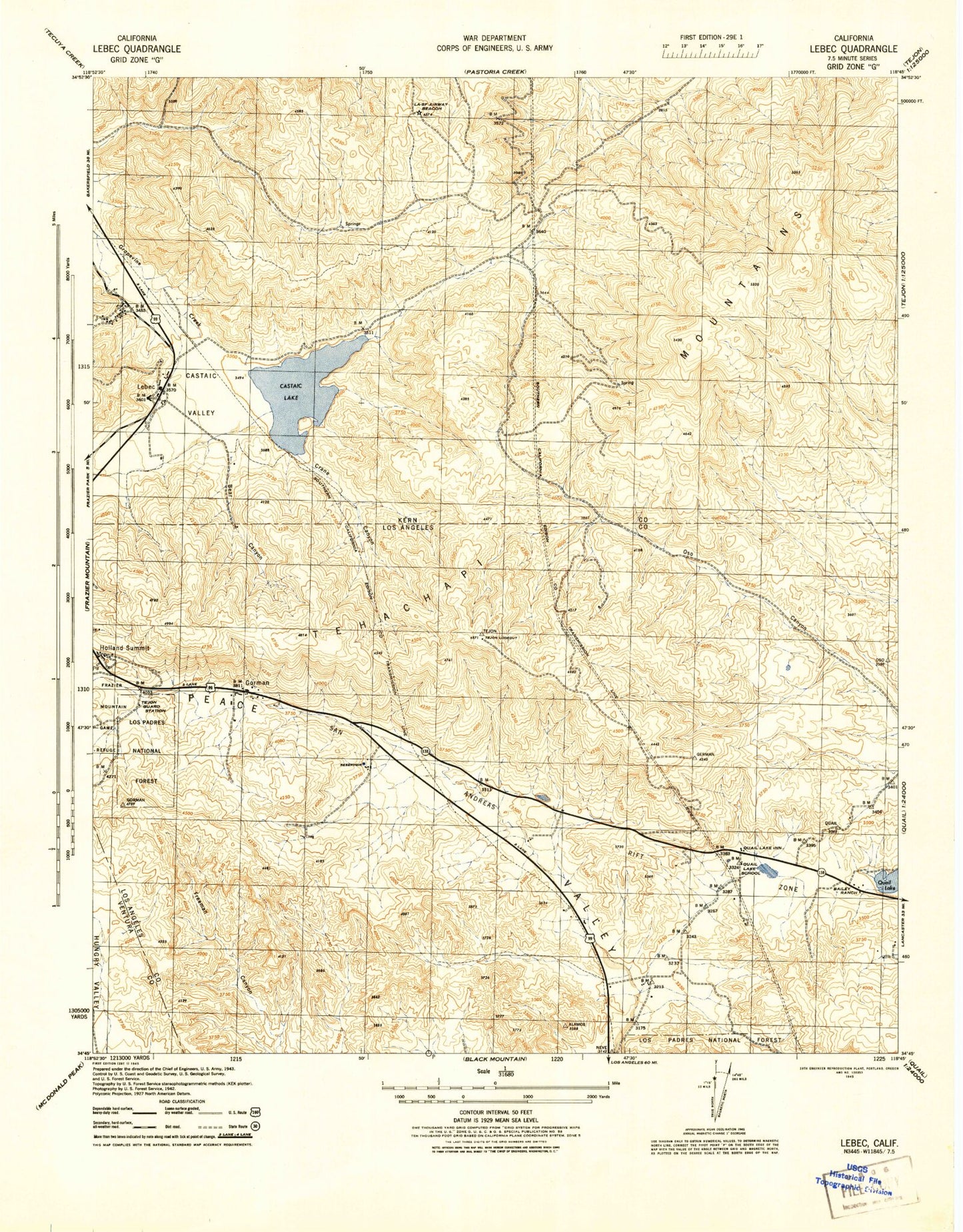
Classic USGS Lebec California 7.5'x7.5' Topo Map
Couldn't load pickup availability
Historical USGS topographic quad map of Lebec in the state of California. Map scale may vary for some years, but is generally around 1:24,000. Print size is approximately 24" x 27"
This quadrangle is in the following counties: Kern, Los Angeles, Ventura.
The map contains contour lines, roads, rivers, towns, and lakes. Printed on high-quality waterproof paper with UV fade-resistant inks, and shipped rolled.
Contains the following named places: 109 Limestone Quarry, 93243, Bailey Substation, Bear Canyon, Castac Lake, Cement Rock Quarry, Circle Canyon Campground, Crane Canyon, Freeman Canyon Cultural Preserve, Freeman Overlook, Gorman, Gorman Cultural Preserve, Gorman Elementary School, Gorman Substation, Holland Summit, Hungry Valley State Vehicular Recreation Area, Kern County Fire Department Station 56 Lebec, Lebec, Lebec Post Office, Los Angeles County Fire Department Station 77, Lower Quail Canal, Mount Pines, Old Bailey Ranch, Quail Lake Inn, Quail Lake School, Quail Pass, Redtail Canyon Campground, Sky Ranch, Tejon Guard Station, Tejon Lookout, Trust Me Canyon, Vortog Radio Navigation Station