MyTopo
Classic USGS Lecompte Louisiana 7.5'x7.5' Topo Map
Couldn't load pickup availability
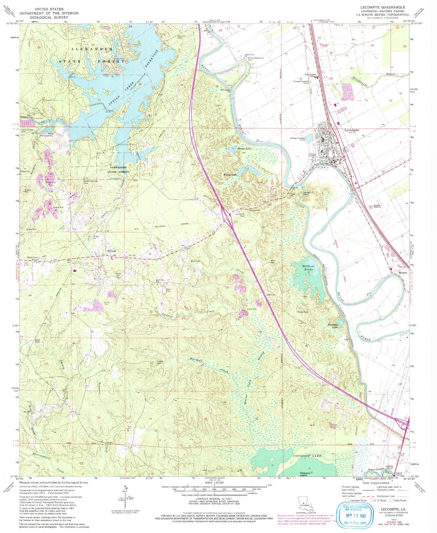
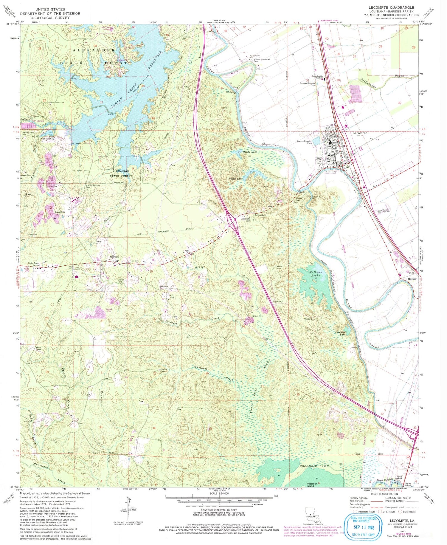
Historical USGS topographic quad map of Lecompte in the state of Louisiana. Map scale may vary for some years, but is generally around 1:24,000. Print size is approximately 24" x 27"
This quadrangle is in the following counties: Evangeline, Rapides.
The map contains contour lines, roads, rivers, towns, and lakes. Printed on high-quality waterproof paper with UV fade-resistant inks, and shipped rolled.
Contains the following named places: Alexander State Forest, Ballard Cemetery, Bayou Cocodrie Dam, Beaver Creek, Beaver Creek Swamp, Beechfish Fish Hatchery, Burgess Creek, Carnal Cemetery, Carr Creek, Carrs Creek, Carter C Raymond Junior High School, Cedar Grove Church, Cheney Creek, Cheneyville Ward Three, Chinquapin Creek, Cockrell Creek, Freeman Lake, Good Hope Church, Hardy Lake, Hawkins Cemetery, Hobson, Indian Creek, Indian Creek Cemetery, Indian Creek Reservoir, KALB-TV (Alexandria), KZMZ-FM (Alexandria), Lecompte, Lecompte Cemetery, Lecompte Police Department, Lecompte Volunteer Fire Department Station 1, Linzay Cemetery, Living Tabernacle Church, Marshall Creek, Martin Springs Cemetery, Mathews Brake, Mathews Cemetery, Meeker, Meeker Cemetery, Midway, Mount Lebanon Baptist Church, Paul Cemetery, Pisgah Cemetery, Pisgah Church, Rapides High School, Red River Academy School, Sartori, Smith Mill School, Soap Creek, South Rapides Academy, Spring Hill Cemetery, Town of Lecompte, Weems Lake, Wells Cemetery, Wilmer Memorial Cemetery, ZIP Code: 71430