MyTopo
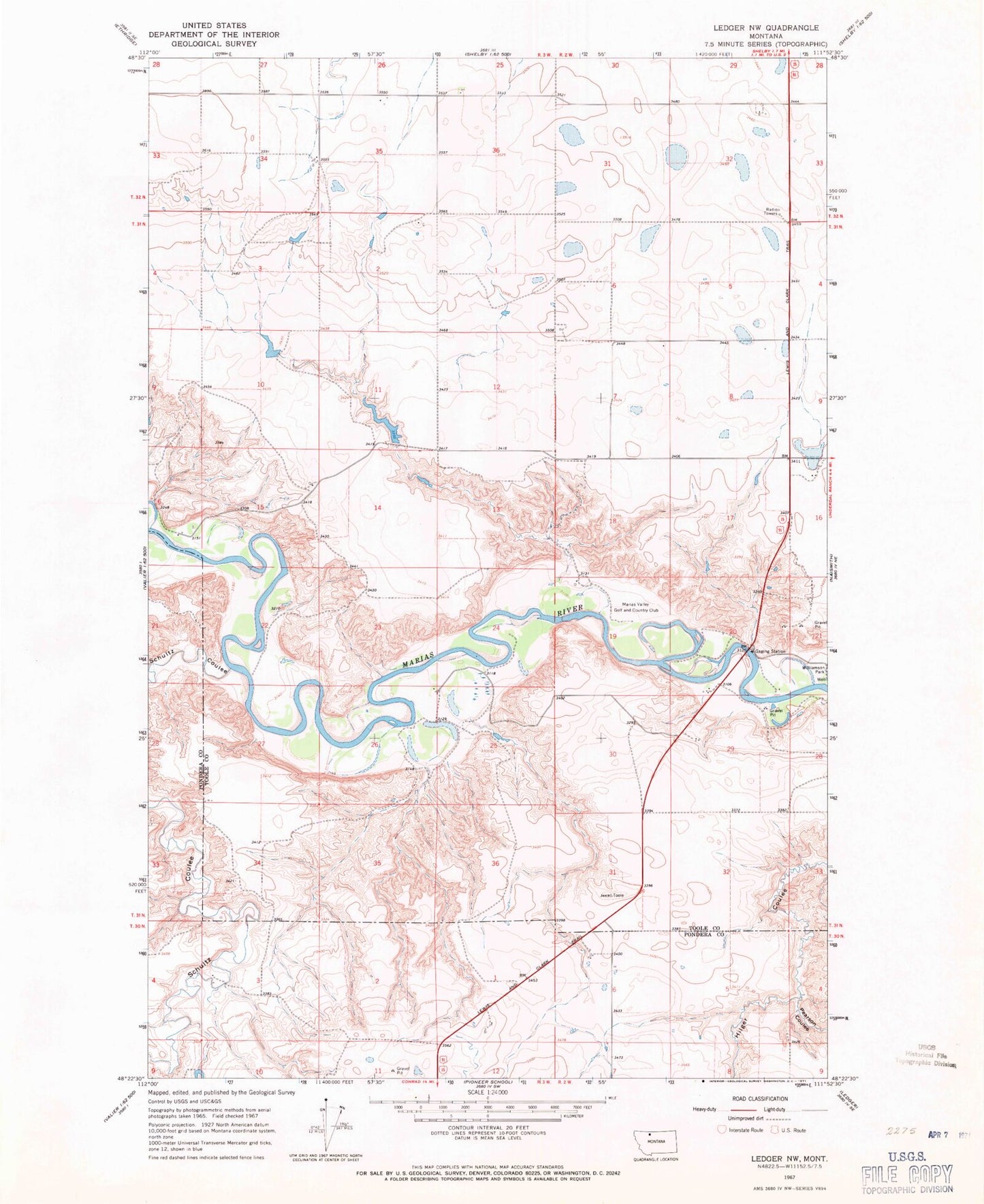
Classic USGS Ledger NW Montana 7.5'x7.5' Topo Map
Couldn't load pickup availability
Historical USGS topographic quad map of Ledger NW in the state of Montana. Map scale may vary for some years, but is generally around 1:24,000. Print size is approximately 24" x 27"
This quadrangle is in the following counties: Pondera, Toole.
The map contains contour lines, roads, rivers, towns, and lakes. Printed on high-quality waterproof paper with UV fade-resistant inks, and shipped rolled.
Contains the following named places: 31N02W20CDDB01 Well, Aubrey Post, Ed McIntyre Dam, Ed McIntyre Reservoir, KSEN-AM (Shelby), Marias Valley Golf and Country Club, Moore Coulee, Pearson Coulee, Russell Coulee, Schultz Coulee, Snow Coulee, The Moonspinner Dam, Twin Coulee, Wanken Dam, Wanken Reservoir, Williamson Park Campground, Zell Coulee