MyTopo
Classic USGS Lee Fire Tower Pennsylvania 7.5'x7.5' Topo Map
Couldn't load pickup availability
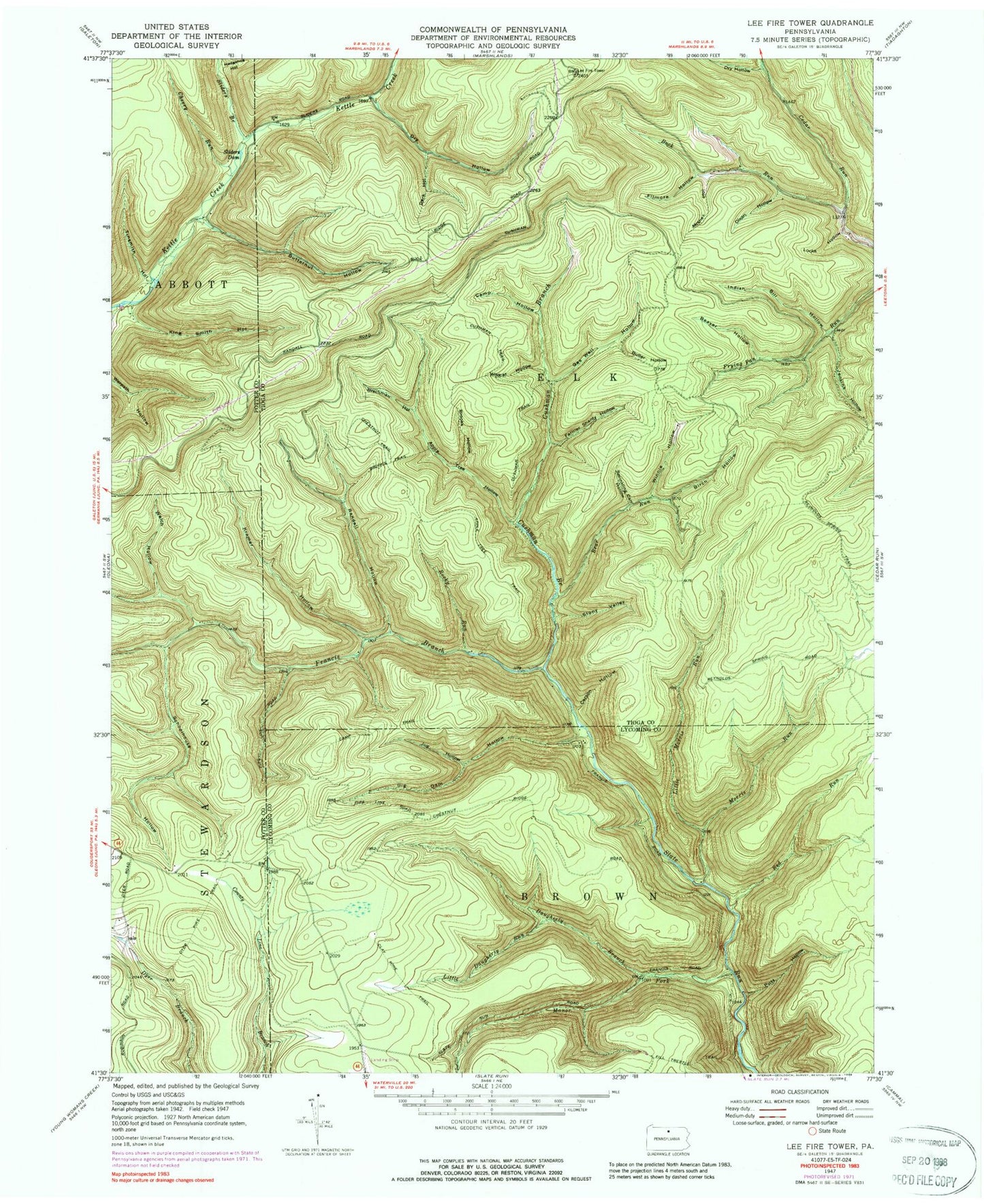
Historical USGS topographic quad map of Lee Fire Tower in the state of Pennsylvania. Typical map scale is 1:24,000, but may vary for certain years, if available. Print size: 24" x 27"
This quadrangle is in the following counties: Lycoming, Potter, Tioga.
The map contains contour lines, roads, rivers, towns, and lakes. Printed on high-quality waterproof paper with UV fade-resistant inks, and shipped rolled.
Contains the following named places: Apple Tree Hollow, Apple Tree Trail, Bear Run, Beaver Hollow, Big Dam Hollow, Birch Hollow, Brackman Hollow, Brooks Hollow, Brooks Trail, Buck Run, Butler Hollow, Butternut Hollow, Camp Hollow, Camp Trail, Carson Hollow, Cherry Run, Chestnut Trail, Clay Mine Trail, Cushman Branch, Cushman Trail, Dark Hollow, Daugherty Branch, Dixon Hollow, Dry Hollow, Dry Hollow, Dyer Pike Trail, Farmer Shanty Hollow, Fill Trestle Trail, Filmore Hollow, Gas Well Hollow, Hedgehog Hollow, Indian Bill Hollow, Jenkins Hollow, Jug Hollow, King Smith Hollow, Kramer Hollow, Little Daugherty Run, Little Morris Run, Locks Hollow, Manor Fork, Misner Hollow, Morris Run, Putt Hollow, Randall Hollow, Red Run, Reynolds Spring Trail, Rocky Run, Schoolhouse Hollow, Sliders Branch, Sliders Dam, Stony Valley, Welch Hollow, Wildcat Hollow, Winnie Hollow, Francis Branch, Tinsmith Hollow, Black Forest Inn Airport (historical), Sprinkling Can Hollow, Algerine Wild Area, Big Dam Hollow Trail, Little Morris Trail, Carson Hollow Trail, Morris Trail, Kramer Trail, Rocky Run Trail, Farmer Shanty Trail, Gaswell Trail, Water Trough Trail, Lee Fire Tower, Township of Elk, Apple Tree Hollow, Apple Tree Trail, Bear Run, Beaver Hollow, Big Dam Hollow, Birch Hollow, Brackman Hollow, Brooks Hollow, Brooks Trail, Buck Run, Butler Hollow, Butternut Hollow, Camp Hollow, Camp Trail, Carson Hollow, Cherry Run, Chestnut Trail, Clay Mine Trail, Cushman Branch, Cushman Trail, Dark Hollow, Daugherty Branch, Dixon Hollow, Dry Hollow, Dry Hollow, Dyer Pike Trail, Farmer Shanty Hollow, Fill Trestle Trail, Filmore Hollow, Gas Well Hollow, Hedgehog Hollow, Indian Bill Hollow, Jenkins Hollow, Jug Hollow, King Smith Hollow, Kramer Hollow, Little Daugherty Run, Little Morris Run, Locks Hollow, Manor Fork, Misner Hollow, Morris Run, Putt Hollow, Randall Hollow, Red Run, Reynolds Spring Trail, Rocky Run, Schoolhouse Hollow, Sliders Branch, Sliders Dam, Stony Valley, Welch Hollow, Wildcat Hollow, Winnie Hollow, Francis Branch, Tinsmith Hollow, Black Forest Inn Airport (historical), Sprinkling Can Hollow, Algerine Wild Area, Big Dam Hollow Trail, Little Morris Trail, Carson Hollow Trail, Morris Trail, Kramer Trail, Rocky Run Trail, Farmer Shanty Trail, Gaswell Trail, Water Trough Trail, Lee Fire Tower, Township of Elk, Apple Tree Hollow, Apple Tree Trail, Bear Run, Beaver Hollow, Big Dam Hollow, Birch Hollow, Brackman Hollow, Brooks Hollow, Brooks Trail, Buck Run, Butler Hollow, Butternut Hollow, Camp Hollow, Camp Trail, Carson Hollow, Cherry Run, Chestnut Trail, Clay Mine Trail, Cushman Branch, Cushman Trail, Dark Hollow, Daugherty Branch, Dixon Hollow, Dry Hollow, Dry Hollow, Dyer Pike Trail, Farmer Shanty Hollow, Fill Trestle Trail, Filmore Hollow, Gas Well Hollow, Hedgehog Hollow, Indian Bill Hollow, Jenkins Hollow, Jug Hollow, King Smith Hollow, Kramer Hollow, Little Daugherty Run, Little Morris Run, Locks Hollow, Manor Fork, Misner Hollow, Morris Run, Putt Hollow, Randall Hollow, Red Run, Reynolds Spring Trail, Rocky Run, Schoolhouse Hollow, Sliders Branch, Sliders Dam, Stony Valley, Welch Hollow, Wildcat Hollow, Winnie Hollow, Francis Branch, Tinsmith Hollow, Black Forest Inn Airport (historical), Sprinkling Can Hollow, Algerine Wild Area, Big Dam Hollow Trail, Little Morris Trail, Carson Hollow Trail, Morris Trail, Kramer Trail, Rocky Run Trail, Farmer Shanty Trail, Gaswell Trail, Water Trough Trail, Lee Fire Tower, Township of Elk


