MyTopo
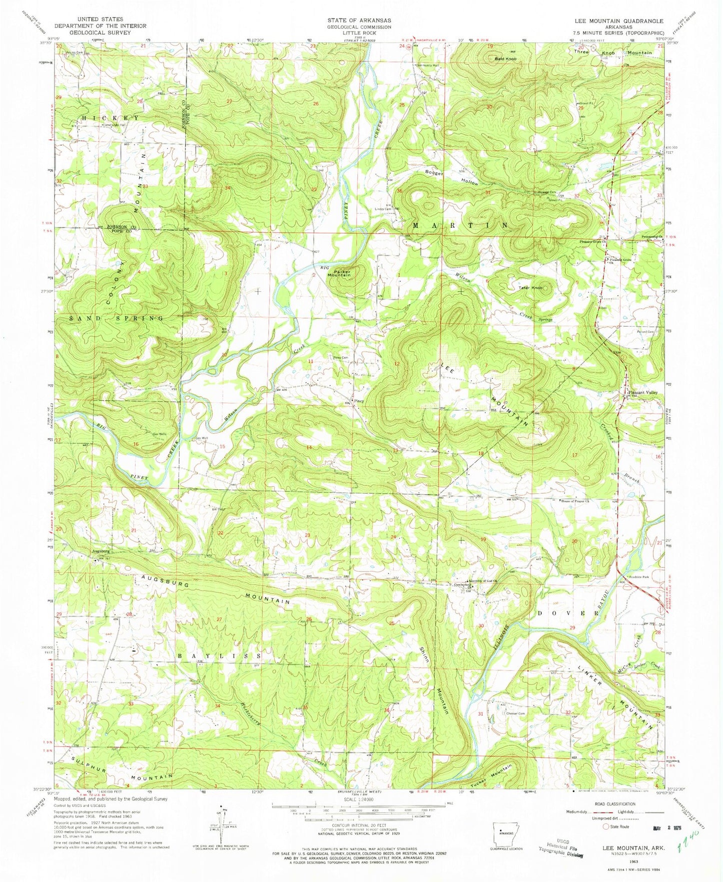
Classic USGS Lee Mountain Arkansas 7.5'x7.5' Topo Map
Couldn't load pickup availability
Historical USGS topographic quad map of Lee Mountain in the state of Arkansas. Typical map scale is 1:24,000, but may vary for certain years, if available. Print size: 24" x 27"
This quadrangle is in the following counties: Johnson, Pope.
The map contains contour lines, roads, rivers, towns, and lakes. Printed on high-quality waterproof paper with UV fade-resistant inks, and shipped rolled.
Contains the following named places: Adams Cemetery, Bald Knob, Booger Hollow, Chesser Cemetery, Crooked Branch, Pentecostal Church, Pleasant Grove Church, Pollard Cemetery, Wilson Creek, Augsburg, Lee Mountain, Parker Mountain, Shinn Mountain, Tater Knob, Knoxville Extension Gas Field, Mount Carmel Church (historical), Mountain Spring School (historical), Famous (historical), Zion Lutheran Church of Augsburg, Tates Island Gas Field, Tatetown (historical), Falerno (historical), Silex School (historical), Oak Grove School (historical), Pleasant Valley School (historical), Walnut Valley School (historical), New Hope Gas Field, Augsburg Cemetery, Rushing Church, Township of Bayliss, Township of Martin, McCoy Creek, Pleasant Valley, Booger Hollow Cemetery, Linker Creek, Piney, Rushing Cemetery, Augsburg Mountain, Colony Mountain, New Hope Cumberland Presbyterian Church (historical), House of Prayer Church, Lindsey Cemetery, Pleasant Grove Church, Sulphur Mountain, North New Hope Church, Cumberland (historical), Pleasant Grove Church of Christ, Brown-Rye Cemetery, Booger Hollow Tabernacle, Booger Hollow Community Hall, First Church of Pine Meadows, Bayliss Rural Fire Department, Martin Township Volunteer Fire Department