MyTopo
Classic USGS Lee Valley Tennessee 7.5'x7.5' Topo Map
Couldn't load pickup availability
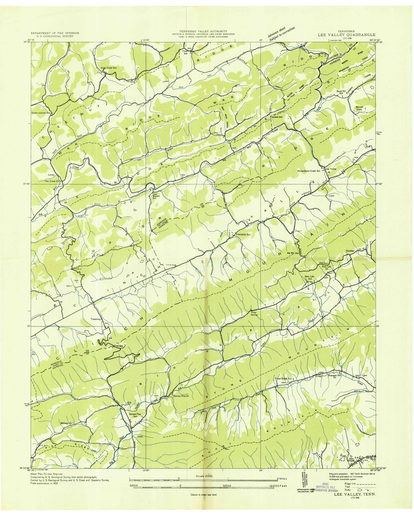
Historical USGS topographic quad map of Lee Valley in the state of Tennessee. Map scale may vary for some years, but is generally around 1:24,000. Print size is approximately 24" x 27"
This quadrangle is in the following counties: Hancock, Hawkins.
The map contains contour lines, roads, rivers, towns, and lakes. Printed on high-quality waterproof paper with UV fade-resistant inks, and shipped rolled.
Contains the following named places: Bear Hollow, Big War Creek Division, Big War Gap, Bond School, Caney Fork, Carpenter Cemetery, Chestnut Flats Gap, Chestnut Ridge, Clinch Mountain, Cloud Creek, Clouds Creek School, Commissioner District 2, Cool Branch, Cool Branch School, Cuba, Davis Cemetery, Duck Creek, Duck Creek Baptist Church, Duck Creek School, Fairmont School, Flat Gap, Flat Gap Elementary School, Friendship, Friendship School, Gills Chapel, Goldmine Hollow, Green Lawson School, Heck Branch, Klondike, Lee Valley, Lee Valley School, Long Hollow, Lovett Cemetery, Luther, McAllister Branch, McGinnis Cemetery, Middle Ridge, Midway Church, Muddy Gap, Murrell Cemetery, Murrelltown, New Hope, New Life Church, New Life School, Pine Ridge, Pleasant Hill Church, Price Quarry, Price Spring, Richardson Creek, Seal Hollow, Short Mountain, Spruce Pine, Spruce Pine Church, Spruce Pine School, Stony Fork, Treadway, Treadway Post Office, Treadway Volunteer Fire Department, Trent Valley, Trents Chapel School, War Creek Church, Wilder Branch, Willis Hill, WSJK-TV (Sneedville), Yount Town