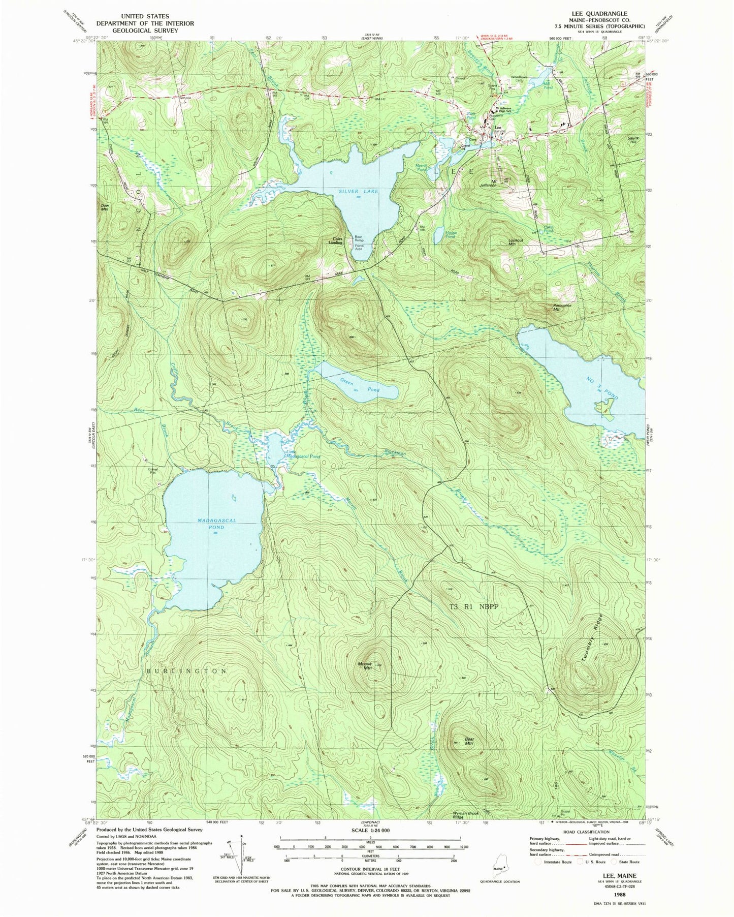
MyTopo
Classic USGS Lee Maine 7.5'x7.5' Topo Map
Couldn't load pickup availability
Historical USGS topographic quad map of Lee in the state of Maine. Typical map scale is 1:24,000, but may vary for certain years, if available. Print size: 24" x 27"
This quadrangle is in the following counties: Penobscot.
The map contains contour lines, roads, rivers, towns, and lakes. Printed on high-quality waterproof paper with UV fade-resistant inks, and shipped rolled.
Contains the following named places: Bear Brook, Bear Mountain, Beaver Brook, Blackman Brook, Cobb Pond, Coffin Brook, Green Pond, House Pond, Jackson Brook, Mount Jefferson, Lee, Little Madagascal Pond, Lookout Mountain, Madagascal Pond, Silver Lake, Merrill Brook, Merrill Pond, Mill Pond, Moose Mountain, Number Three Pond, Park Pond, Pool Brook, Porcupine Mountain, Skunk Hill, Sucker Brook, Twombly Ridge, Woodlawn Cemetery, Academy Cemetery, Town of Lee, Unorganized Territory of Twombly Ridge, Mill Pond Dam, Lee Dam, Merrill Pond, Mattakeunk Pond Dam, Lee Academy, Lee Baptist Church, Lee Post Office, Mount Jefferson Junior High School, T3 R1 NBPP, Lee Volunteer Fire Station