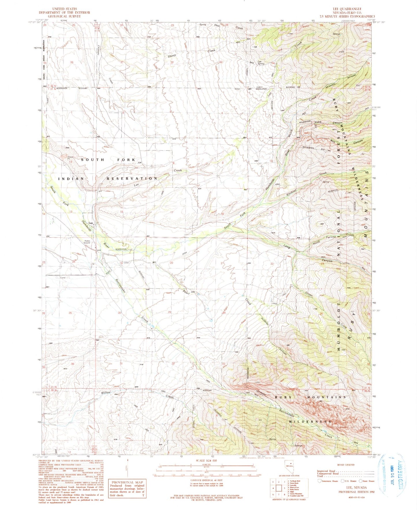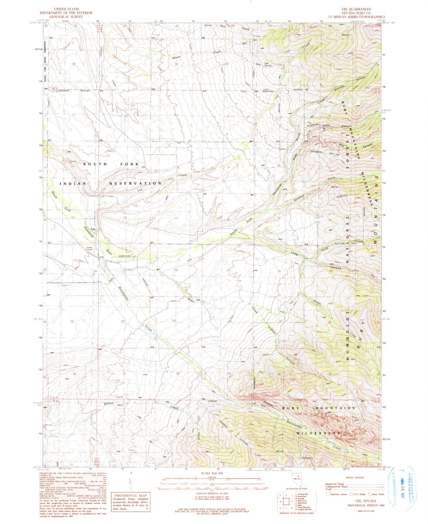
MyTopo
Classic USGS Lee Nevada 7.5'x7.5' Topo Map
Couldn't load pickup availability
Historical USGS topographic quad map of Lee in the state of Nevada. Map scale may vary for some years, but is generally around 1:24,000. Print size is approximately 24" x 27"
This quadrangle is in the following counties: Elko.
The map contains contour lines, roads, rivers, towns, and lakes. Printed on high-quality waterproof paper with UV fade-resistant inks, and shipped rolled.
Contains the following named places: Box Canyon, Drown Creek, Echo Canyon, Gund Ranch, Kleckner Creek, Lee, Lee Creek, Lee Mining District, Lee Post Office, Lee Spring, Long Canyon, Magnuson Ranch, North Fork, North Furlong Creek, Pearl Creek, Rattlesnake Creek, South Fork Reservation, Stoddard Creek, Welch Creek, Wysong Ranch, ZIP Code: 89815