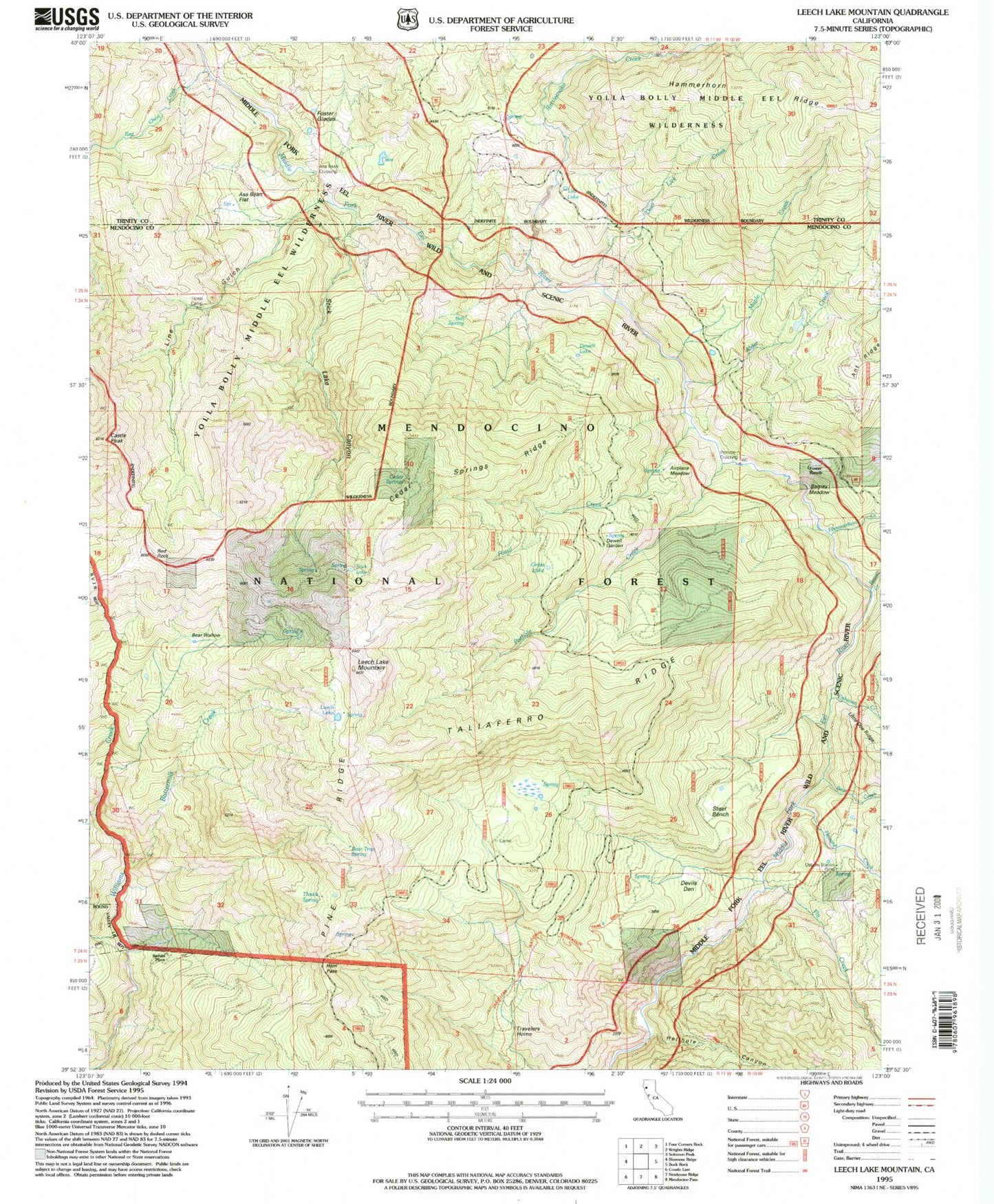
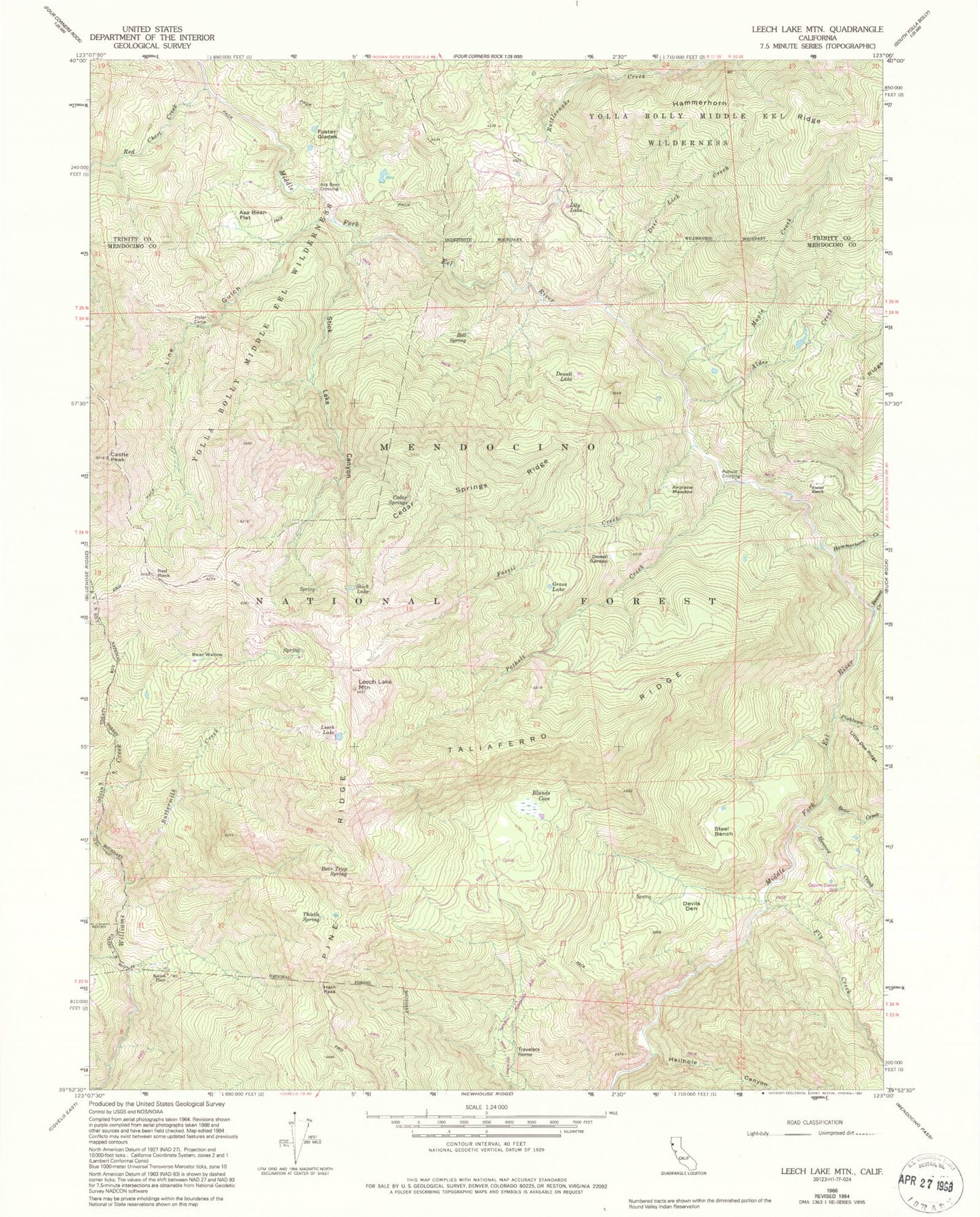
MyTopo
Classic USGS Leech Lake Mountain California 7.5'x7.5' Topo Map
Couldn't load pickup availability
Historical USGS topographic quad map of Leech Lake Mountain in the state of California. Map scale may vary for some years, but is generally around 1:24,000. Print size is approximately 24" x 27"
This quadrangle is in the following counties: Mendocino, Trinity.
The map contains contour lines, roads, rivers, towns, and lakes. Printed on high-quality waterproof paper with UV fade-resistant inks, and shipped rolled.
Contains the following named places: Airplane Meadow, Alder Creek, Asa Bean Flat, Asa Bear Crossing, Barney Meadow, Bear Creek, Bear Trap Spring, Bear Wallow, Beaver Creek, Bell Spring, Blands Cove, Buttermilk Creek, Castle Peak, Cedar Springs, Cedar Springs Ridge, Deer Lick Creek, Devils Den, Dewell Garden, Dewell Lake, Fishtown Creek, Fly Creek, Fossil Creek, Foster Glades, Foster Ranch, Grass Lake, Ham Pass, Hammerhorn Creek, Hellhole Canyon, Hotel Camp, Howard Creek, Leech Lake, Leech Lake Mountain, Lily Lake, Line Gulch, Maple Creek, Osborn Station, Pine Ridge, Pothole Creek, Pothole Crossing, Rattlesnake Creek, Red Chert Creek, Red Rock, Reeves Place, Steel Bench, Stick Lake, Stick Lake Canyon, Taliaferro Ridge, Thistle Spring, Travelers Home