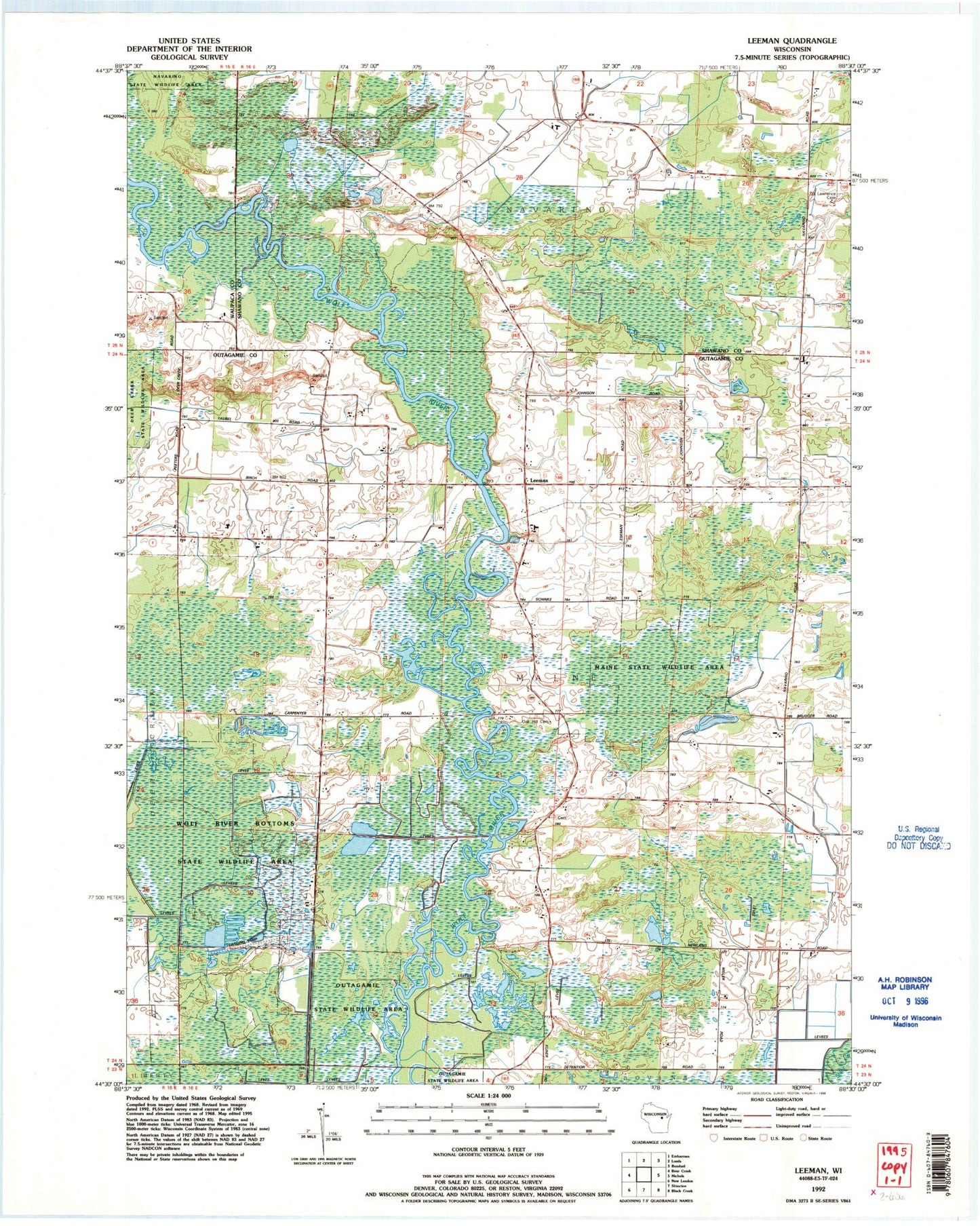
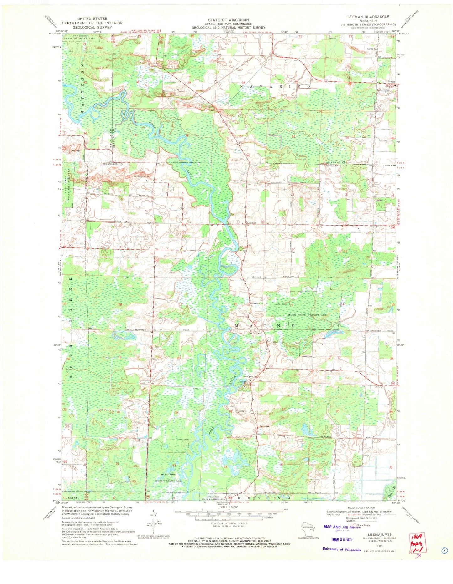
MyTopo
Classic USGS Leeman Wisconsin 7.5'x7.5' Topo Map
Couldn't load pickup availability
Historical USGS topographic quad map of Leeman in the state of Wisconsin. Map scale may vary for some years, but is generally around 1:24,000. Print size is approximately 24" x 27"
This quadrangle is in the following counties: Outagamie, Shawano, Waupaca.
The map contains contour lines, roads, rivers, towns, and lakes. Printed on high-quality waterproof paper with UV fade-resistant inks, and shipped rolled.
Contains the following named places: Leeman, Maine State Wildlife Area, Navarino Elementary School, Oak Hill Cemetery, Oakland School, Outagamie State Wildlife Area, Pleasant Hill School, Pleasant View School, Saint Lawrence Cemetery, South Maine Cemetery, South Maine Church, Sunset School, Town of Maine, Wolf River Landing Strip, WOZZ-FM (New London), ZIP Code: 54170