MyTopo
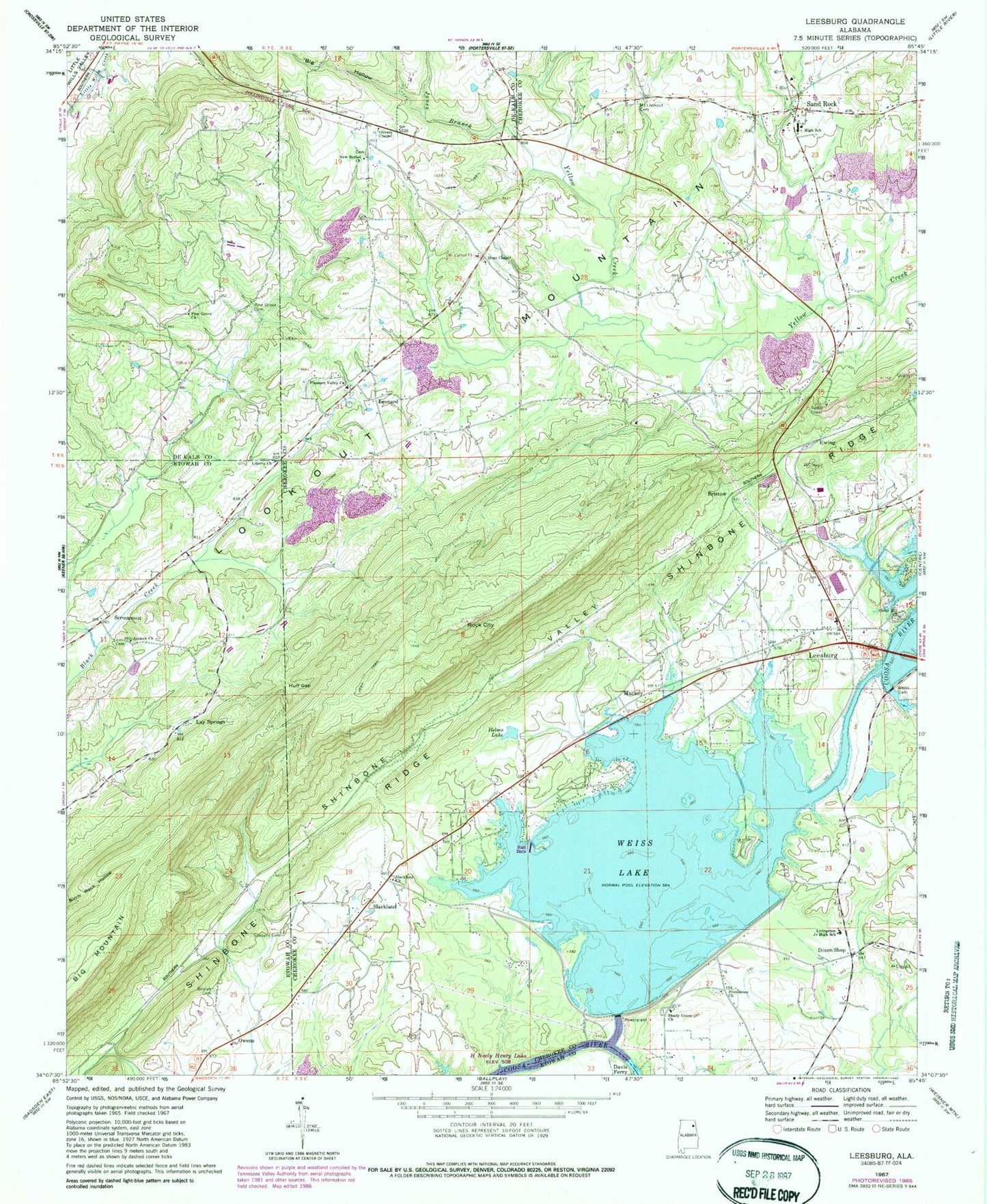
Classic USGS Leesburg Alabama 7.5'x7.5' Topo Map
Couldn't load pickup availability
Historical USGS topographic quad map of Leesburg in the state of Alabama. Typical map scale is 1:24,000, but may vary for certain years, if available. Print size: 24" x 27"
This quadrangle is in the following counties: Cherokee, DeKalb, Etowah.
The map contains contour lines, roads, rivers, towns, and lakes. Printed on high-quality waterproof paper with UV fade-resistant inks, and shipped rolled.
Contains the following named places: Antioch Church of Christ, Beulah Cemetery, Big Mountain, Cedar Hill Methodist Church, Davis Ferry (historical), Helms Lake, Huff Gap, Liberty Church of Christ, Livingston Junior High School, Mackey, Mount Lookout Cemetery, New Bethel Church, Owl Hollow, Providence Church, Rock City, Sand Rock, Slackland, Weiss Dam, Aubrey Isle, Byrams Island, Cedar Hill Methodist Church Cemetery, Hamptons Ferry (historical), Hunt Chapel Church Cemetery, Kings Hill (historical), Leesburg Industrial Park, Leesburg Park, Little Rock City Park, Lookout Valley Acres, Mackey Cemetery, Mountain Lake Estates, New Bethel Church Cemetery, Pleasant Valley Church Cemetery, Sand Rock Church Cemetery, Sand Rock Church, Sand Rock High School, Shady Grove Cemetery, Tripp Ferry (historical), Bar Hill, Buelah Baptist Church (historical), Bristow Spring, Tillery Cove, Weiss Dam Powerhouse, Weiss Lake Dike, Big Hollow, Jones Branch, Pine Grove Cemetery, Hunt Chapel, Leesburg, Pine Grove Church, Pleasant Valley Baptist Church, Shady Grove Baptist Church, Sheppard Cemetery, Olivers Chapel Church of Christ, Slackland Baptist Church, Bristow, Dixon Shop, Ewing, Lay Springs, Leonard, Owens, Scrougeout, Calvery Church, Leesburg Division, Leesburg Post Office, Shinbone Valley, Missionary Church, Pine Cove Marina, Town of Leesburg, Town of Sand Rock, Leesburg Volunteer Fire Department, Sand Rock Volunteer Fire Department, Leesburg Police Department


