MyTopo
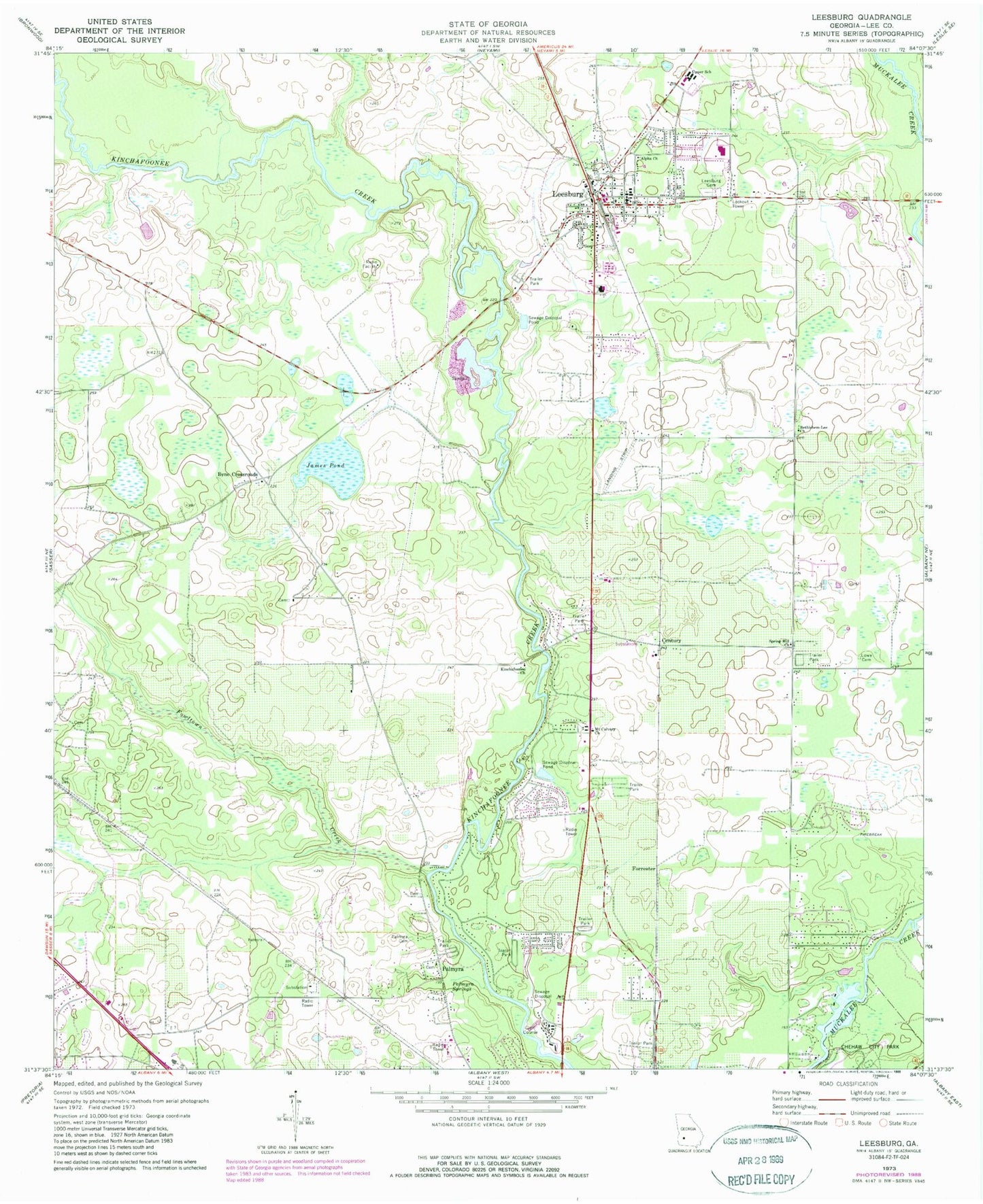
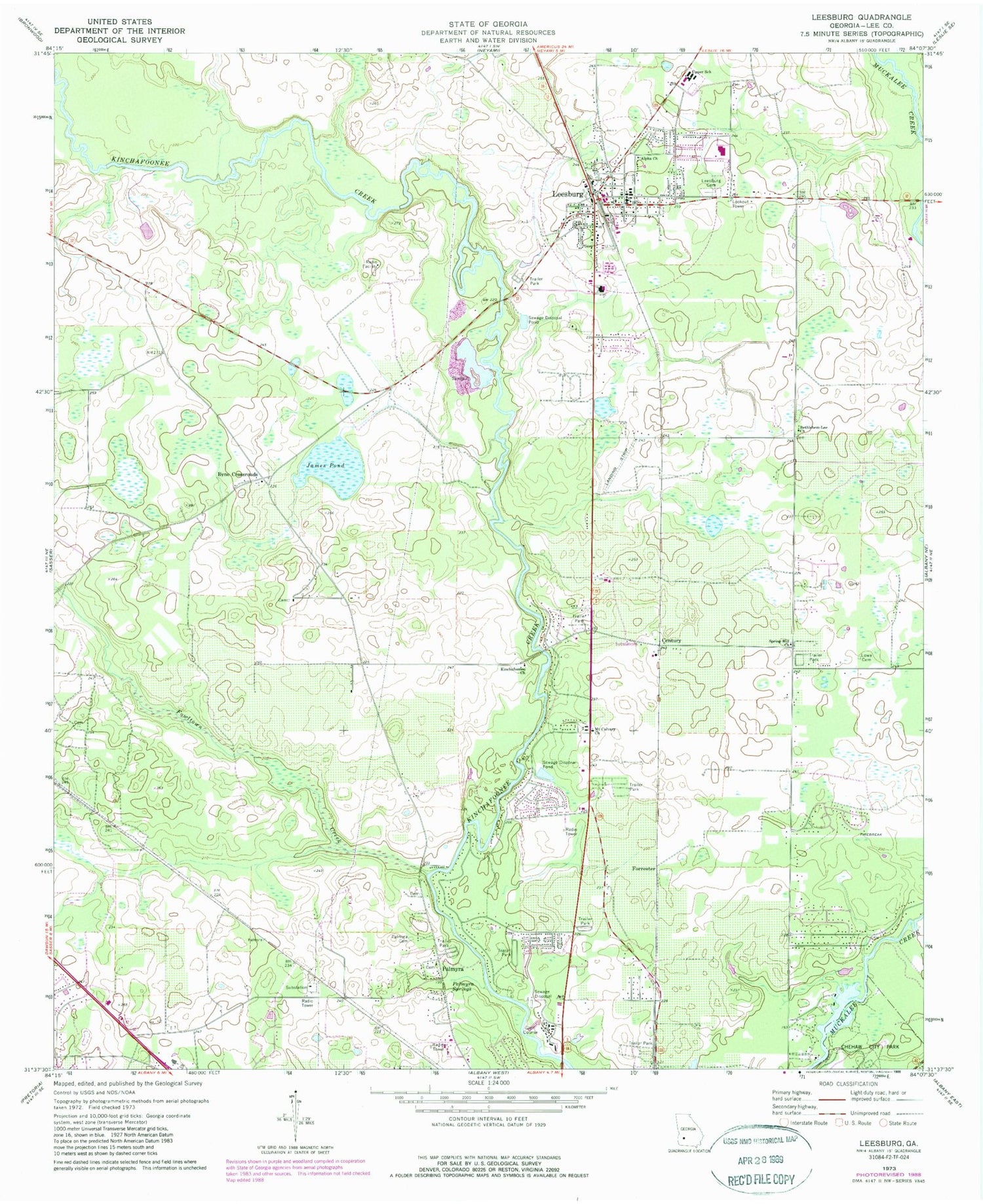
Classic USGS Leesburg Georgia 7.5'x7.5' Topo Map
Couldn't load pickup availability
Historical USGS topographic quad map of Leesburg in the state of Georgia. Map scale may vary for some years, but is generally around 1:24,000. Print size is approximately 24" x 27"
This quadrangle is in the following counties: Lee.
The map contains contour lines, roads, rivers, towns, and lakes. Printed on high-quality waterproof paper with UV fade-resistant inks, and shipped rolled.
Contains the following named places: Alpha Church, Bethlehem-Lee Church, Byne Crossroads, Century, City of Leesburg, Forrester, Fowltown Creek, Haley Plantation, Jackson Bridge, James Pond, Kinchafoonee Church, Lee County Courthouse, Lee County Elementary School, Lee County Emergency Medical Services Century Station, Lee County Fire Department Station 1 Leesburg, Lee County Fire Department Station 2, Lee County High School, Leesburg, Leesburg Cemetery, Leesburg Division, Leesburg Police Department, Leesburg Post Office, Lowe Cemetery, Mount Calvary Church, Palmyra, Palmyra Cemetery, Palmyra Springs, Reedy Creek, Rock Hole Creek, Spring Hill Church, Upper School, WIKX-FM (Leesburg), WJIZ-FM (Albany), Wooten Church