MyTopo
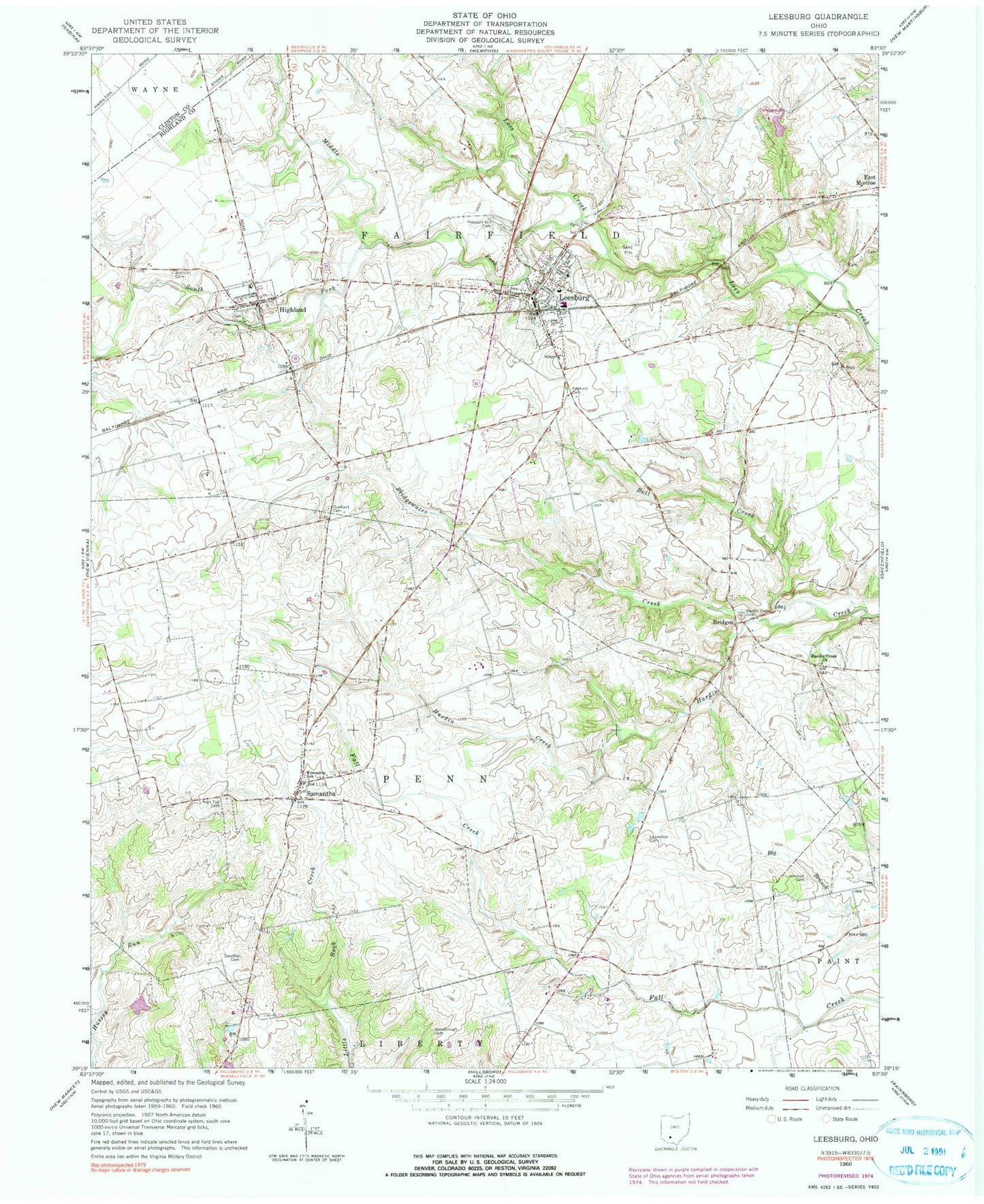
Classic USGS Leesburg Ohio 7.5'x7.5' Topo Map
Couldn't load pickup availability
Historical USGS topographic quad map of Leesburg in the state of Ohio. Map scale may vary for some years, but is generally around 1:24,000. Print size is approximately 24" x 27"
This quadrangle is in the following counties: Clinton, Highland.
The map contains contour lines, roads, rivers, towns, and lakes. Printed on high-quality waterproof paper with UV fade-resistant inks, and shipped rolled.
Contains the following named places: Antioch Cemetery, Armco Pond, Armco Pond Dam, Bridges, Bridges Post Office, Bridgewater Creek, Bull Creek, Cemetery Hill, Clear Creek Farms, Donner Field, Dunkard Cemetery, Fairfield Cemetery, Fairfield High School, Fairfield Quaker Meeting House, Fairfield-Highland Elementary School, Hansbro School, Hansbrough Cemetery, Hardin Creek Cemetery, Hardin Creek Church, Hattan Farms, High Top Cemetery, Highland, Highland Cemetery, Highland County North Joint Fire and Ambulance District, Highland Post Office, Highland Station, Johnson Cemetery, Kornvolt Farms Pond, Kornvolt Farms Pond Dam, Leaverton Cemetery, Leesburg, Leesburg Police Department, Leesburg Post Office, Methodist Cemetery, Middle Fork Lees Creek, Mount Igorott School, Pleasant Hill Cemetery, Roehm Farms, Rosebush School, Samantha, Samantha Freewill Baptist Church, Samantha Post Office, School Number 3, School Number 4, Slickaway School, South Fork Lees Creek, Swadley Cemetery, Township of Fairfield, Township of Penn, Union School, Village of Highland, Village of Leesburg, ZIP Codes: 45132, 45135