MyTopo
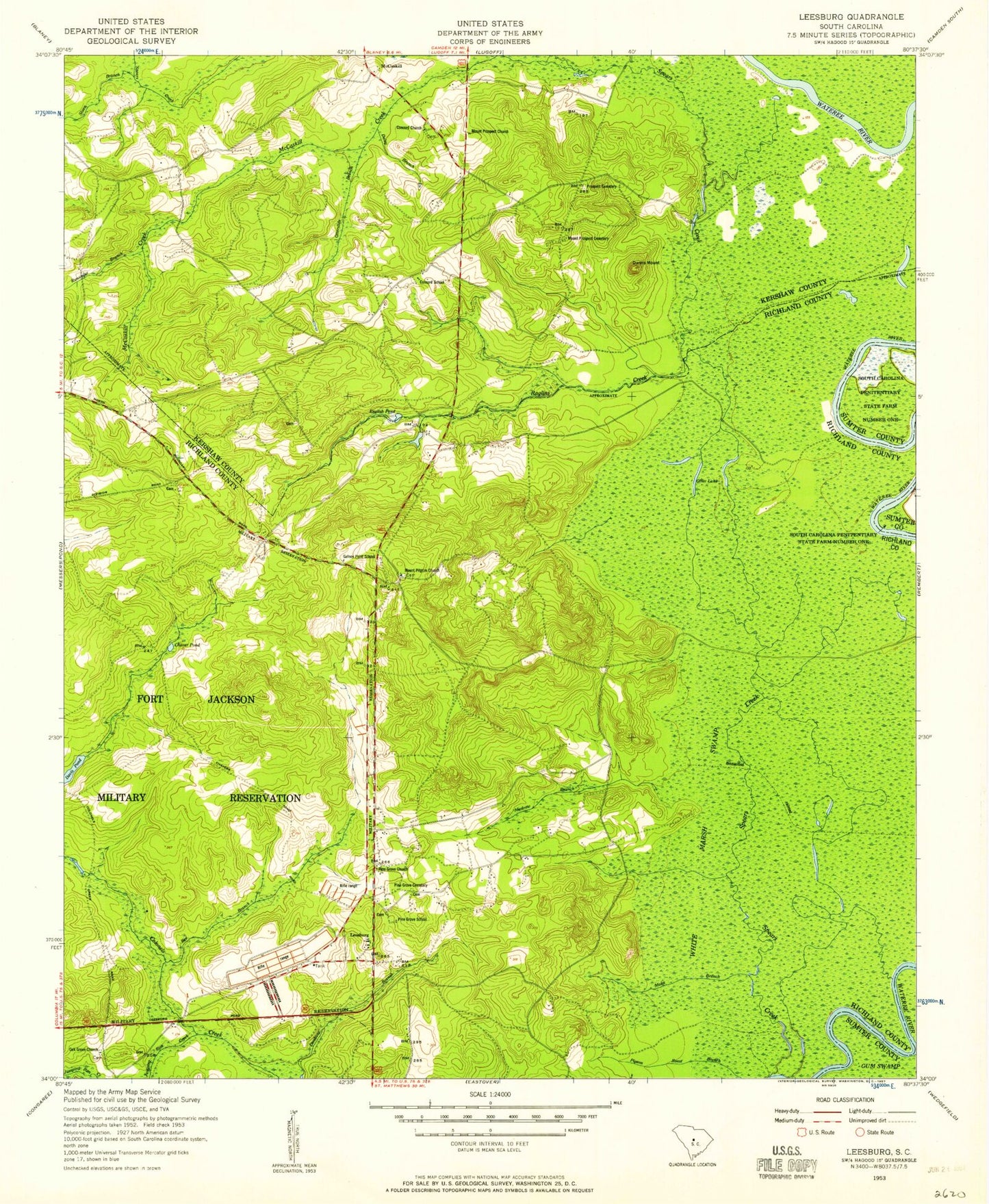
Classic USGS Leesburg South Carolina 7.5'x7.5' Topo Map
Couldn't load pickup availability
Historical USGS topographic quad map of Leesburg in the state of South Carolina. Typical map scale is 1:24,000, but may vary for certain years, if available. Print size: 24" x 27"
This quadrangle is in the following counties: Kershaw, Richland, Sumter.
The map contains contour lines, roads, rivers, towns, and lakes. Printed on high-quality waterproof paper with UV fade-resistant inks, and shipped rolled.
Contains the following named places: Bee Branch, Chaver Pond, Concord School, Daley Branch, Davis Pond, English Pond, Gafney Point School, Jumping Run Creek, Leesburg Branch, Madraw Branch, Moke Branch, Mount Prospect Cemetery, Otter Lake, Otterslide Branch, Pigeon Roost Branch, Pine Grove Cemetery, Pine Grove Church, Pine Grove School, Prospect Cemetery, Rununder Branch, Sloan Branch, Spears Creek, White Marsh Swamp, Leesburg, McCaskill, Beaver Creek, Cedar Creek, Dobys Mill (historical), English Swamp, Meadow View, Prospect Church (historical), Spears Creek, Wilson Mill Pond D-0594 Dam, McCaskill Creek, Concord Church, Dunns Mount, Burndown House (historical), Colonels Creek Church (historical), Dabney Pond Church (historical), English (historical), Leesburg School (historical), Livingston Lodge (historical), Pilgrim Church (historical), Pine Grove Church (historical), Progressive Church, Scuffletown School (historical), Shady Grove School (historical), Texas School (historical), Zion Hill School (historical), Mount Pilgrim Church, Mount Prospect Church, Oak Grove Church, Raglins Creek, WWDM-FM (Sumter), Leesburg Fire Department Station 31


