MyTopo
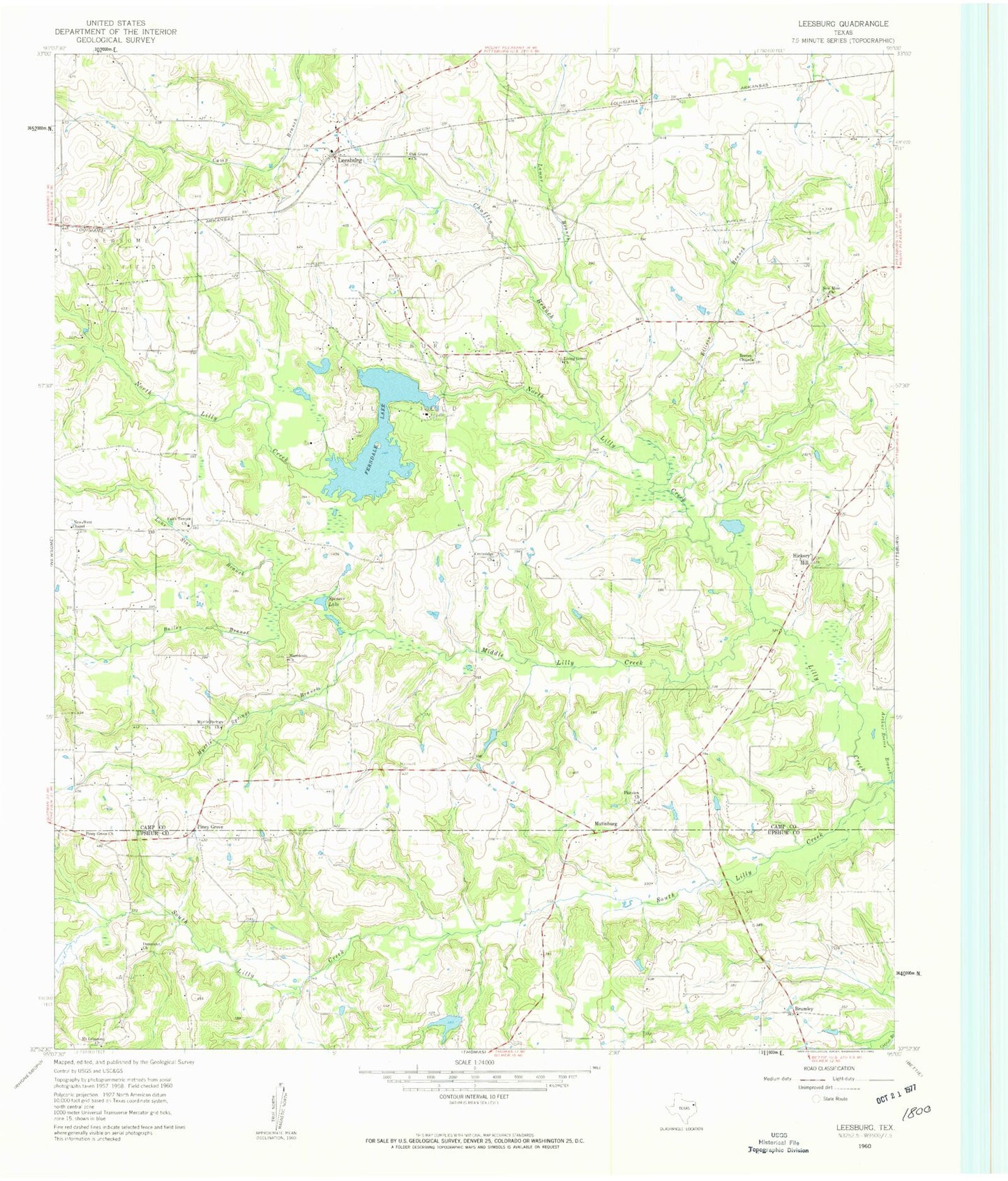
Classic USGS Leesburg Texas 7.5'x7.5' Topo Map
Couldn't load pickup availability
Historical USGS topographic quad map of Leesburg in the state of Texas. Map scale may vary for some years, but is generally around 1:24,000. Print size is approximately 24" x 27"
This quadrangle is in the following counties: Camp, Upshur.
The map contains contour lines, roads, rivers, towns, and lakes. Printed on high-quality waterproof paper with UV fade-resistant inks, and shipped rolled.
Contains the following named places: Arthur Reeves Branch, Bailey Branch, Brumley, Centeridge Church, Chaffin Branch, Damascus Church, Ellison Branch, Fairview Church, Faith Temple Church, Ferndale Dam, Ferndale Lake, Ferndale Lake Club, Harris Lake, Harris Lake Dam, Hickory Hill, Hopewell Cemetery, Lamar Branch, Leesburg, Leesburg Post Office, Leesburg-Newsome Division, Living Green Church, Lone Star Branch, Macedonia Church, Matinburg, Middle Lilly Creek, Mount Lebanon Church, Myrtle Springs Branch, Myrtle Springs Church, New Mine Church, New West Chapel, Newsome Oil Field, North Lilly Creek, Oak Grove Cemetery, Oak Grove Church, Piney Grove, Piney Grove Church, Pittsburg Oil Field, Reeves Chapel, South Lilly Creek, Spencer Lake