MyTopo
Classic USGS Leesville California 7.5'x7.5' Topo Map
Couldn't load pickup availability
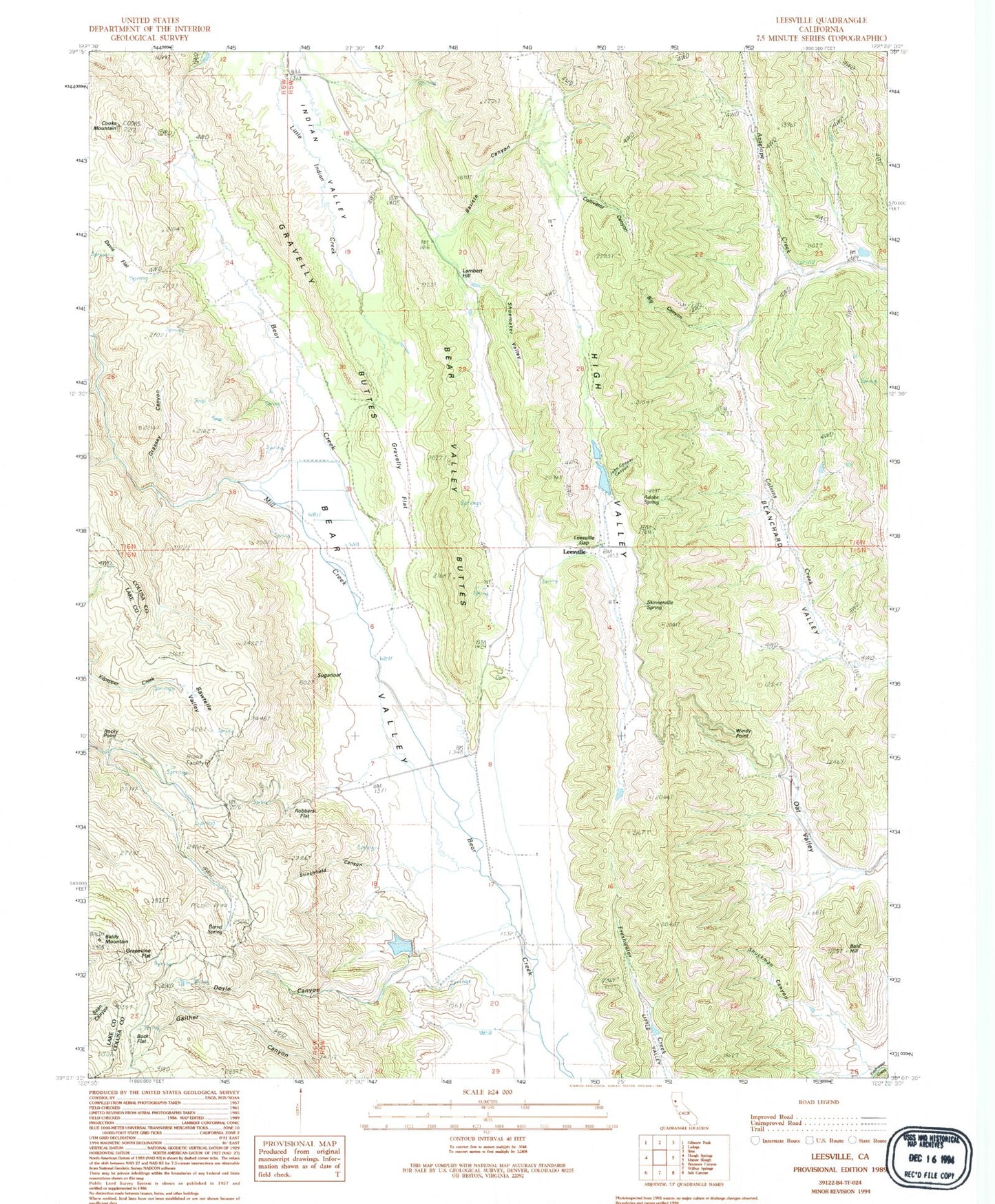
Historical USGS topographic quad map of Leesville in the state of California. Map scale may vary for some years, but is generally around 1:24,000. Print size is approximately 24" x 27"
This quadrangle is in the following counties: Colusa, Lake.
The map contains contour lines, roads, rivers, towns, and lakes. Printed on high-quality waterproof paper with UV fade-resistant inks, and shipped rolled.
Contains the following named places: Adobe Spring, Bald Hill, Baldy Mountain, Barrel Spring, Batiste Canyon, Bear Valley Buttes, Big Canyon, Buck Flat, California Department of Forestry and Fire Protection Leesville, California Division of Forestry Station, Cooks Mountain, Cultivator Canyon, Doyle Canyon, Grapevine Flat, Grassey Canyon, Gravelly Buttes, Gravelly Flat, High Valley, Huffmaster Ranch, John Cooper Canyon, Lambert Hill, Leesville, Leesville Cemetery, Leesville Gap, Mill Creek, Oat Valley, Rees Jones 361 Dam, Robbers Flat, Rocky Point, Sawtelle Valley, Shoemaker Valley, Shuckman Canyon, Skinnerville Spring, Stinchfield Canyon, Sugarloaf, Sulphur Spring, West Colusa Division, Windy Point, York Hill 360 Dam