
MyTopo
Classic USGS Leesville Louisiana 7.5'x7.5' Topo Map
Couldn't load pickup availability
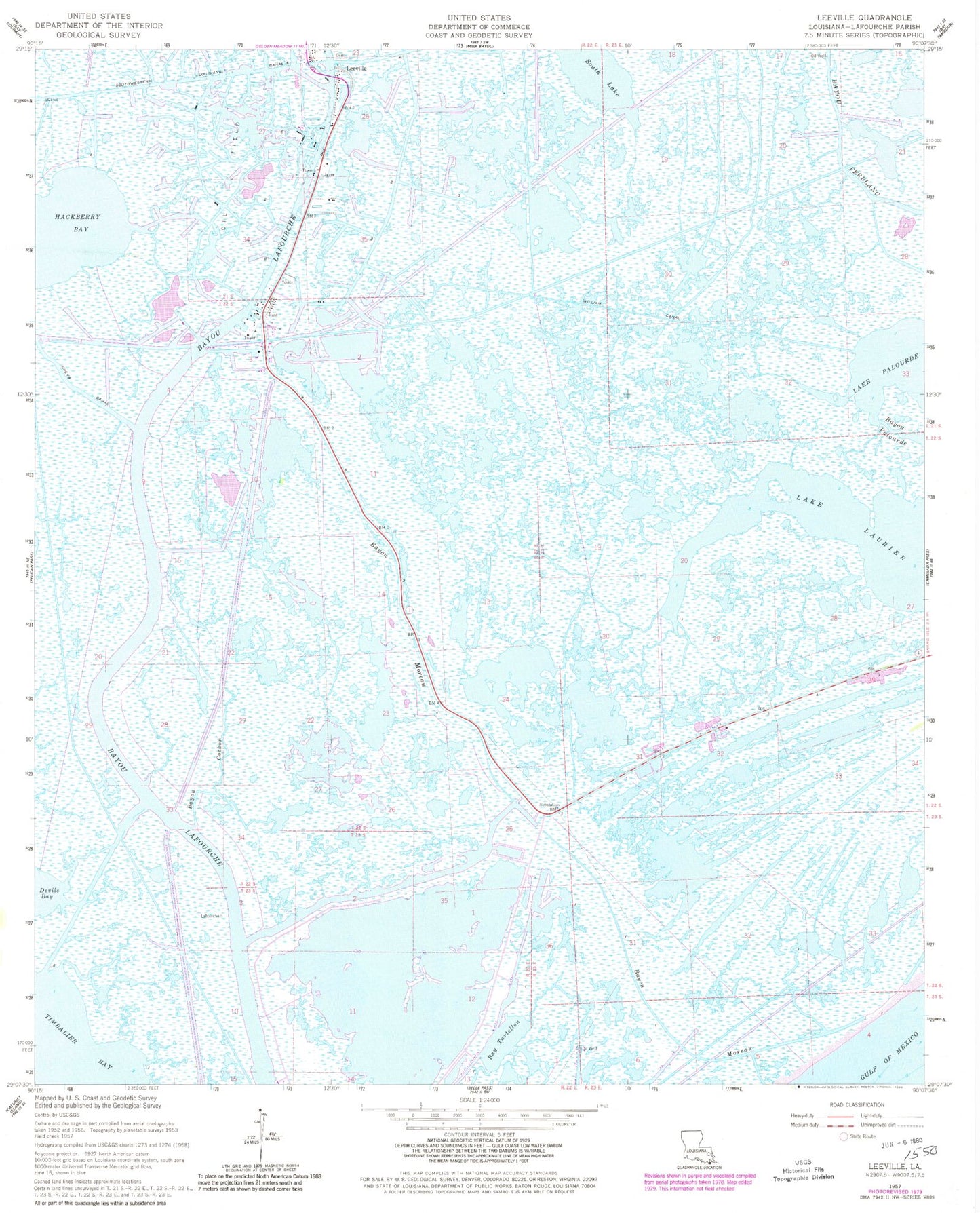
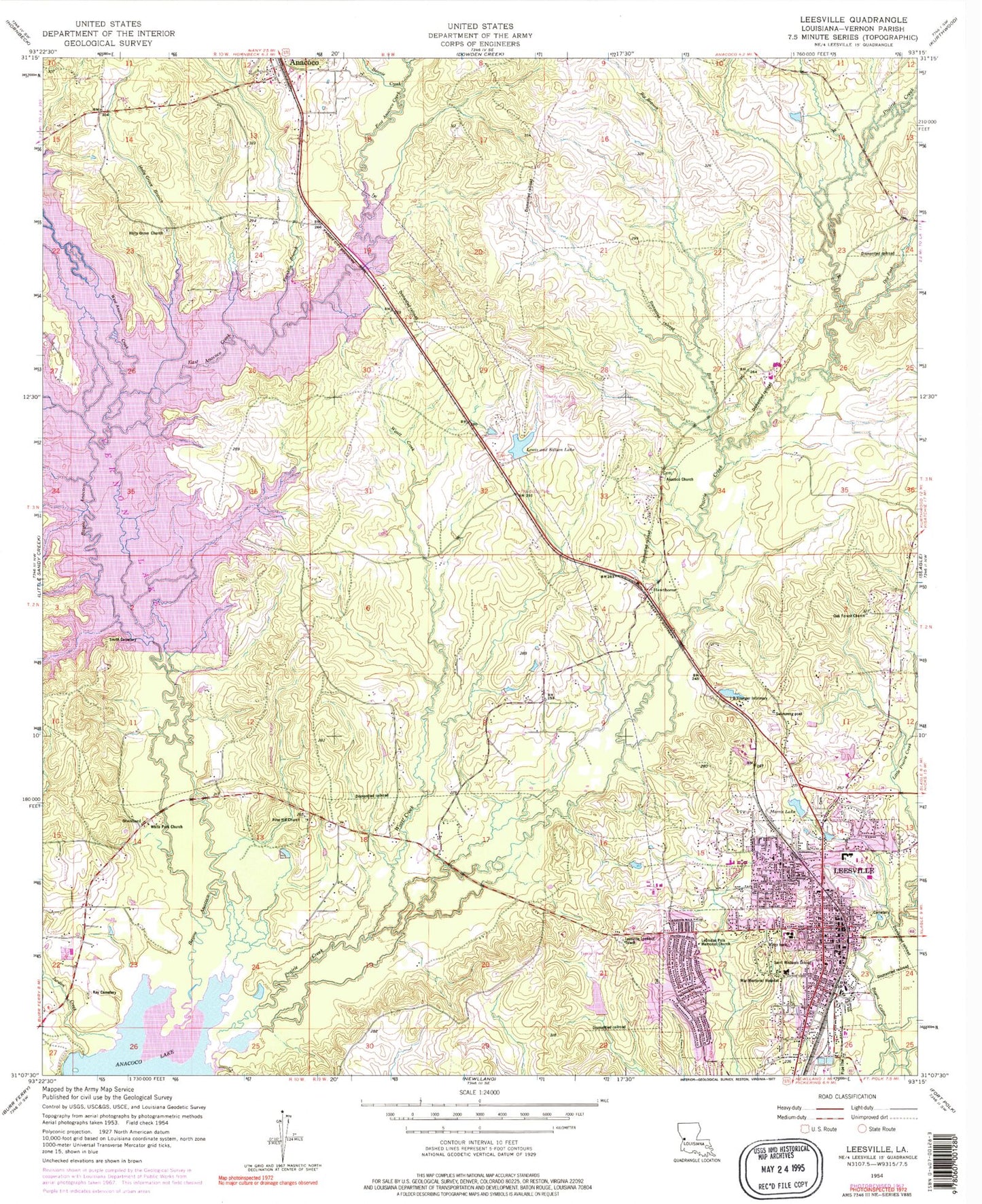
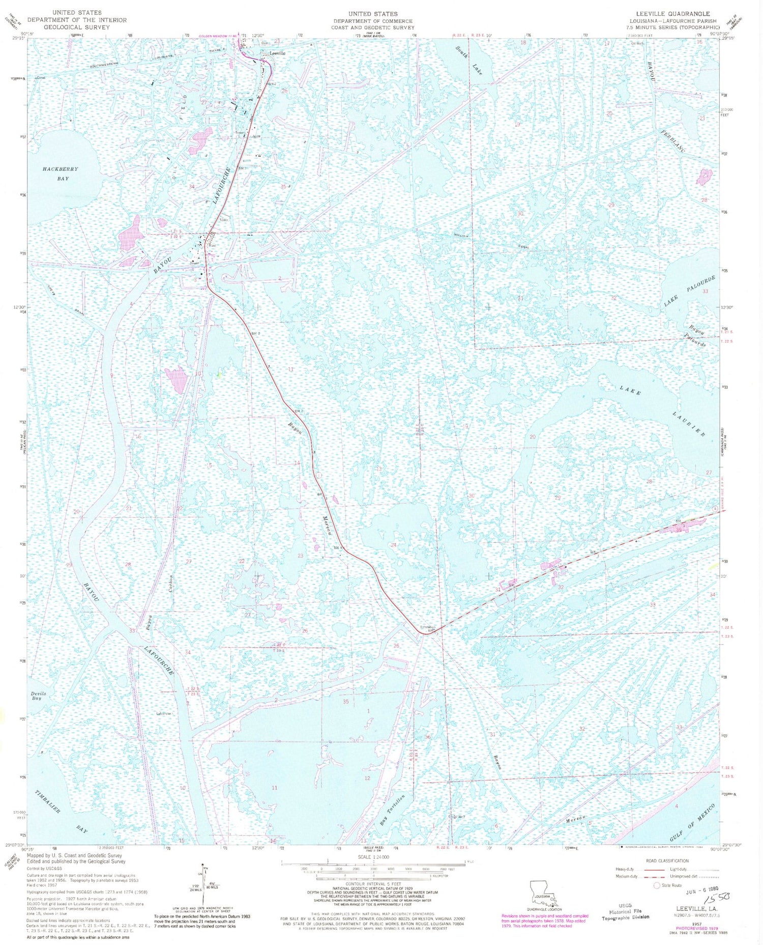
Historical USGS topographic quad map of Leesville in the state of Louisiana. Map scale may vary for some years, but is generally around 1:24,000. Print size is approximately 24" x 27"
This quadrangle is in the following counties: Vernon.
The map contains contour lines, roads, rivers, towns, and lakes. Printed on high-quality waterproof paper with UV fade-resistant inks, and shipped rolled.
Contains the following named places: Allendale, Anacoco Police Department, Anacoco Volunteer Fire Department, Anacoco-Prairie State Game and Fish Preserve, Berrytown Shopping Center, Big Branch, Boone Creek, Byrd Memorial Hospital Heliport, Byrd Regional Hospital, City of Leesville, Dixie, Doctors Hospital at Deer Creek, Dry Fork, East Anacoco Creek, East Leesville Elementary School, East Side, Elm Bayou, Emanuel Baptist Church, Fertitta Park, First Assembly Christian Academy School, First Assembly of God Church, First Christian Church, First Saint Paul Baptist Church, Franklin Branch, Gilbert Field, Hawthorne, Hawthorne Cemetery, Holly Grove Branch, Holly Grove Cemetery, Holly Grove United Methodist Church, J B Younger Infirmary, Jurdon Creek, Kay Cemetery, Kimberly Heights, KJAE-FM (Leesville), KLLA-AM (Leesville), Lee Hills, Leesville, Leesville Airport, Leesville Cemetery, Leesville Church of the Nazarene, Leesville City Park, Leesville Community Recreation Center, Leesville Fire Department, Leesville High School, Leesville Junior High School, Leesville Lookout Tower, Leesville Police Department, Leesville Post Office, Leesville Rehabilitation Hospital, Leesville Residential Services Center, Leonidas Polk Memorial Church, Lewis and Killan Lake Dam, Lewis and Killian Lake, Liberty Creek, Lincoln Heights, Lions Club Camp, Little Prairie Creek, Lyles Addition, Magnolia Park, McFarland Heights, Morris Addition, Morris Lake, Morris Lake Dam, Museum of West Louisiana, Myrtle Park, Oak Forest Baptist Church, Old Anacoco Baptist Church, Old Anacoco Cemetery, Parish Governing Authority District 10, Parish Governing Authority District 12, Parish Governing Authority District 9, Paul Lawrence Dunbar Public Library, Peggy Stevens Pond Dam, Pine Hill Baptist Church, Pine Hill Baptist Church Cemetery, Pinecrest, Powell Park, Prairie Creek, Prairie Creek Airport, Roberts Camp, Saint Andrew Presbyterian Church, Saint Michaels Catholic Church, Saint Michaels School, Smith Cemetery, South End, Standard, Thaxtons Landing, Tower Estates Number 1, Tower Estates Number 2, Tower Trailer Park, Vernon Lake, Vernon Lake Dam, Vernon Middle School, Vernon Parish Courthouse, Vernon Parish Optional School, Vernon Parish Sheriff's Office, War Memorial Hospital, West Anacoco Creek, West End, West Leesville Elementary School, West Side, Westwood Village, Whispering Pines Estates, White Park Church, Wild Bills Marina, Woodlands, Wyatt Creek