MyTopo
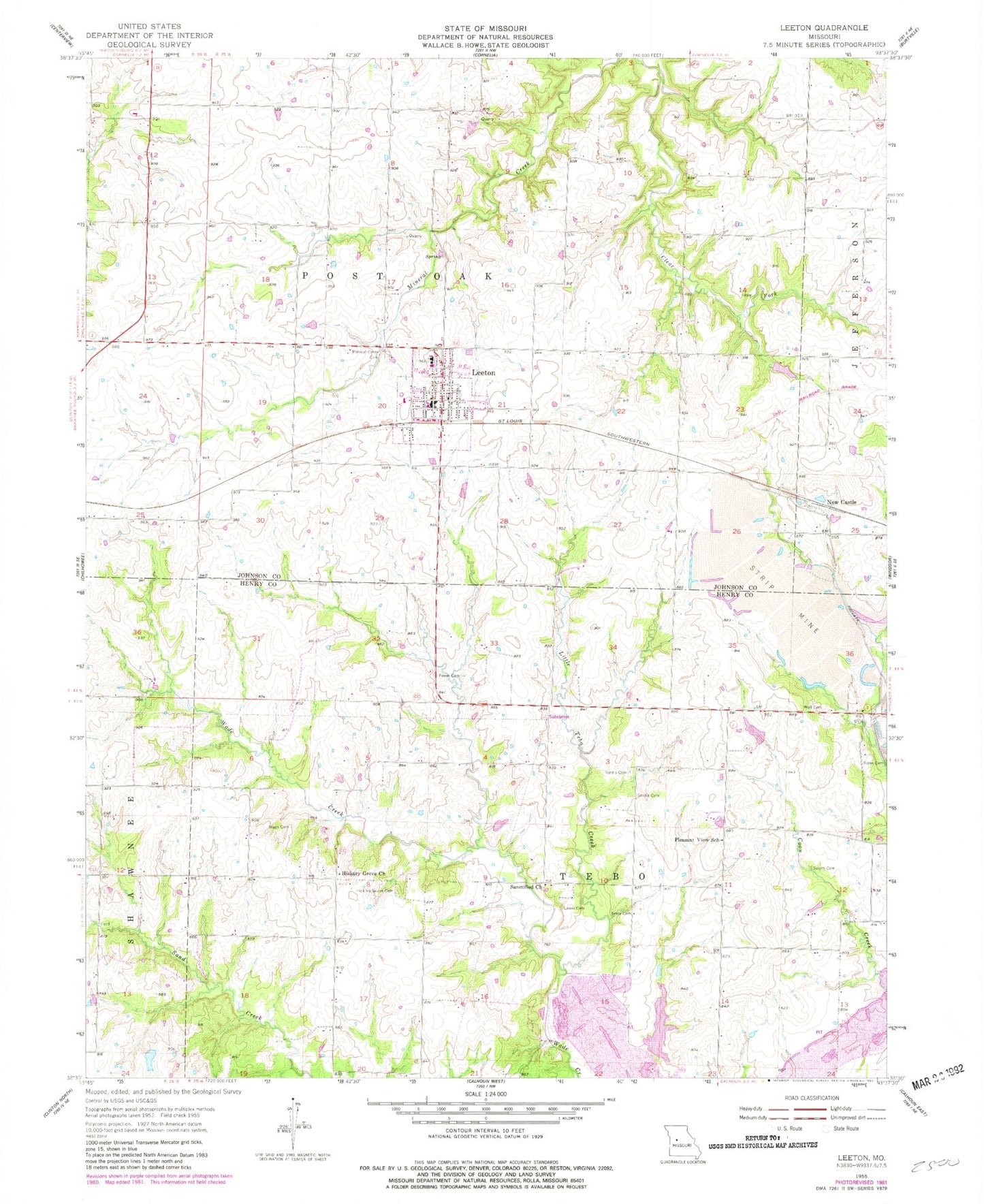
Classic USGS Leeton Missouri 7.5'x7.5' Topo Map
Couldn't load pickup availability
Historical USGS topographic quad map of Leeton in the state of Missouri. Map scale may vary for some years, but is generally around 1:24,000. Print size is approximately 24" x 27"
This quadrangle is in the following counties: Henry, Johnson.
The map contains contour lines, roads, rivers, towns, and lakes. Printed on high-quality waterproof paper with UV fade-resistant inks, and shipped rolled.
Contains the following named places: Avery Cemetery, Avery Settlement, City of Leeton, Cold Springs School, Fewel Cemetery, Gladden School, Groff Lake Dam, Hickory Grove Cemetery, Hickory Grove Church, Hickory Grove School, Johnson County Fire Protection District Station 2 Leeton, Leeton, Leeton Elementary School, Leeton High School, Leeton Middle School, Leeton Post Office, Leeton School, Lewis Cemetery, Little Tebo Creek, Lone Valley School, Mineral Creek Cemetery, Mineral Valley School, New Castle, Number 106 Lake, Number 131 Reservoir, Pleasant View School, Salem Cemetery, Sanctified Church, Sardis North Cemetery, Sardis South Cemetery, Tebo Diversionary Impoundment Dam, Township of Post Oak, Township of Tebo, Wade Cemetery, Washington School, Wilson Lake, Wilson Lake Dam, Windsor Lake Dam, ZIP Code: 64761