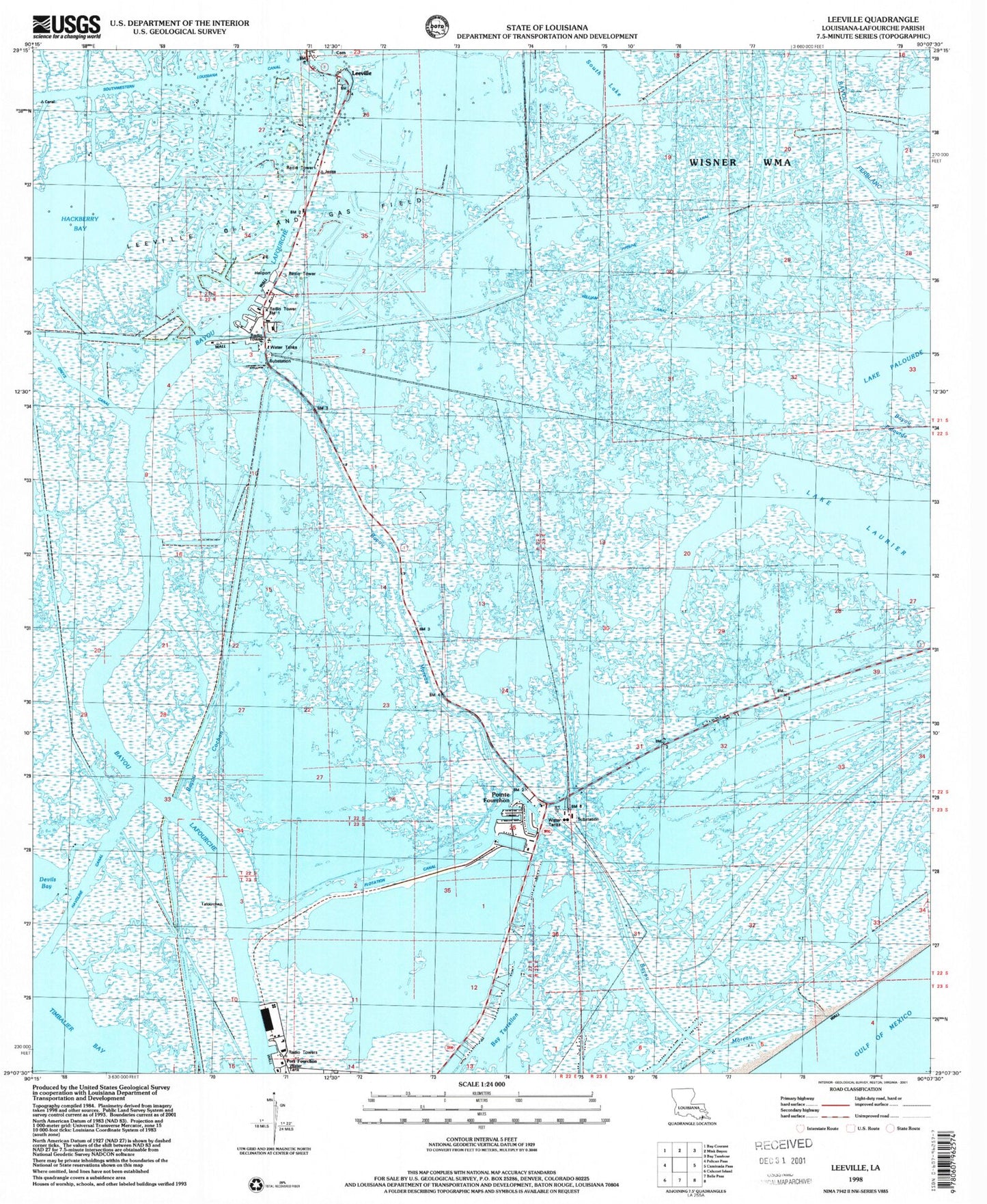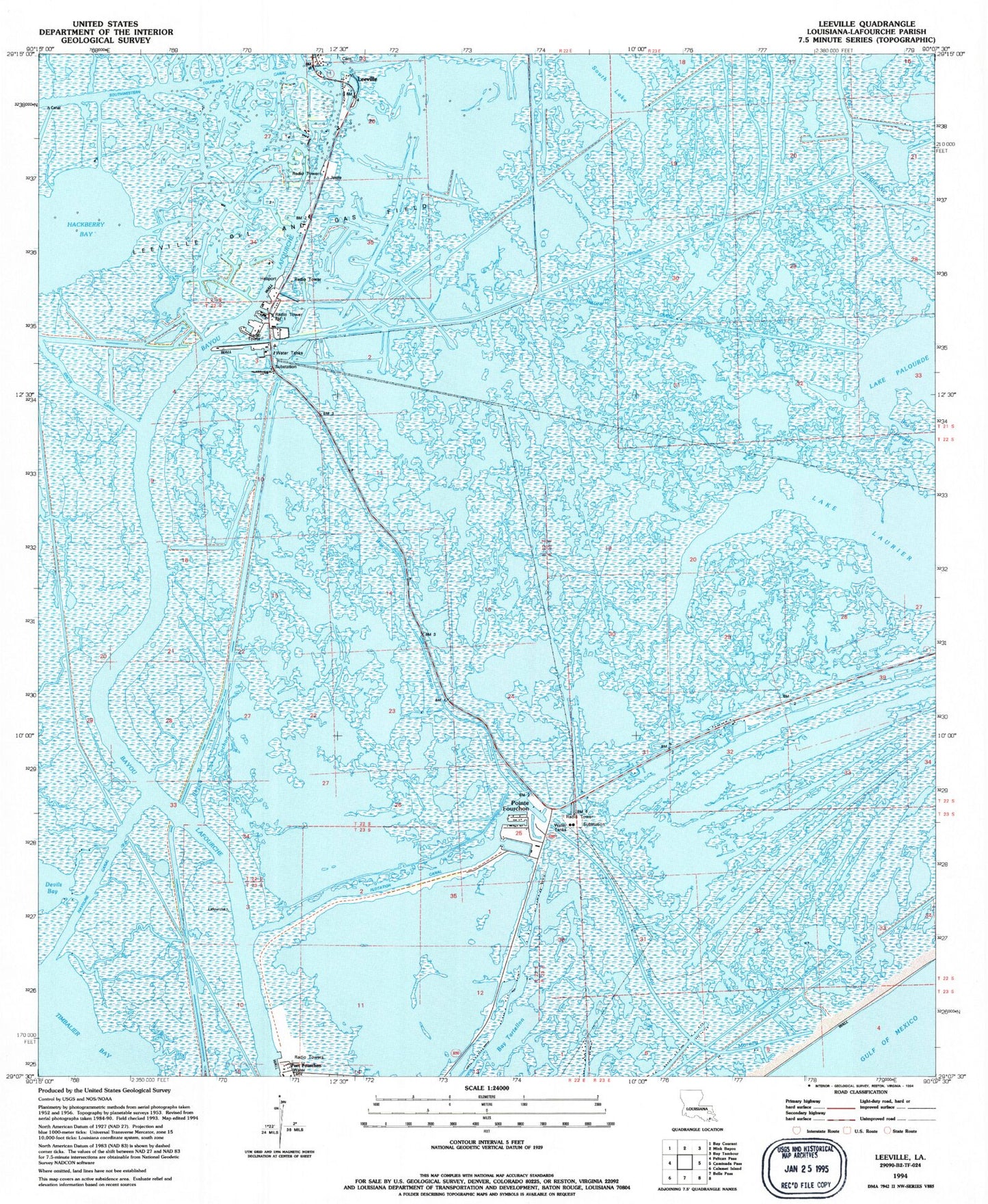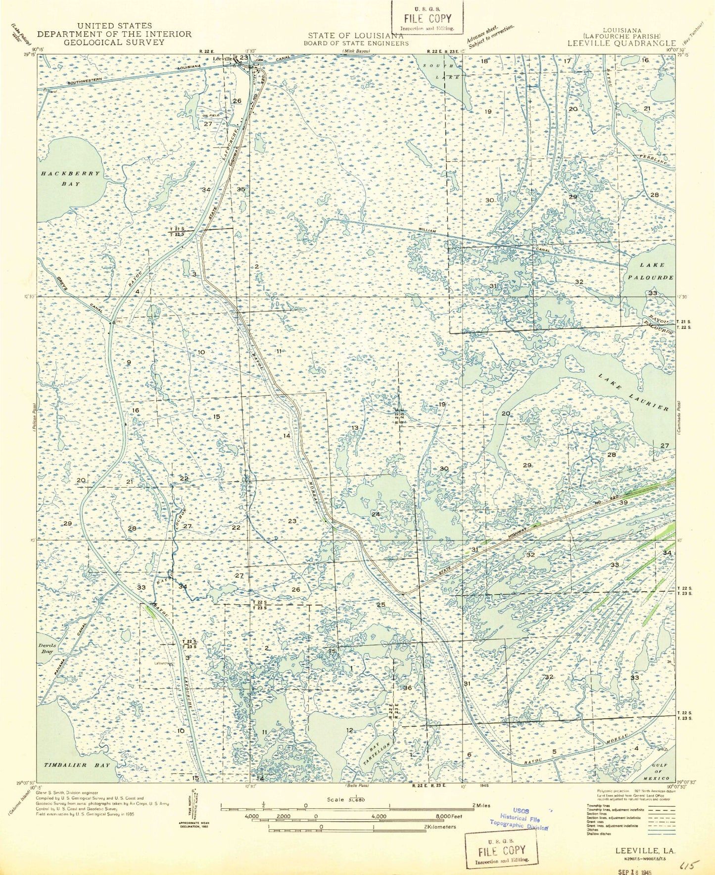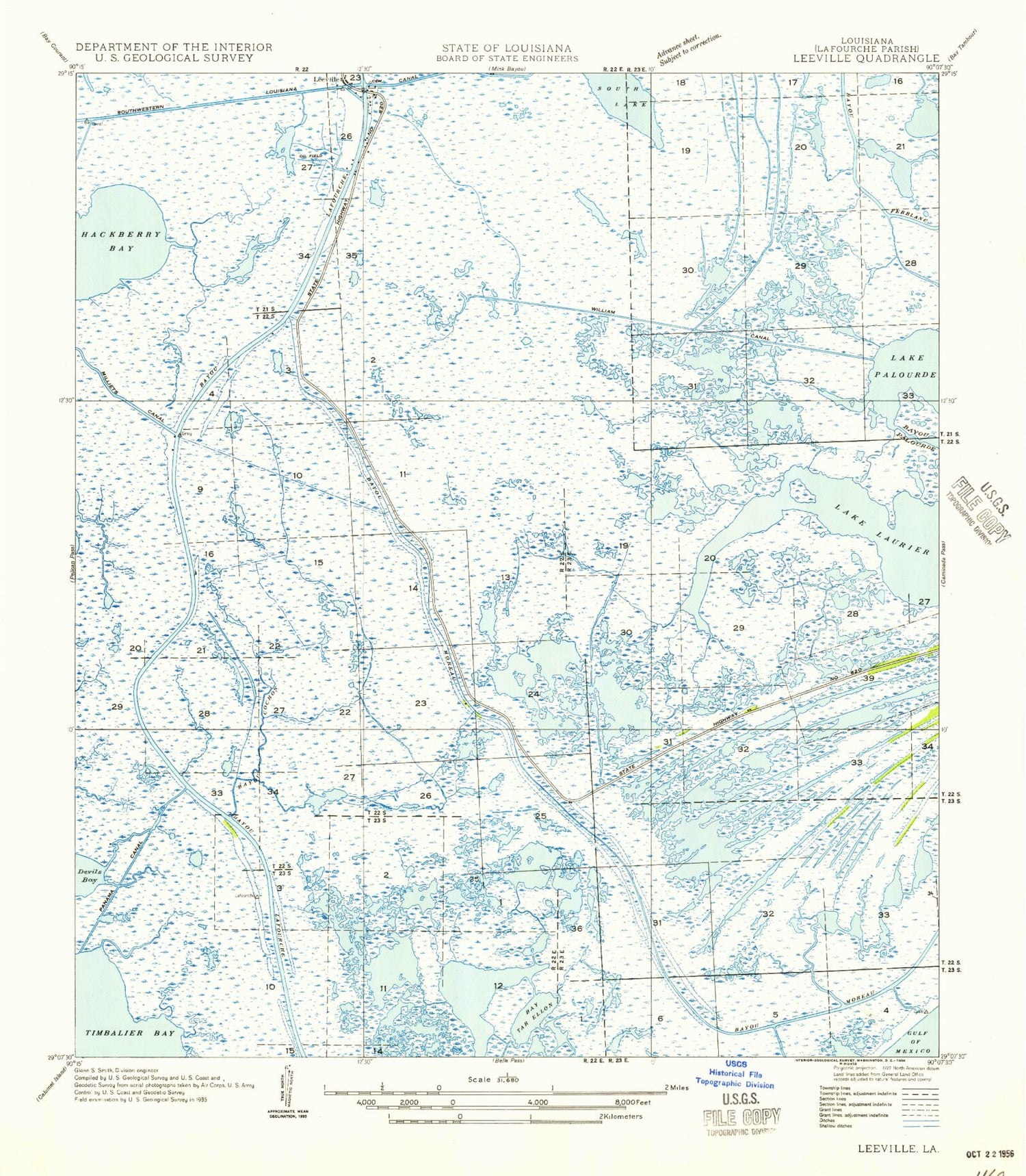

MyTopo
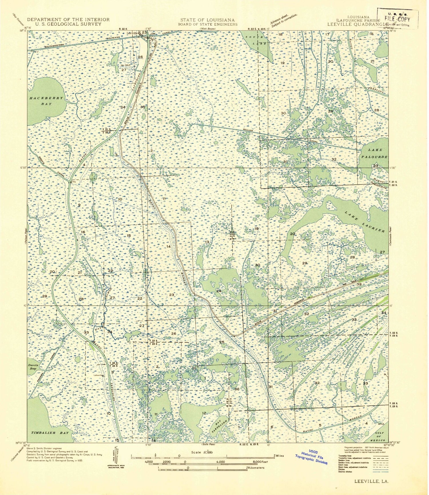
Classic USGS Leeville Louisiana 7.5'x7.5' Topo Map
Couldn't load pickup availability
Historical USGS topographic quad map of Leeville in the state of Louisiana. Map scale may vary for some years, but is generally around 1:24,000. Print size is approximately 24" x 27"
This quadrangle is in the following counties: Lafourche.
The map contains contour lines, roads, rivers, towns, and lakes. Printed on high-quality waterproof paper with UV fade-resistant inks, and shipped rolled.
Contains the following named places: Bay Tartellon, Bayou Cochon, Bayou Moreau, Chevron USA Incorporated Heliport, Compressor Station 524 Heliport, Flotation Canal, Greys Canal, Hackberry Bay, Havoline Canal, Lafourche Parish Fire District 3 Leeville Station, Lake Laurier, Lake Palourde, Leeville, Leeville Bridge, Parish Governing Authority District 15, Piroque Canal, Pointe Fourchon, South Lake, William Canal, Wisner State Wildlife Management Area, ZIP Code: 70357