
MyTopo
Classic USGS Leggetts Crossroads North Carolina 7.5'x7.5' Topo Map
Couldn't load pickup availability
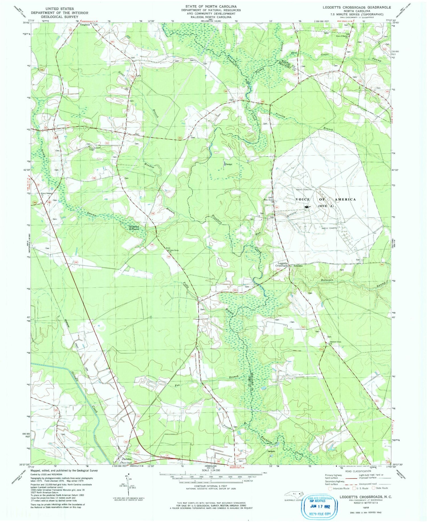
Historical USGS topographic quad map of Leggetts Crossroads in the state of North Carolina. Map scale may vary for some years, but is generally around 1:24,000. Print size is approximately 24" x 27"
This quadrangle is in the following counties: Beaufort, Martin, Pitt.
The map contains contour lines, roads, rivers, towns, and lakes. Printed on high-quality waterproof paper with UV fade-resistant inks, and shipped rolled.
Contains the following named places: Bear Grass Swamp, Briery Swamp, Briery Swamp Church, Clemons Grove Chapel, Flat Swamp Church, Great Branch Meadow Branch, Haw Branch, Hayes Chapel, Horsepen Swamp, Hunting Run, Leggetts Crossroads, Pactolus, Pea Branch, Pinelog Branch, Piney Grove Church, Pocoson Branch, Poley Branch, Rose of Sharon Church, Shepard Millpond Dam, Sheppard Millpond, Stokes Elementary School, Township of Pactolus, Tranters Creek Church, Turkey Swamp, Union Grove Church, Voice of America


