MyTopo
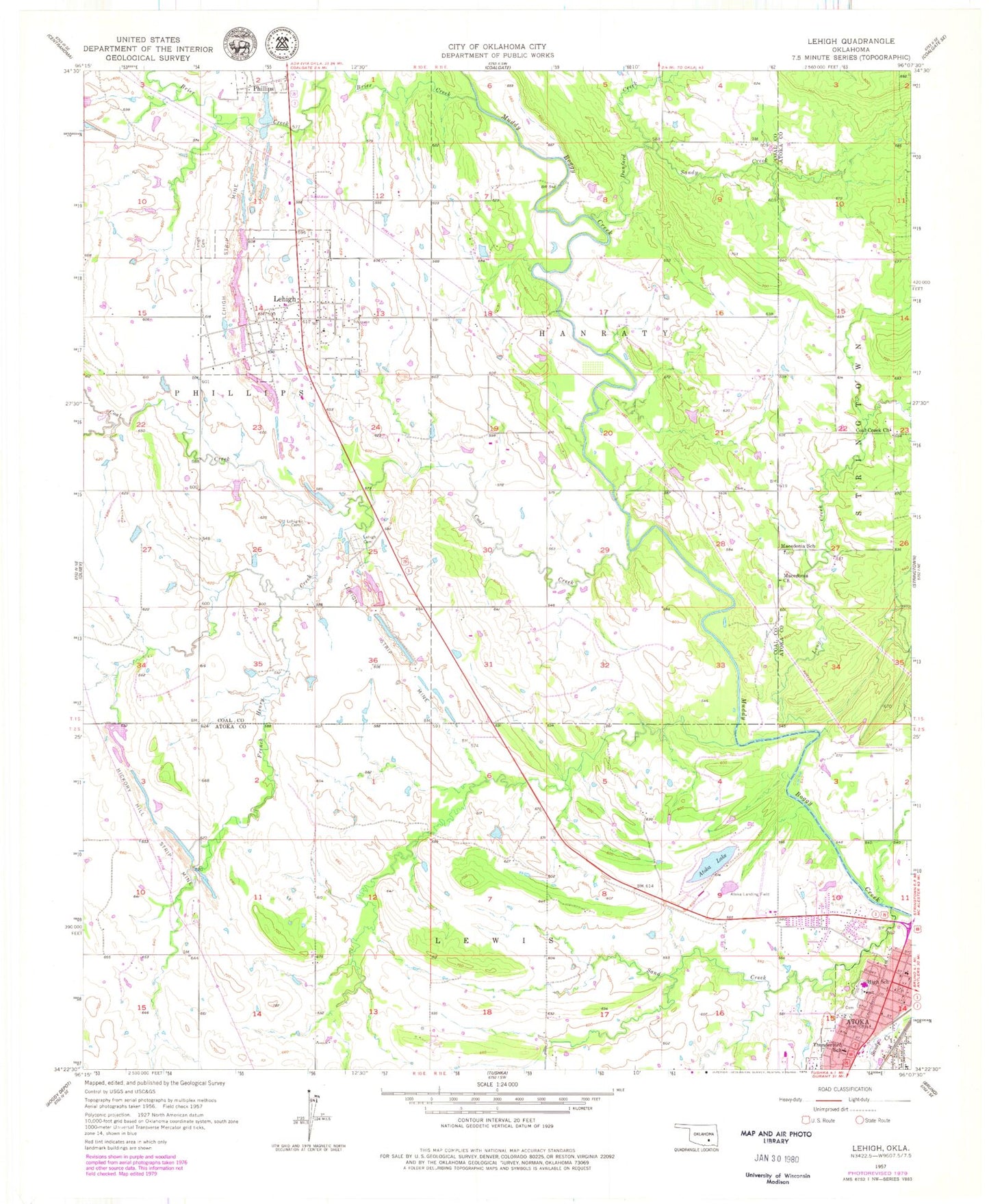
Classic USGS Lehigh Oklahoma 7.5'x7.5' Topo Map
Couldn't load pickup availability
Historical USGS topographic quad map of Lehigh in the state of Oklahoma. Map scale may vary for some years, but is generally around 1:24,000. Print size is approximately 24" x 27"
This quadrangle is in the following counties: Atoka, Coal.
The map contains contour lines, roads, rivers, towns, and lakes. Printed on high-quality waterproof paper with UV fade-resistant inks, and shipped rolled.
Contains the following named places: Atoka, Atoka County Jail, Atoka County Medical Center, Atoka County Sheriff's Office, Atoka Elementary School, Atoka High School, Atoka Lake, Atoka Lake Dam, Atoka Middle School, Atoka Municipal Airport, Atoka Police Department, Brier Creek, City of Atoka, City of Lehigh, Coal Creek, Coal Creek Cemetery, Coal Creek Church, Dunford Creek, Faith Christian School, Fist Baptist Church, French Henry Creek, Green Meadows Cemetery, Hickory Hill Strip Mine, KEOR-AM (Atoka), KHKC-FM (Atoka), Kiamichi Technology Center Atoka Campus, Lehigh, Lehigh Cemetery, Lehigh Fire Department, Lehigh Post Office, Lehigh Strip Mine, Long Creek, Macedonia Cemetery, Macedonia Church, Macedonia School, McCall Middle School, Midway, Old Lehigh Cemetery, Presbyterian Church, Sand Creek, Sandy Creek, Thunderbird School, West View Cemetery, ZIP Code: 74556