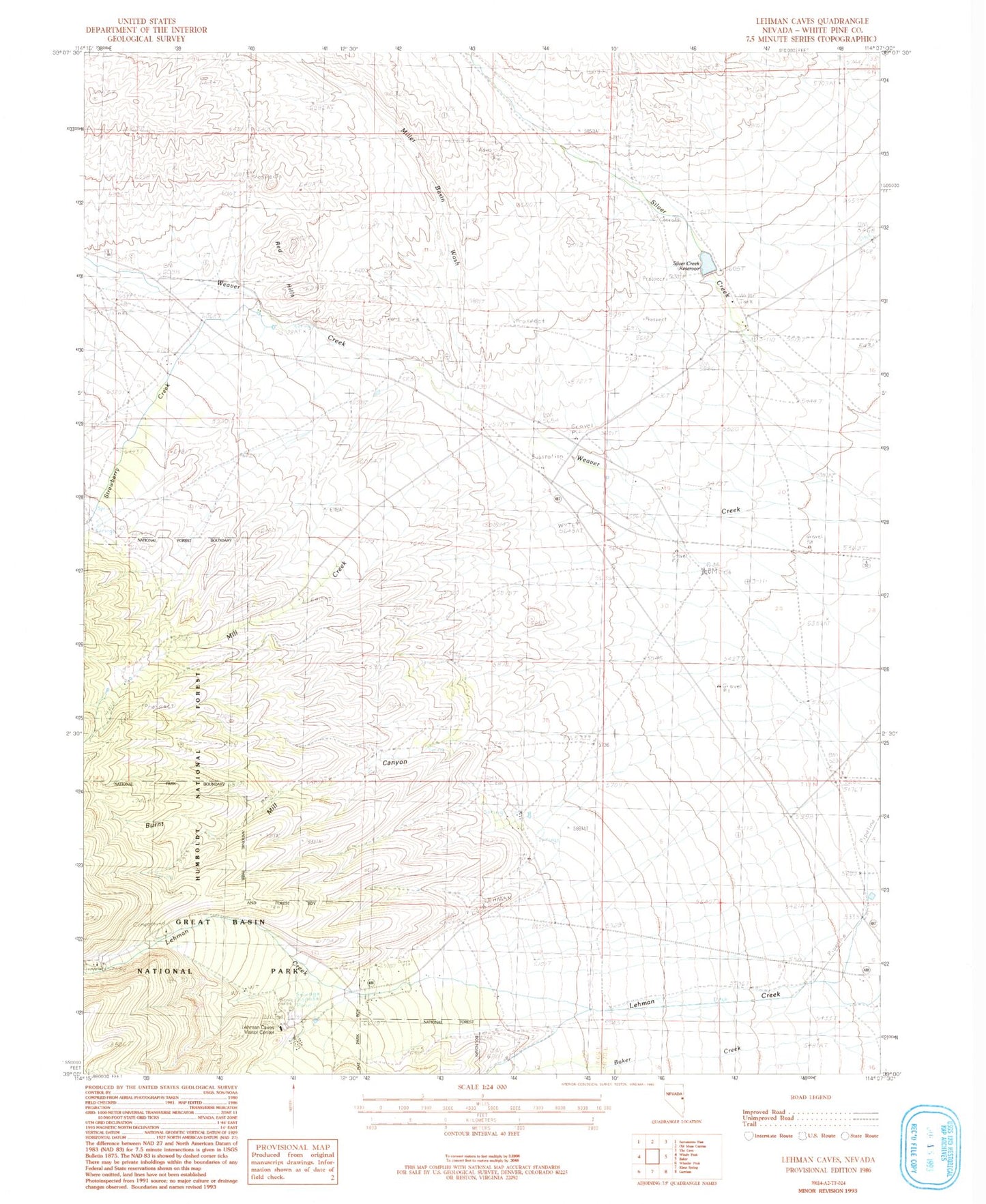
MyTopo
Classic USGS Lehman Caves Nevada 7.5'x7.5' Topo Map
Couldn't load pickup availability
Historical USGS topographic quad map of Lehman Caves in the state of Nevada. Map scale may vary for some years, but is generally around 1:24,000. Print size is approximately 24" x 27"
This quadrangle is in the following counties: White Pine.
The map contains contour lines, roads, rivers, towns, and lakes. Printed on high-quality waterproof paper with UV fade-resistant inks, and shipped rolled.
Contains the following named places: Baker Maintenance Station, Bellander Mine, Bellander Ranch, Bone Spring, Burnt Mill Canyon, Great Basin National Park Visitor Center, Lehman Caves National Monument, Lehmans, Lower Lehman Creek Campground, Mill Creek, Miller Basin Wash, Red Hills, Silver Creek Airport, Silver Creek Dam, Silver Creek Reservoir, Snake Valley Volunteer Fire Department, Strawberry Creek, Strawberry Spring, Upper Lehman Creek Campground, White Pine County Emergency Medical Services - Baker