MyTopo
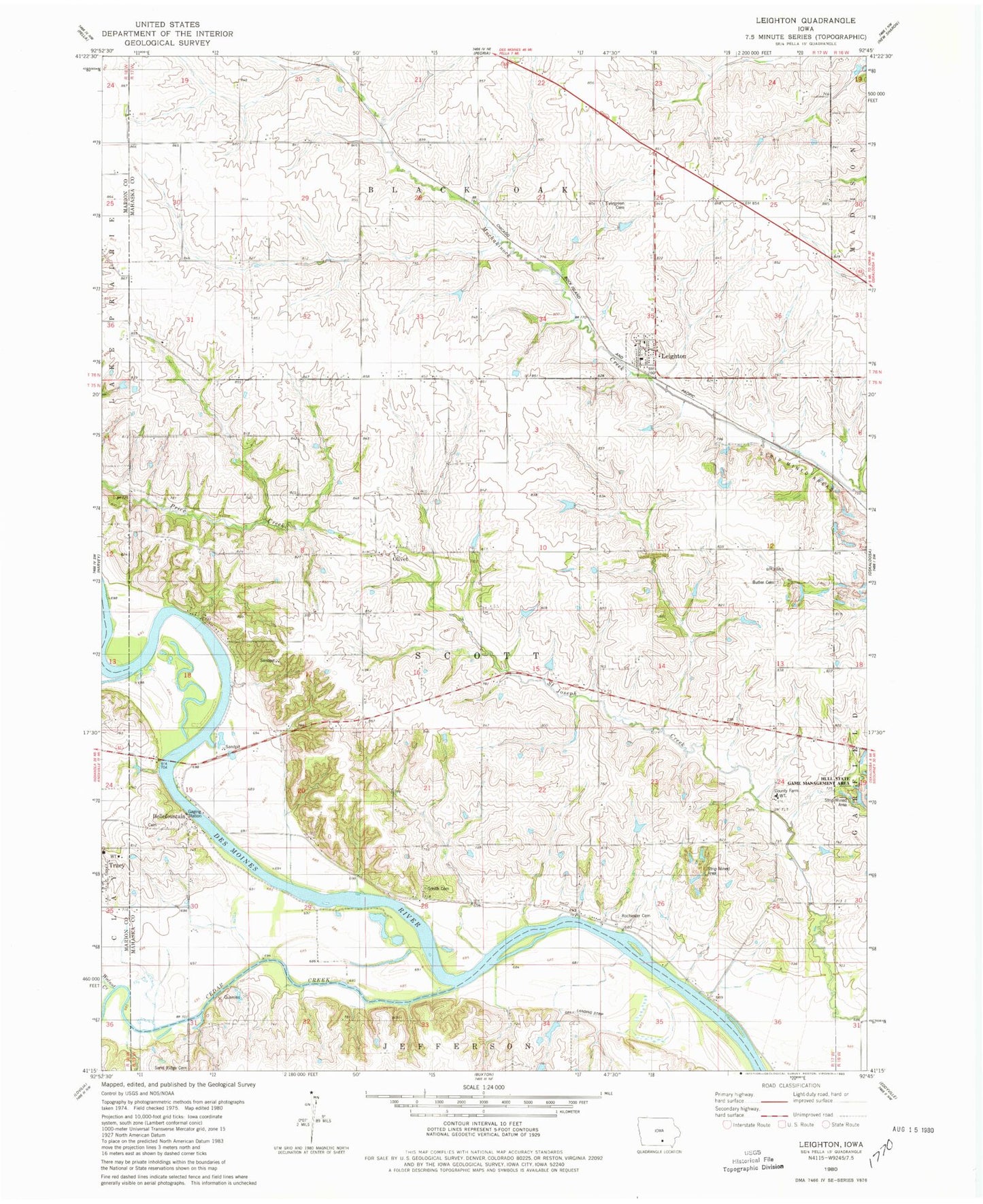
Classic USGS Leighton Iowa 7.5'x7.5' Topo Map
Couldn't load pickup availability
Historical USGS topographic quad map of Leighton in the state of Iowa. Map scale may vary for some years, but is generally around 1:24,000. Print size is approximately 24" x 27"
This quadrangle is in the following counties: Mahaska, Marion.
The map contains contour lines, roads, rivers, towns, and lakes. Printed on high-quality waterproof paper with UV fade-resistant inks, and shipped rolled.
Contains the following named places: Auburn, Auburn Post Office, Belle Fountain Post Office, Bellefountain, Bellefountain Bridge, Bellefountaine Cemetery, Butler Cemetery, Cedar Bluffs Natural Area, Cedar Creek, Cedar Creek Access, City of Leighton, Clay Township Fire and Rescue, Ebenezer Reformed Church, Evergreen Cemetery, Fishville Cemetery, Howard Cemetery, Hull State Game Management Area, Leighton, Leighton Christian Reformed Church, Leighton Elementary School, Leighton Post Office, Mahaska County Farm, Mahaska County Farm Cemetery, Olivet, Olivet Cemetery, Olivet Post Office, Rochester Cemetery, Smith Cemetery, Township of Scott, Walnut Creek, ZIP Code: 50143