MyTopo
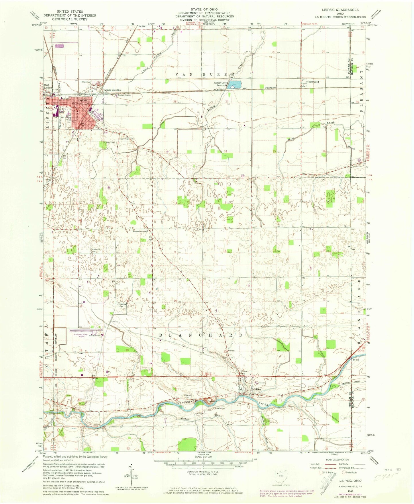
Classic USGS Leipsic Ohio 7.5'x7.5' Topo Map
Couldn't load pickup availability
Historical USGS topographic quad map of Leipsic in the state of Ohio. Map scale may vary for some years, but is generally around 1:24,000. Print size is approximately 24" x 27"
This quadrangle is in the following counties: Hancock, Putnam.
The map contains contour lines, roads, rivers, towns, and lakes. Printed on high-quality waterproof paper with UV fade-resistant inks, and shipped rolled.
Contains the following named places: Blanchard Cemetery, Blanchard Township Gilboa Fire Department, Cholera Cemetery, Crawfis Cemetery, Crawfish College, Dukes Run, Dutch Run, First Christian Church, First Lutheran Church, Gilboa, Gilboa Elementary School, Gilboa Main Street Historic District, Gilboa Post Office, Gilboa Quarry, Gilboa United Methodist Church, Harmon Cemetery, Hovest Farms, Leipsic, Leipsic Elementary School, Leipsic Emergency Medical Services, Leipsic High School, Leipsic Junction, Leipsic Police Department, Leipsic Post Office, Leipsic Upground Reservoir Dam, Leipsic Volunteer Fire Department Station 1, Leipsic Volunteer Fire Department Station 2, Maidlow Cemetery, Melody Acres Trailer Park, Orchard Lane Trailer Court, Pleasant Grove Church, Putnam County Airport, Putnam County Home, Riley Creek, Saint Marys Catholic Church, Saint Marys Cemetery, Saint Marys School, Sugar Ridge Cemetery, Township of Blanchard, Township of Van Buren, Townwood, Townwood Post Office, Village of Gilboa, Village of Leipsic, Yellow Creek Reservoir, ZIP Code: 45856