MyTopo
Classic USGS Lela Oklahoma 7.5'x7.5' Topo Map
Couldn't load pickup availability
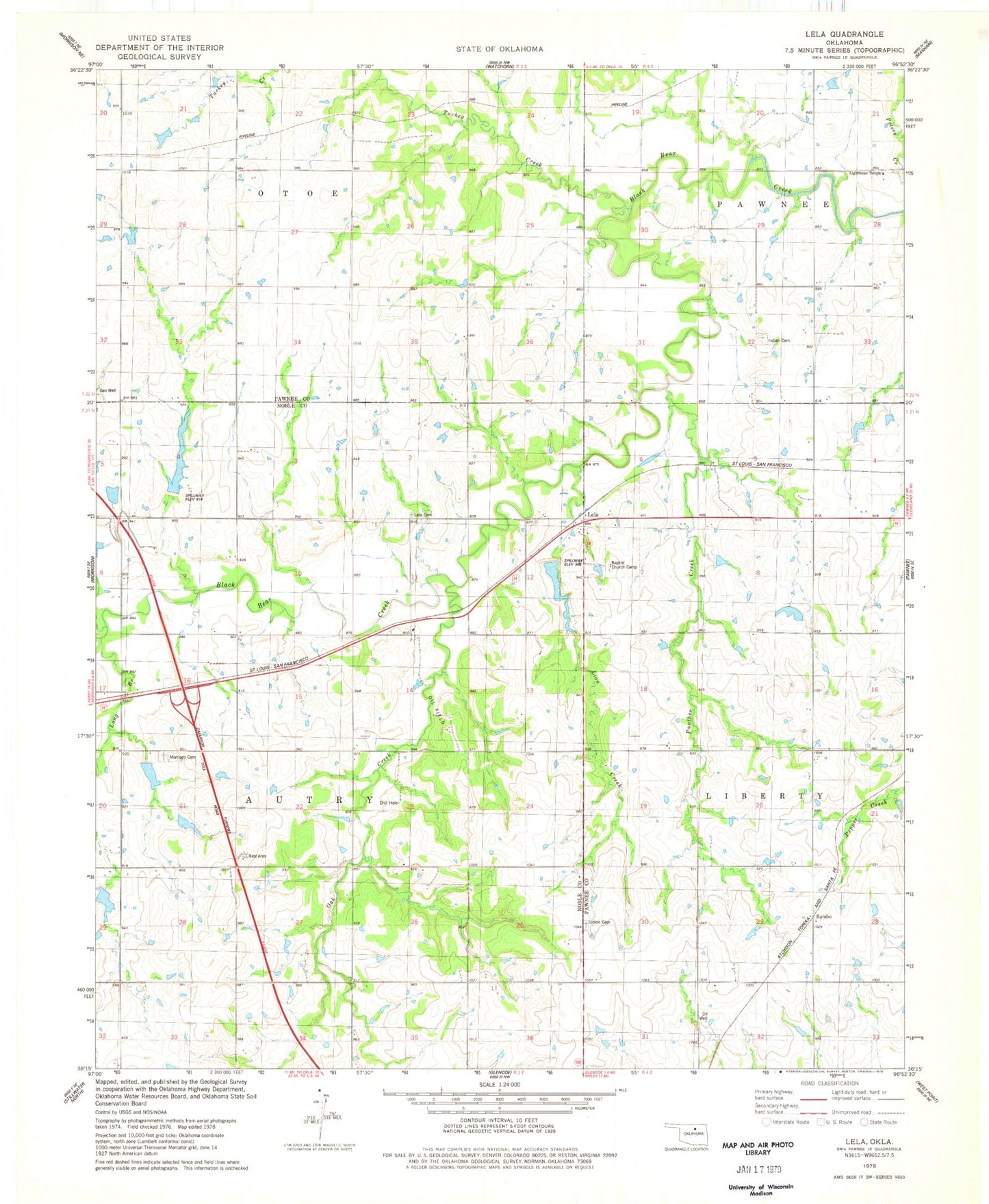
Historical USGS topographic quad map of Lela in the state of Oklahoma. Map scale may vary for some years, but is generally around 1:24,000. Print size is approximately 24" x 27"
This quadrangle is in the following counties: Noble, Pawnee.
The map contains contour lines, roads, rivers, towns, and lakes. Printed on high-quality waterproof paper with UV fade-resistant inks, and shipped rolled.
Contains the following named places: Baptist Church Camp, Indian Cemetery, Lela, Lela Cemetery, Lighthouse Temple, Lion Creek, Long Branch, Long Branch Creek Site 11 Dam, Long Branch Creek Site 11 Reservoir, Long Branch Watershed Site 11 Dam, Lower Black Bear Creek Site 11 Dam, Lower Black Bear Creek Site 11 Reservoir, Lower Black Bear Creek Site 14 Dam, Lower Black Bear Creek Site 14 Reservoir, Lower Black Bear Creek Site 6 Dam, Lower Black Bear Creek Site 6 Reservoir, Morrison Cemetery, Oak Creek, Oknoname 117003 Dam, Oknoname 117003 Reservoir, Oknoname 117004 Dam, Oknoname 117004 Reservoir, Panther Creek, Rambo, Township of Autry, Union Cemetery