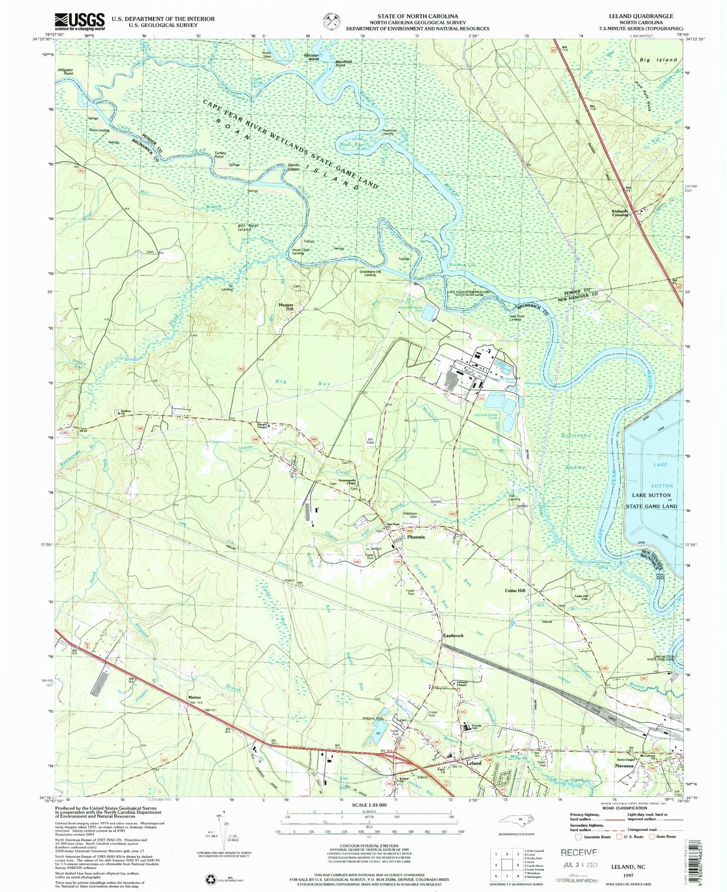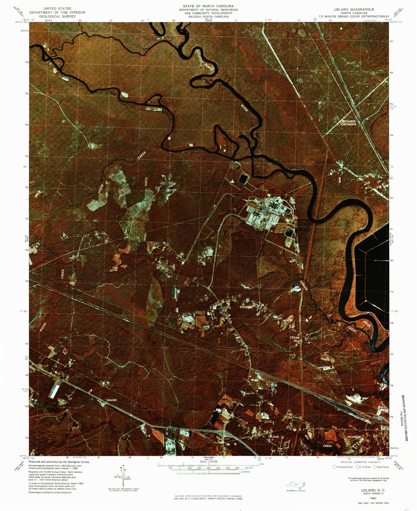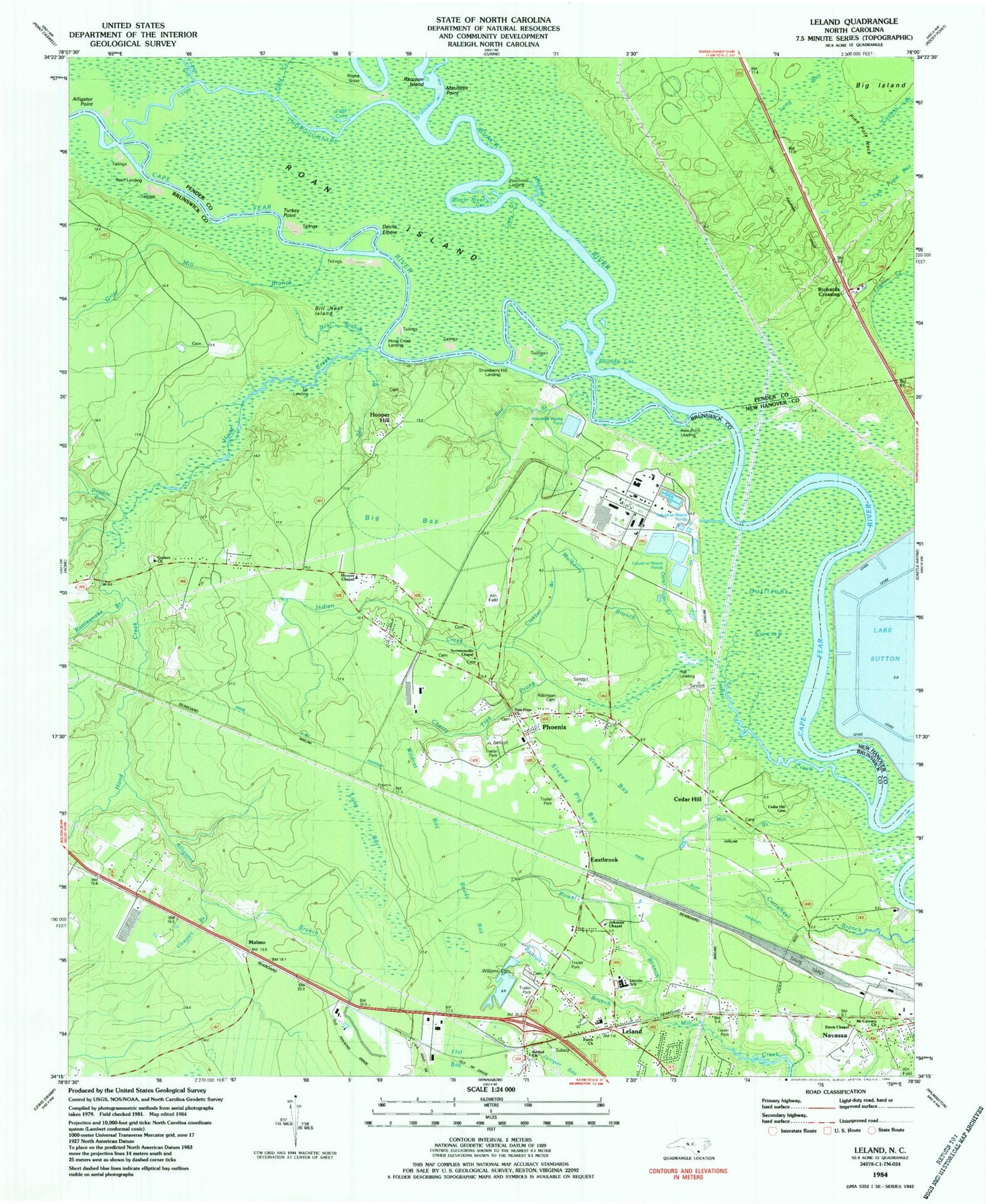

MyTopo
Classic USGS Leland North Carolina 7.5'x7.5' Topo Map
Couldn't load pickup availability
Historical USGS topographic quad map of Leland in the state of North Carolina. Map scale may vary for some years, but is generally around 1:24,000. Print size is approximately 24" x 27"
This quadrangle is in the following counties: Brunswick, New Hanover, Pender.
The map contains contour lines, roads, rivers, towns, and lakes. Printed on high-quality waterproof paper with UV fade-resistant inks, and shipped rolled.
Contains the following named places: Alligator Branch, Alligator Point, Banton Branch, Bay Branch, Bethel Church, Big Bay, Big Island, Bill Neal Island, Black River, Black River Cut, Bulldog Cut, Cedar Hill, Cedar Hill Cemetery, Cherry Tree Prong, Clabber Branch, Cowpen Branch, Davis Chapel, Davis Yard, Devils Elbow, Dollisons Landing, Dollisons Swamp, Double Run, Eastbrook, Faith Church, Field Cove, Field Creek, Flat Bay, George Brown Branch, Gibbs Creek, Goshen Church, Grist Mill Branch, Hale Point Landing, Hall Landing, Hood Creek, Hood Creek Landing, Hooper Chapel, Hooper Hill, Indian Creek, Johnson Chapel, Juniper Bay, Lake Sutton, Leland, Leland Industrial Park, Lincoln High School, Line Creek, Long Bay, Lyon Creek, Lyon Thorofare, Machine Creek, Magnolia Landing, Malmo, Maultbys Point, Mill Branch, Mount Calvary Church, Mulberry Branch, Mulberry Cemetery, Navassa, Navassa Police Department, Navassa Post Office, Navassa Volunteer Fire Station 1, Neal Branch, New Hope Church, Otter Branch, Peachtree Landing, Phoenix, Pine Pole Neck, Raccoon Island, Rattlesnake Branch, Ready Bay, Rhyne Grave, Richards Crossing, Roan Island, Roan Landing, Robinson Cemetery, Rowel Branch, Royster, Singed Pig Bay, Skipper Hill Branch, Strawberry Hill Landing, Summersville Chapel, Tar Landing, Town of Navassa, Township of Northwest, Turkey Point, Two Pond Bay, Vines Bay, Wildcat Bay, Williams Cemetery