MyTopo
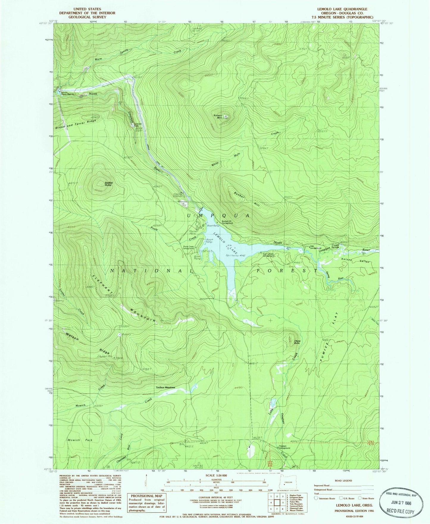
Classic USGS Lemolo Lake Oregon 7.5'x7.5' Topo Map
Couldn't load pickup availability
Historical USGS topographic quad map of Lemolo Lake in the state of Oregon. Typical map scale is 1:24,000, but may vary for certain years, if available. Print size: 24" x 27"
This quadrangle is in the following counties: Douglas.
The map contains contour lines, roads, rivers, towns, and lakes. Printed on high-quality waterproof paper with UV fade-resistant inks, and shipped rolled.
Contains the following named places: Pumice Flat, Watson Ridge, Lemolo Canal Number 1, Basket Butte, Bunker Hill, Crystal Springs, Elbow Butte, Elephant Mountain, Kelsay Mountain, Kelsay Valley, Lake Creek, Lake Creek Forest Camp, Lemolo Falls, Lemolo Lake, Poole Creek, Spring River, Thielsen Creek, Thielsen Forest Camp, Thirsty Creek, Toolbox Meadows, Warm Spring Creek, White Mule Creek, Windigo Way, Lemolo Lake Resort, Bunker Hill Recreation Site, Inlet Recreation Site, East Lemolo Recreation Site, Poole Creek Recreation Site, Crystal Creek, Lemolo Number 1 Dam, Lemolo Number 2 Forebay Dam, Lemolo Lake Boat Ramp North, Lemolo Lake Boat Ramp South