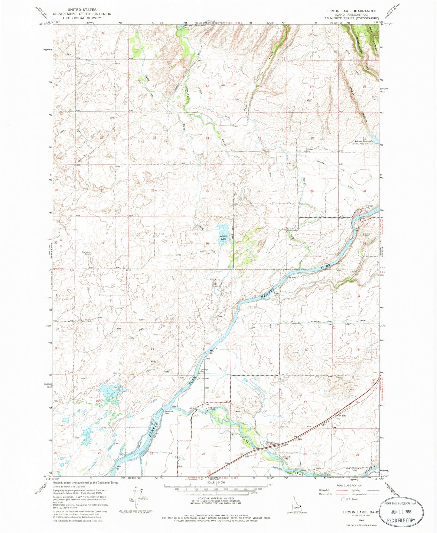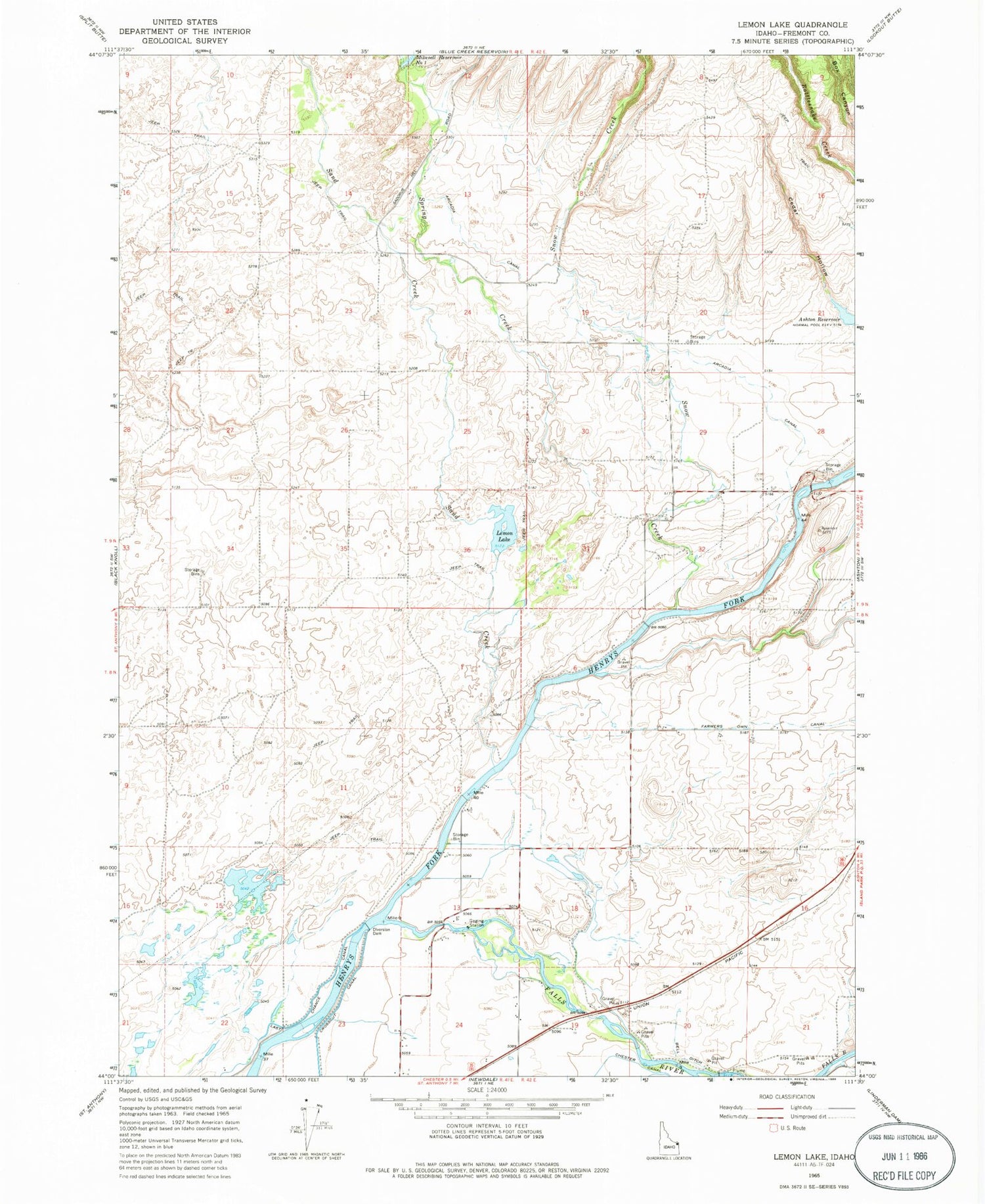
MyTopo
Classic USGS Lemon Lake Idaho 7.5'x7.5' Topo Map
Regular price
$16.95
Regular price
Sale price
$16.95
Unit price
per
Couldn't load pickup availability
Historical USGS topographic quad map of Lemon Lake in the state of Idaho. Map scale may vary for some years, but is generally around 1:24,000. Print size is approximately 24" x 27"
This quadrangle is in the following counties: Fremont.
The map contains contour lines, roads, rivers, towns, and lakes. Printed on high-quality waterproof paper with UV fade-resistant inks, and shipped rolled.
Contains the following named places: Arcadia Canal, Bell Ditch, Cedar Hollow, Cross Cut Diversion Dam, Fall River, Fall River Access Area, Lemon Lake, Mikesell Number One - Lower Dam, Ora, Ora Cemetery, Sand Creek, Sarilda, Snow Creek, Spring Creek, ZIP Code: 83421