MyTopo
Classic USGS Lena Nebraska 7.5'x7.5' Topo Map
Couldn't load pickup availability
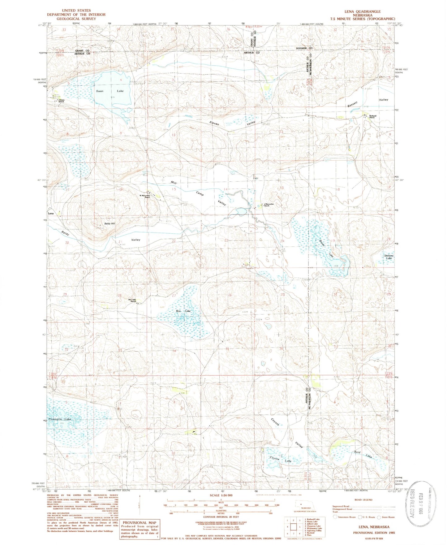
Historical USGS topographic quad map of Lena in the state of Nebraska. Map scale may vary for some years, but is generally around 1:24,000. Print size is approximately 24" x 27"
This quadrangle is in the following counties: Arthur, Grant, Hooker, McPherson.
The map contains contour lines, roads, rivers, towns, and lakes. Printed on high-quality waterproof paper with UV fade-resistant inks, and shipped rolled.
Contains the following named places: Baldy Hill, Baldy Valley, Bassett Valley, Box Lake, Box Lake Ranch, Brown Lake, Calora, Calora Post Office, Coyote Lake, Coyote Valley, Eleven Valley, J Macomber Ranch, Lena, Lena Post Office, Mill Camp Valley, Omara Ranch, Prairie Dale School, Reid Lake, Rothwell Ranch, Swan Lake, Threemile Lake, W Macomber Ranch