MyTopo
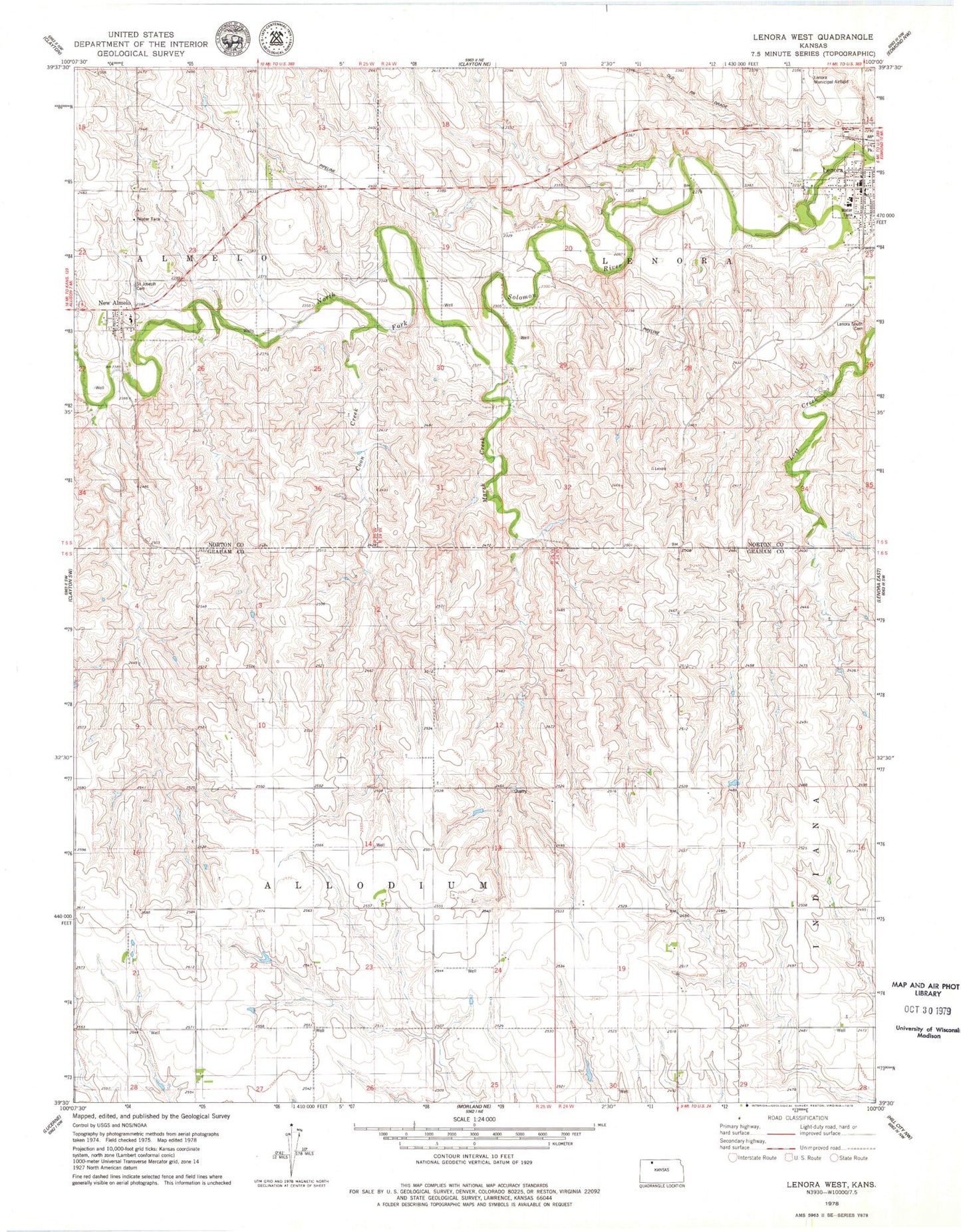
Classic USGS Lenora West Kansas 7.5'x7.5' Topo Map
Couldn't load pickup availability
Historical USGS topographic quad map of Lenora West in the state of Kansas. Map scale may vary for some years, but is generally around 1:24,000. Print size is approximately 24" x 27"
This quadrangle is in the following counties: Graham, Norton.
The map contains contour lines, roads, rivers, towns, and lakes. Printed on high-quality waterproof paper with UV fade-resistant inks, and shipped rolled.
Contains the following named places: Barbeau House, City of Lenora, Coon Creek, Goshen, Hi-Plains Co - Operative Association Grain Elevator Number 5, Lenora, Lenora Church of God, Lenora City Hall, Lenora Elementary School, Lenora High School, Lenora Post Office, Lenora Public Library, Lenora Senior Center, Lenora South Cemetery, Lenora Volunteer Fire Department, Marsh Creek, New Almelo, Saint Joseph Cemetery, Saint Joseph's Catholic Church, Solomon Valley Rural Fire Department, Township of Allodium, United Parish of Lenora