MyTopo
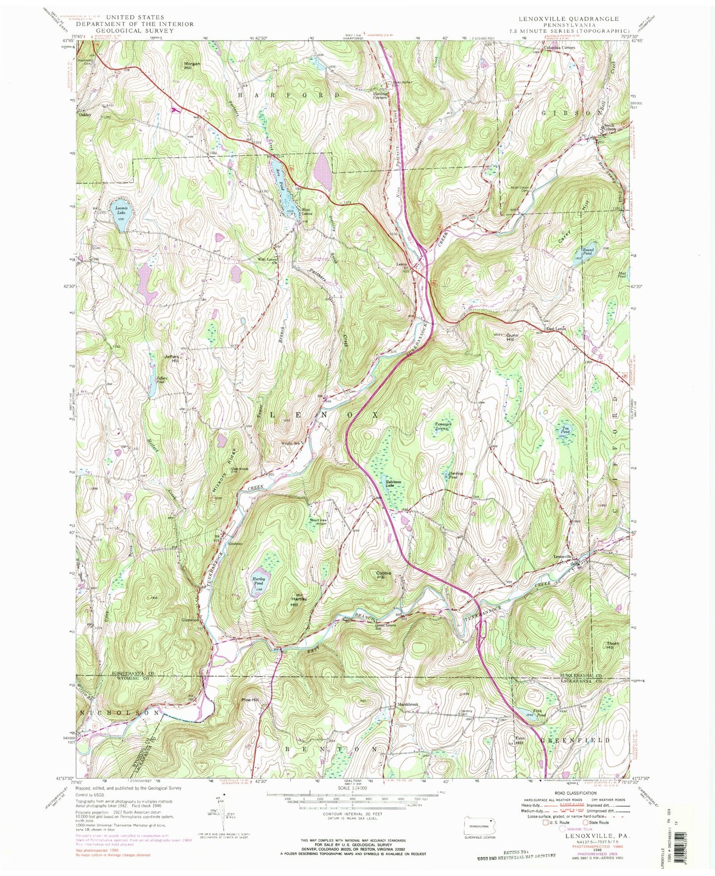
Classic USGS Lenoxville Pennsylvania 7.5'x7.5' Topo Map
Couldn't load pickup availability
Historical USGS topographic quad map of Lenoxville in the state of Pennsylvania. Map scale may vary for some years, but is generally around 1:24,000. Print size is approximately 24" x 27"
This quadrangle is in the following counties: Lackawanna, Susquehanna, Wyoming.
The map contains contour lines, roads, rivers, towns, and lakes. Printed on high-quality waterproof paper with UV fade-resistant inks, and shipped rolled.
Contains the following named places: Acre Pond, Acre Pond Dam, Bear Swamp Creek, Bell Creek, Butler Creek, Carey Hill, Cobble Hill, Columbia Corners, East Branch Tunkhannock Creek, East Lenox, Finn Hill, Finn Pond, Glenwood, Green Grove School, Gunn Hill, Harding Cemetery, Harding Corners, Harding Pond, Hartley Hill, Hartley Pond, Hickory Ridge, Horton Lake, Horton Lake Dam, Jeffers Hill, Jeffers Pond, Jeffers Pond Dam, Lenox, Lenoxville, Loomis Lake, Maplewood Cemetery, Marshbrook, Millard Creek, Morgan Hill, Nine Partners Creek, Oak Knob, Partners Creek, Pine Hill, Pratt Hollow, Robinson Lake, Round Pond, South Gibson, South Gibson Cemetery, South Gibson Post Office, South Harford Cemetery, Sterling Brook, Tamarack Swamp, Tea Pond, Thorn Hill, Tower Branch, Township of Lenox, West Lenox, West Lenox Church, Willow Brook, Wright School, ZIP Code: 18826